MyTopo
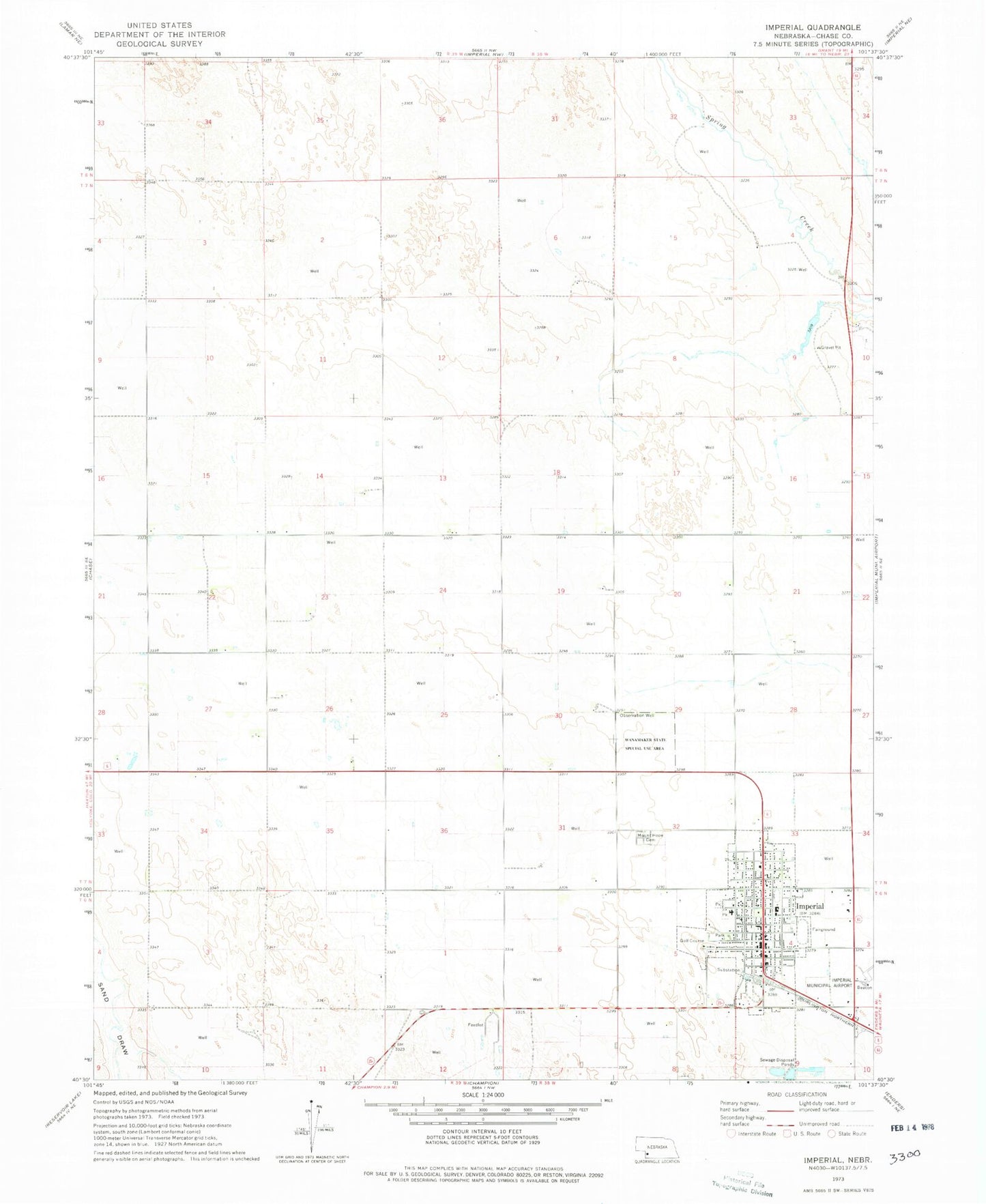
Classic USGS Imperial Nebraska 7.5'x7.5' Topo Map
Couldn't load pickup availability
Historical USGS topographic quad map of Imperial in the state of Nebraska. Map scale may vary for some years, but is generally around 1:24,000. Print size is approximately 24" x 27"
This quadrangle is in the following counties: Chase.
The map contains contour lines, roads, rivers, towns, and lakes. Printed on high-quality waterproof paper with UV fade-resistant inks, and shipped rolled.
Contains the following named places: Berean Fundamental Church, Carmans Mobile Park, Chase County, Chase County Community Hospital, Chase County Court House, Chase County Fair Grounds, Chase County High School, Chase County Sheriff's Office, Christian Faith Outreach, Church of Christ, City of Imperial, First United Methodist Church, Frenchman Valley Family Practice, Frenchman Valley Farmers Coop Elevator, Heartland Counseling Clinic, Imperial, Imperial Bible Church, Imperial Capitol Mobile Court, Imperial City Park, Imperial Country Club, Imperial East Election Precinct, Imperial Elementary School, Imperial Emergency Medical Services, Imperial Heights Retirement Center, Imperial Manor Nursing Home, Imperial Municipal Airport, Imperial Police Department, Imperial Post Office, Imperial Public Library, Imperial Rural Election Precinct, Imperial Volunteer Fire Department, Imperial West Election Precinct, Jehovahs Witnesses Kingdom Hall, KKEI-FM (Imperial), Longan Chiropractic Clinic, Max Addition Park, Meyer Eye Clinic, Mount Hope Cemetery, Reorganized Church of Jesus Christ of Latter Day Saints, Saint Patricks Catholic Church, Schroeder Park, Trinidad Bean and Elevator Company Elevator, Wanamaker State Wildlife Management Area, Wesleyan Church, West Park, Westside Church of Christ, Winters Mobile Home Park, Zion Lutheran Church, ZIP Code: 69033