MyTopo
Classic USGS In-Ko-Pah Gorge California 7.5'x7.5' Topo Map
Couldn't load pickup availability
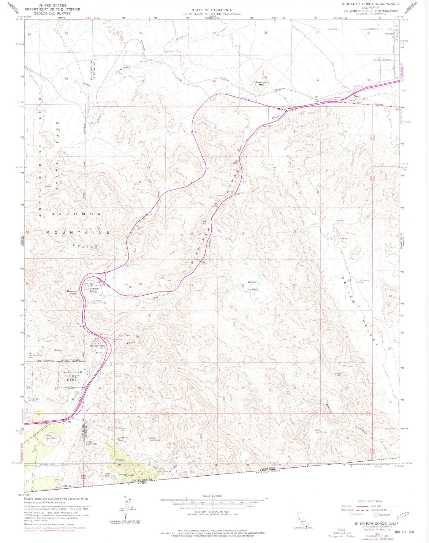
Historical USGS topographic quad map of In-Ko-Pah Gorge in the state of California. Typical map scale is 1:24,000, but may vary for certain years, if available. Print size: 24" x 27"
This quadrangle is in the following counties: Imperial, San Diego.
The map contains contour lines, roads, rivers, towns, and lakes. Printed on high-quality waterproof paper with UV fade-resistant inks, and shipped rolled.
Contains the following named places: Boulder Creek, Boulder Park, Devils Canyon, Easy Pickins Mine, In-Ko-Pah County Park, In-Ko-Pah Gorge, Little Randsburg Mine, Mica Gem Mine, Mountain Spring, Myer Creek, Myer Valley, Stage Station Historical Marker, Sugarloaf Mountain, Mountain Spring, Mountain Springs County Park, Jacumba Wilderness, Ocotillo Census Designated Place