
MyTopo
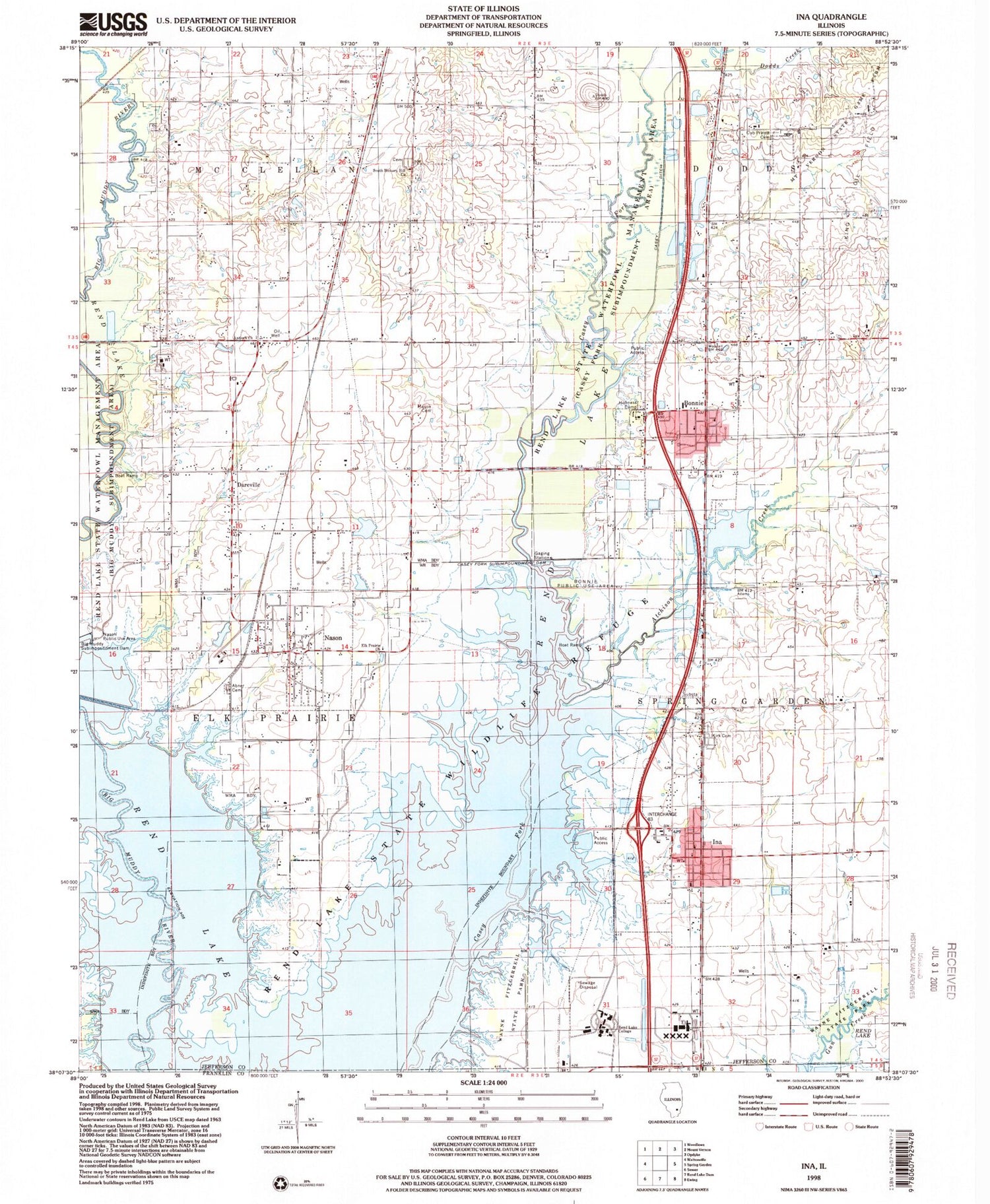
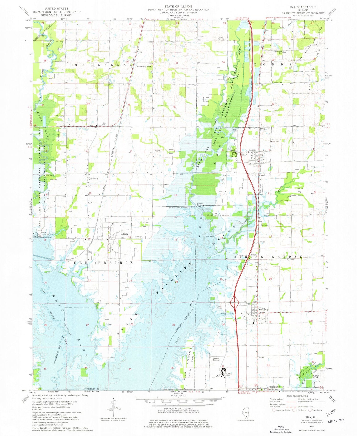
Classic USGS Ina Illinois 7.5'x7.5' Topo Map
Couldn't load pickup availability
Historical USGS topographic quad map of Ina in the state of Illinois. Map scale may vary for some years, but is generally around 1:24,000. Print size is approximately 24" x 27"
This quadrangle is in the following counties: Franklin, Jefferson.
The map contains contour lines, roads, rivers, towns, and lakes. Printed on high-quality waterproof paper with UV fade-resistant inks, and shipped rolled.
Contains the following named places: Abner Cemetery, Antioch Church, Atchison Creek, Big Muddy River Correctional Center, Bonnie, Bonnie Post Office, Bonnie Public Use Area, Casey Ditch, Casey Fork Subimpoundment Dam, City of Nason, Crossroads School, Cubb Prairie Cemetery, Dareville, Davy Jones (Private) Airport, Dodds Creek, Elk Prairie Church, Hickory Hill School, Holiness Camp, Ina, Ina Community Consolidated School, Jefferson Fire Protection District Station 2, Kirk Cemetery, Mason Cemetery, Mount Vernon State Game Farm, Nason, Oak Grove School, Rend Lake College, Rend Lake State Wildlife Refuge, Robinson School, South Hickory Hill Cemetery, South Hickory Hill Church, Township of Elk Prairie, Valley Breeze School, Village of Bonnie, Village of Ina, ZIP Code: 62816


