MyTopo
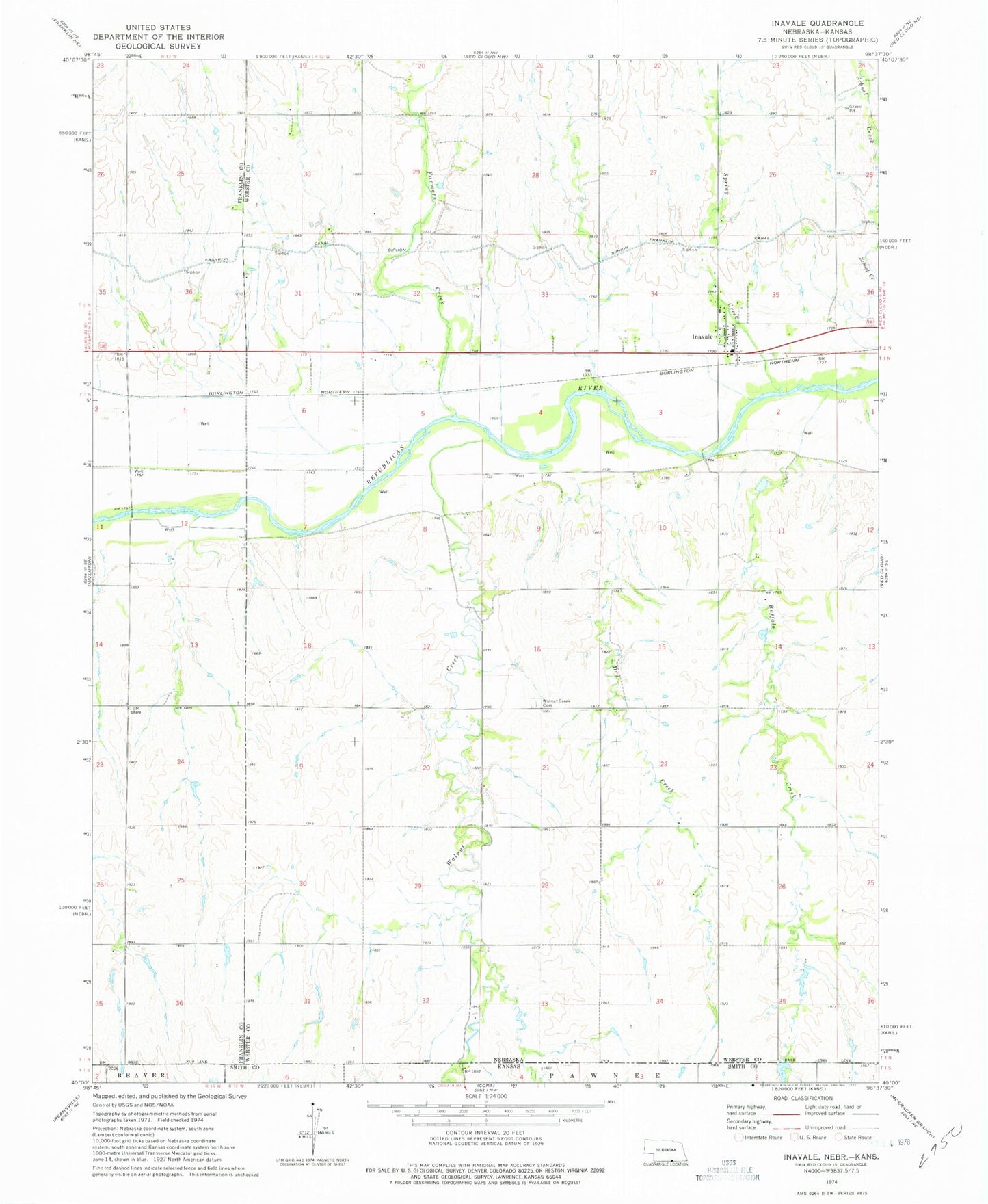
Classic USGS Inavale Nebraska 7.5'x7.5' Topo Map
Regular price
$16.95
Regular price
Sale price
$16.95
Unit price
per
Couldn't load pickup availability
Historical USGS topographic quad map of Inavale in the state of Nebraska. Map scale may vary for some years, but is generally around 1:24,000. Print size is approximately 24" x 27"
This quadrangle is in the following counties: Franklin, Smith, Webster.
The map contains contour lines, roads, rivers, towns, and lakes. Printed on high-quality waterproof paper with UV fade-resistant inks, and shipped rolled.
Contains the following named places: Buffalo Creek, Dry Creek, Farmers Creek, Gala Gardens Manor, Inavale, Inavale Census Designated Place, Inavale Post Office, M and N Grain Incorporated Elevator, Spring Creek, Talkington Dam, Talkington Reservoir, Walnut Creek, Walnut Creek Cemetery, ZIP Code: 68952