MyTopo
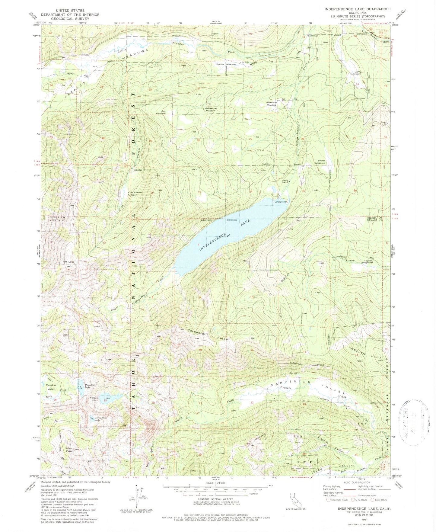
Classic USGS Independence Lake California 7.5'x7.5' Topo Map
Couldn't load pickup availability
Historical USGS topographic quad map of Independence Lake in the state of California. Typical map scale is 1:24,000, but may vary for certain years, if available. Print size: 24" x 27"
This quadrangle is in the following counties: Nevada, Sierra.
The map contains contour lines, roads, rivers, towns, and lakes. Printed on high-quality waterproof paper with UV fade-resistant inks, and shipped rolled.
Contains the following named places: Devils Oven Lake, Basin Peak, Carpenter Ridge, Carpenter Valley, Cold Stream, Coon Canyon, Crabtree Canyon, Independence Lake, Mount Lola, Paradise Lake, Perazzo Meadows, Red Mountain, Euer Valley, Little Truckee River, Sagehen Hills, Warren Lake, Warren Lake Trail, Independence Lake Campground, Mount Lola Trail, Independence 105-006 Dam, Sagehen Campground, Upper Independence Creek, Anderson Meadow, Cold Stream Meadow, Dry Meadow, Meathouse Meadow, Saddle Meadow, Secret Meadow, Donner Division