MyTopo
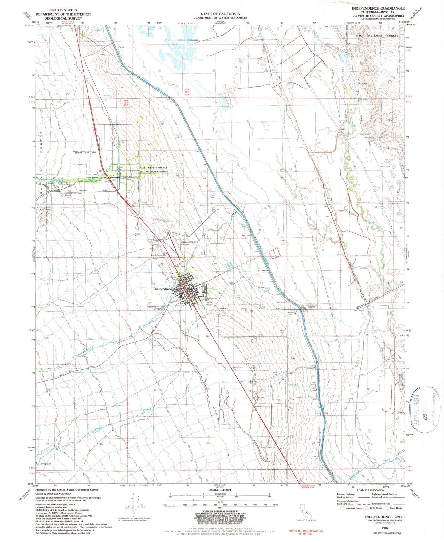
Classic USGS Independence California 7.5'x7.5' Topo Map
Couldn't load pickup availability
Historical USGS topographic quad map of Independence in the state of California. Map scale may vary for some years, but is generally around 1:24,000. Print size is approximately 24" x 27"
This quadrangle is in the following counties: Inyo.
The map contains contour lines, roads, rivers, towns, and lakes. Printed on high-quality waterproof paper with UV fade-resistant inks, and shipped rolled.
Contains the following named places: Dehy Park, Department of Forestry and Fire Protection Station 59 Independence, Duck Lake, Eastern California Museum, Fort Independence Campground, Fort Independence Reservation, Independence, Independence Airport, Independence Cemetery, Independence Census Designated Place, Independence Creek, Independence Creek Campground, Independence Fire Department, Independence Post Office, Indian Cemetery, Inyo County Courthouse, Inyo County Free Library, Inyo County Sheriff's Office Independence, Jackrabbit Prospect, KNYO-AM (Independence), Mount Whitney Fish Hatchery, N R A Prospect, Oak Creek, Old Independence Cemetery, Owens Valley Elementary School, Owens Valley High School, Stevens Canal, Symmes Creek, Symmes Creek Campground, Tulare Swamp