MyTopo
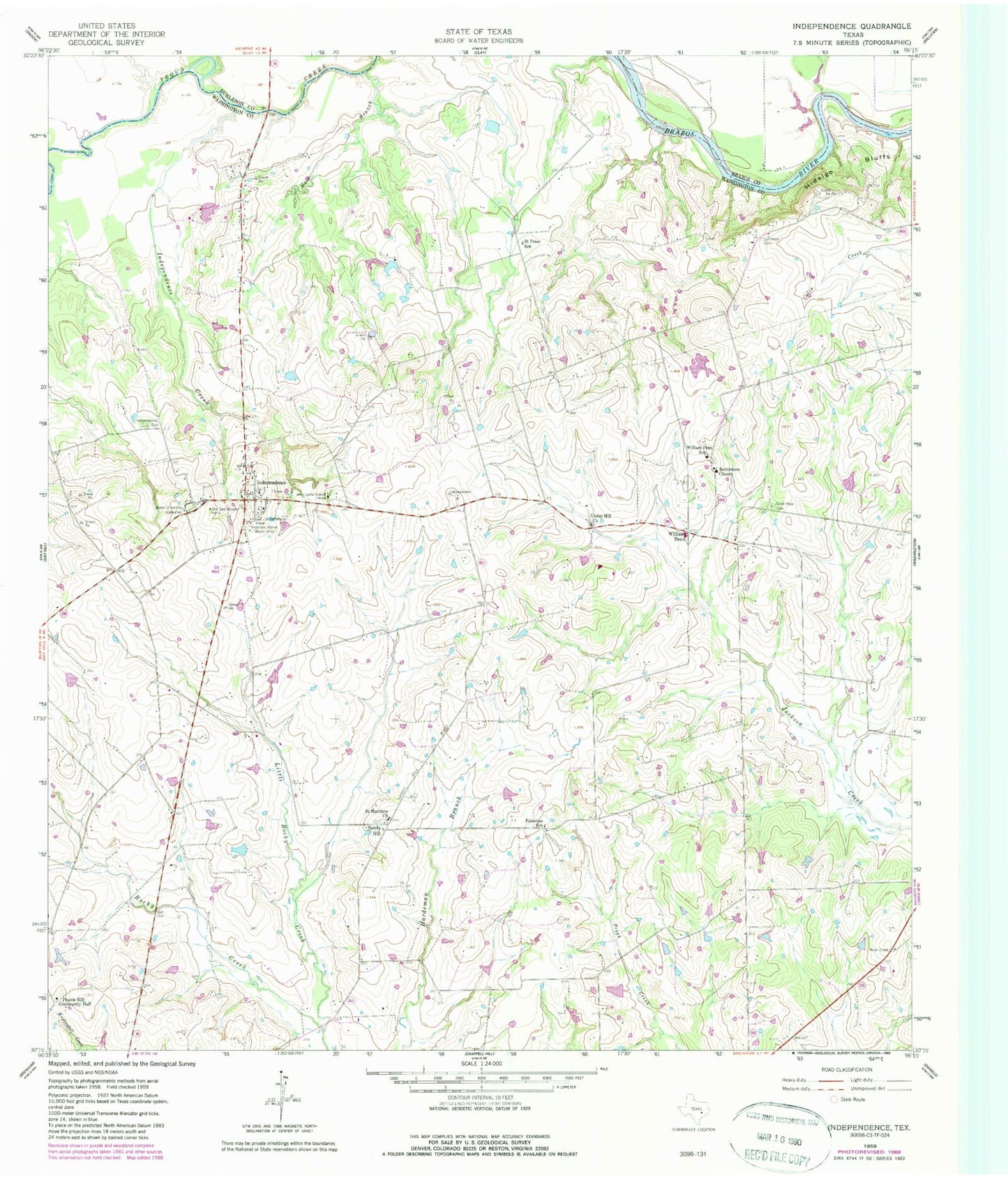
Classic USGS Independence Texas 7.5'x7.5' Topo Map
Couldn't load pickup availability
Historical USGS topographic quad map of Independence in the state of Texas. Map scale may vary for some years, but is generally around 1:24,000. Print size is approximately 24" x 27"
This quadrangle is in the following counties: Brazos, Burleson, Washington.
The map contains contour lines, roads, rivers, towns, and lakes. Printed on high-quality waterproof paper with UV fade-resistant inks, and shipped rolled.
Contains the following named places: Asa Hoxey House, Baylor University State Park, Bethlehem Church, Faust Farm Airport, Flying C Ranch Airport, Fritz Paul and Emma Schroeder House, General J B Robertson Home, General Sam Houston Home, Good Hope Cemetery, Hale Branch, Independence, Independence Cemetery, Independence Creek, John Laura Seward Home, Little Rocky Creek, Mrs Sam Houston House, Palestine School, Prairie Hill - Rocky Hill Volunteer Fire Department, Prairie Hill Community Hall, Reue-Eickenhorst House, Saint Matthew Church, Saint Peter School, Sandy Hill, Sky Lane Ranch Airport, Summers Cemetery, Union Hill Church, William Penn, William Penn School