MyTopo
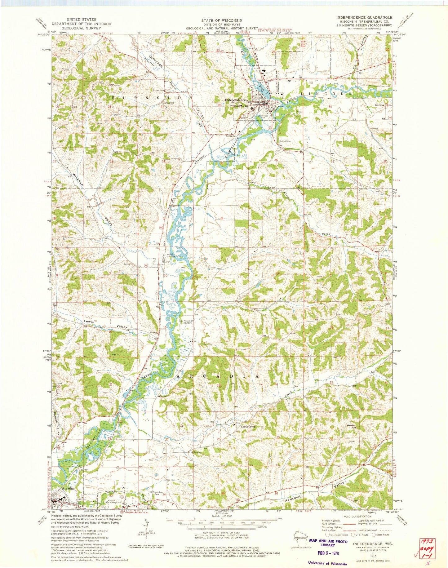
Classic USGS Independence Wisconsin 7.5'x7.5' Topo Map
Couldn't load pickup availability
Historical USGS topographic quad map of Independence in the state of Wisconsin. Map scale may vary for some years, but is generally around 1:24,000. Print size is approximately 24" x 27"
This quadrangle is in the following counties: Trempealeau.
The map contains contour lines, roads, rivers, towns, and lakes. Printed on high-quality waterproof paper with UV fade-resistant inks, and shipped rolled.
Contains the following named places: Arcadia Country Club, Arcadia Elementary School, Arcadia Landing Strip, Bethel Cemetery, Bugle Lake, City of Independence, Dewey Corners, Elk Creek, Greenwood Cemetery, Independence, Independence Airport, Independence Dam, Independence Elementary School, Independence High School, Independence Police Department, Independence Post Office, Independence Volunteer Fire Department, Island Park, Joe Pietrek Junior County Park, Kniffen Creek, Korpal Valley, Korpal Valley School, Lewis Valley, Lewis Valley School, Lower Plum Creek School, Maule Coulee, New City, New City School, North Creek, North Creek School, Oakdale School, Plum Creek, Rainey Valley, Rainey Valley School, Saint Stanislaus Cemetery, Saints Peter and Paul Catholic School, Sunny Slope School, Traverse Valley, Traverse Valley Creek, Weaver Hill, Wickham School, Wickham Valley, Williamsburg, Williamsburg School, Wojcik School