MyTopo
Classic USGS Index Washington 7.5'x7.5' Topo Map
Couldn't load pickup availability
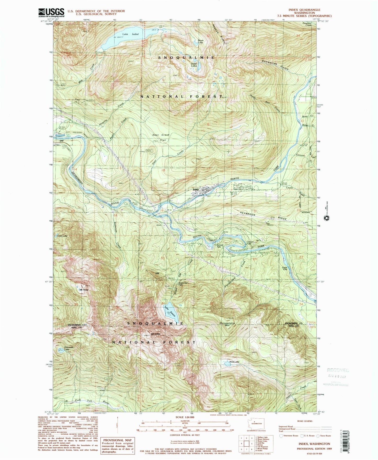
Historical USGS topographic quad map of Index in the state of Washington. Typical map scale is 1:24,000, but may vary for certain years, if available. Print size: 24" x 27"
This quadrangle is in the following counties: King, Snohomish.
The map contains contour lines, roads, rivers, towns, and lakes. Printed on high-quality waterproof paper with UV fade-resistant inks, and shipped rolled.
Contains the following named places: Anderson Creek, Austin Creek, Barclay Creek, Bitter Creek, Boss Creek, Bridal Veil Creek, Bridal Veil Falls, Canyon Creek, Canyon Falls, Copperbelt Mine, Deer Creek, Deer Creek Flat, Eagle Falls, East Fork Index Creek, Halford, Hogarty Creek, Honeymoon Mine, Index, Mount Index, Lake Isabel, Lewis Creek, Noname Creek, North Fork Guard Station, North Fork Skykomish River, North Star Creek, Mount Persis, Philadelphia Creek, Philadelphia Mountain, Ragged Ridge, Lake Serene, Snowslide Gulch, South Fork Skykomish River, Sunset Falls, Heybrook Mountain, Heybrook Lookout, Reiter (historical), Reiter-Skykomish Rearing Ponds Dam, Reiter-Skykomish Rearing Ponds, Town of Index, Index Elementary School, North Fork Skykomish River Bridge, Snohomish County Fire District 28 Station 55, Index Post Office