MyTopo
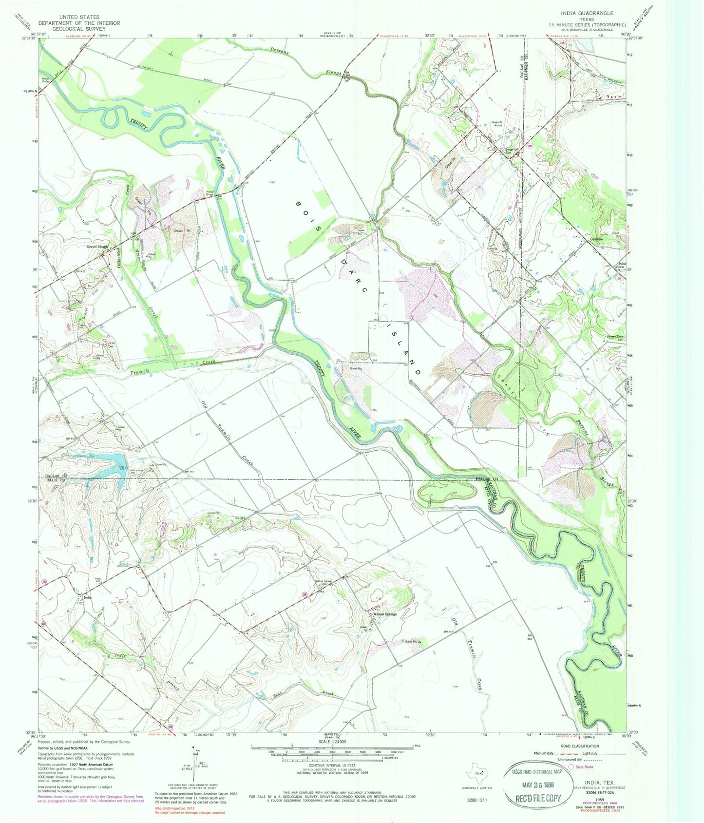
Classic USGS India Texas 7.5'x7.5' Topo Map
Couldn't load pickup availability
Historical USGS topographic quad map of India in the state of Texas. Map scale may vary for some years, but is generally around 1:24,000. Print size is approximately 24" x 27"
This quadrangle is in the following counties: Dallas, Ellis, Kaufman.
The map contains contour lines, roads, rivers, towns, and lakes. Printed on high-quality waterproof paper with UV fade-resistant inks, and shipped rolled.
Contains the following named places: Bois D'Arc Island, City of Combine, Combine, Combine City Hall, Combine Fire Department, Combine Police Department, Cottonwood Creek, Grange Hill Cemetery, Gravel Slough, India, India Branch, KDFT-AM (Ferris), Malloy Bridge, Parsons Slough, Pleasant Grove Cemetery, Point View Church, Pruitt Cemetery, Seagoville Airport, Soil Conservation Service Site 10 Dam, Soil Conservation Service Site 10 Reservoir, Soil Conservation Service Site 3 Dam, Soil Conservation Service Site 3 Reservoir, Soil Conservation Service Site 4 Dam, Soil Conservation Service Site 4 Reservoir, Soil Conservation Service Site 9 Dam, Soil Conservation Service Site 9 Reservoir, Tenmile Creek, Walnut Springs, Walnut Springs Cemetery, Wilmer Bridge, ZIP Codes: 75125, 75159