MyTopo
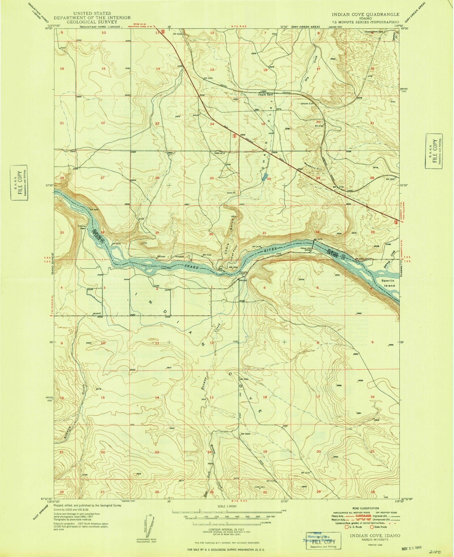
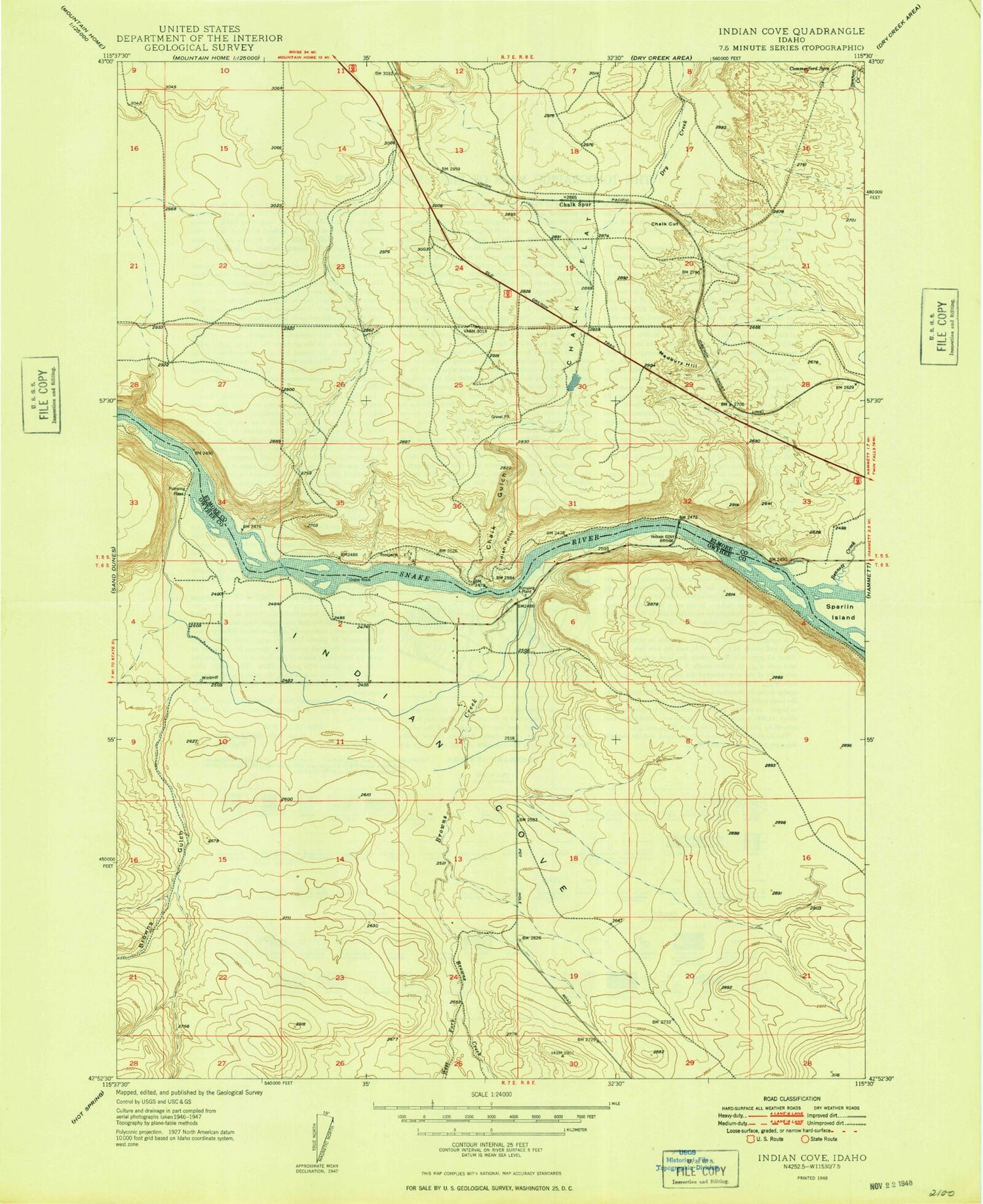
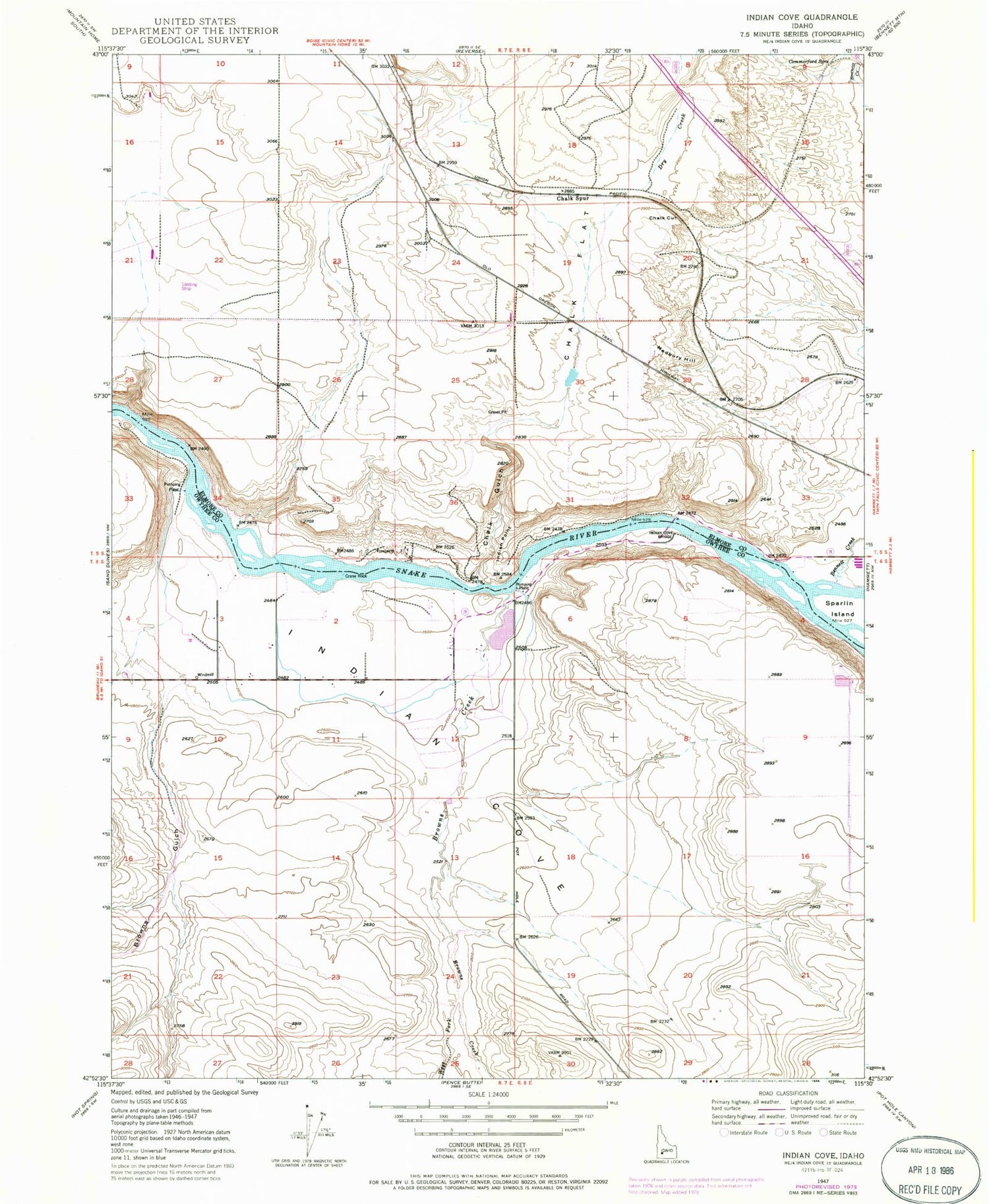
Classic USGS Indian Cove Idaho 7.5'x7.5' Topo Map
Regular price
$16.95
Regular price
Sale price
$16.95
Unit price
per
Couldn't load pickup availability
Historical USGS topographic quad map of Indian Cove in the state of Idaho. Map scale may vary for some years, but is generally around 1:24,000. Print size is approximately 24" x 27"
This quadrangle is in the following counties: Elmore, Owyhee.
The map contains contour lines, roads, rivers, towns, and lakes. Printed on high-quality waterproof paper with UV fade-resistant inks, and shipped rolled.
Contains the following named places: Bennett Creek, Browns Creek, Browns Gulch, Chalk Cut, Chalk Flat, Chalk Gulch, Chalk Spur, Commerford Springs, Crane Rock, Dry Creek, East Fork Browns Creek, Indian Cove, Indian Cove Bridge, Indian Point, Medbury Hill, ZIP Code: 83627