MyTopo
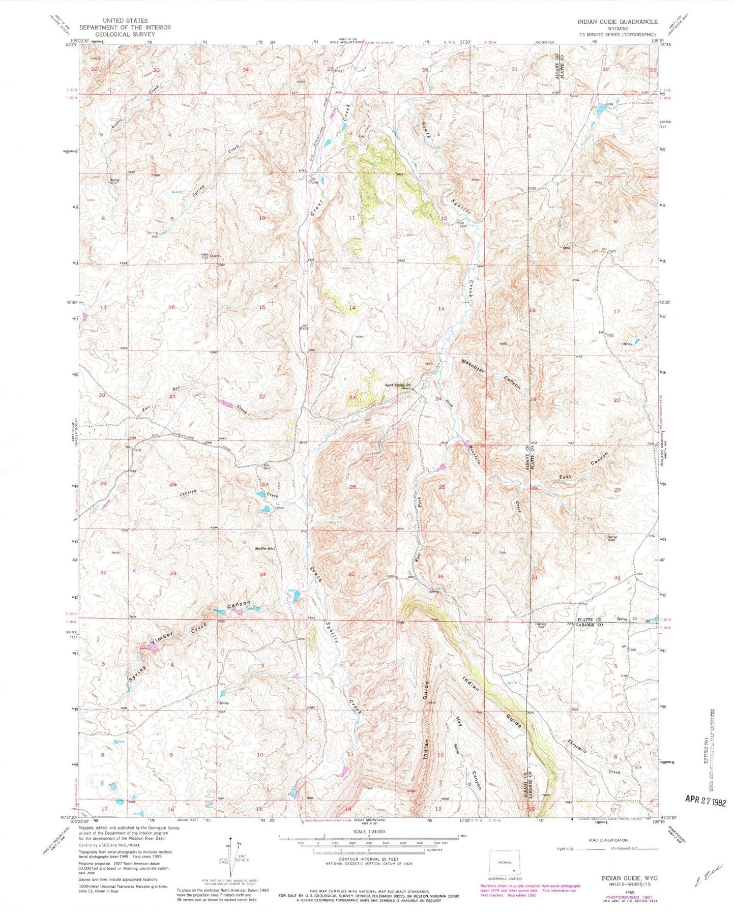
Classic USGS Indian Guide Wyoming 7.5'x7.5' Topo Map
Couldn't load pickup availability
Historical USGS topographic quad map of Indian Guide in the state of Wyoming. Map scale may vary for some years, but is generally around 1:24,000. Print size is approximately 24" x 27"
This quadrangle is in the following counties: Albany, Laramie, Platte.
The map contains contour lines, roads, rivers, towns, and lakes. Printed on high-quality waterproof paper with UV fade-resistant inks, and shipped rolled.
Contains the following named places: Canon Number 1 Dam, Canon Number 1 Reservoir, Canon Number 2 Dam, Canon Number 2 Reservoir, Canon Number 3 Dam, Canon Number 3 Reservoir, Canon Number 4 Dam, Canon Number 4 Reservoir, Canteen Creek, East Canyon, Indian Guide, Iron Mountain Creek, Iron Mountain Dam, Iron Mountain Number 1 Dam, Iron Mountain Number 1 Reservoir, Iron Mountain Reservoir, Shaffer School, South Sybille School, Spring Creek, Taylor Deposit, Timber Canyon, Two Bar Creek, Two Bar Number 1 Dam, Two Bar Number 1 Reservoir, Waechter Canyon, West Fork, West Fork Iron Mountain Creek