MyTopo
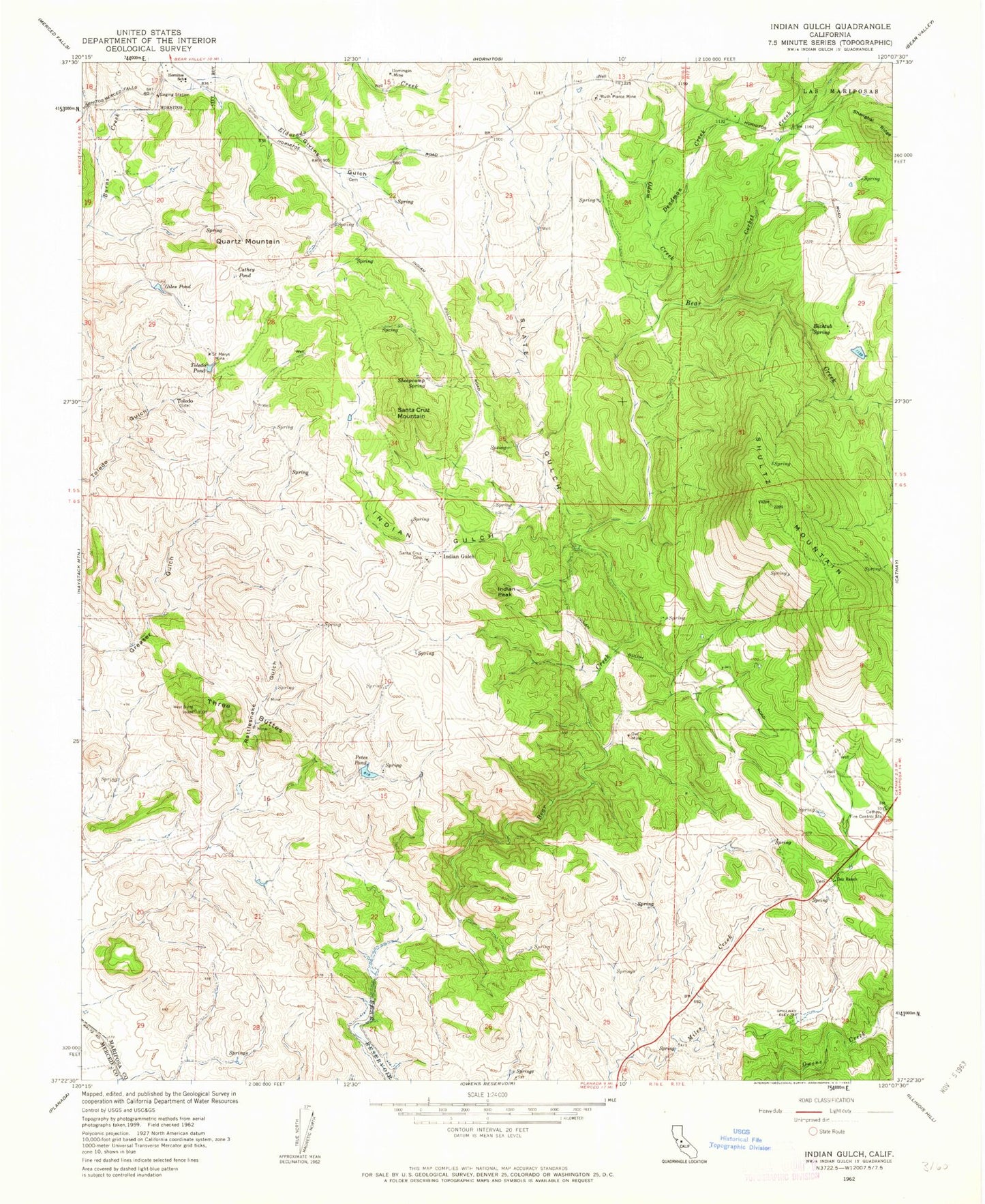
Classic USGS Indian Gulch California 7.5'x7.5' Topo Map
Couldn't load pickup availability
Historical USGS topographic quad map of Indian Gulch in the state of California. Map scale may vary for some years, but is generally around 1:24,000. Print size is approximately 24" x 27"
This quadrangle is in the following counties: Mariposa, Merced.
The map contains contour lines, roads, rivers, towns, and lakes. Printed on high-quality waterproof paper with UV fade-resistant inks, and shipped rolled.
Contains the following named places: Bathtub Spring, Cathay Fire Control Station, Cathey Pond, Corbet Creek, Day Ranch, Deadman Creek, Department of Forestry and Fire Protection Catheys Valley Fire Station, Domingas Mine, Eldorado Creek, Giles Pond, Givens Cemetery, Givins Gulch, Hornitos School, Indian Gulch, Indian Peak, KAMB-FM (Merced), Odom Creek, Owl Mine, Petes Pond, Quartz Mountain, Rattlesnake Gulch, Ruth Pierce Mine, Saint Marys Mine, Santa Cruz Cemetery, Santa Cruz Mountain, Shanghai Ridge, Sheepcamp Spring, Shultz Mountain, Slate Gulch, Three Buttes, Toledo, Toledo Pond, ZIP Code: 95325