
MyTopo
Classic USGS Indian Hay Meadows Idaho 7.5'x7.5' Topo Map
Couldn't load pickup availability
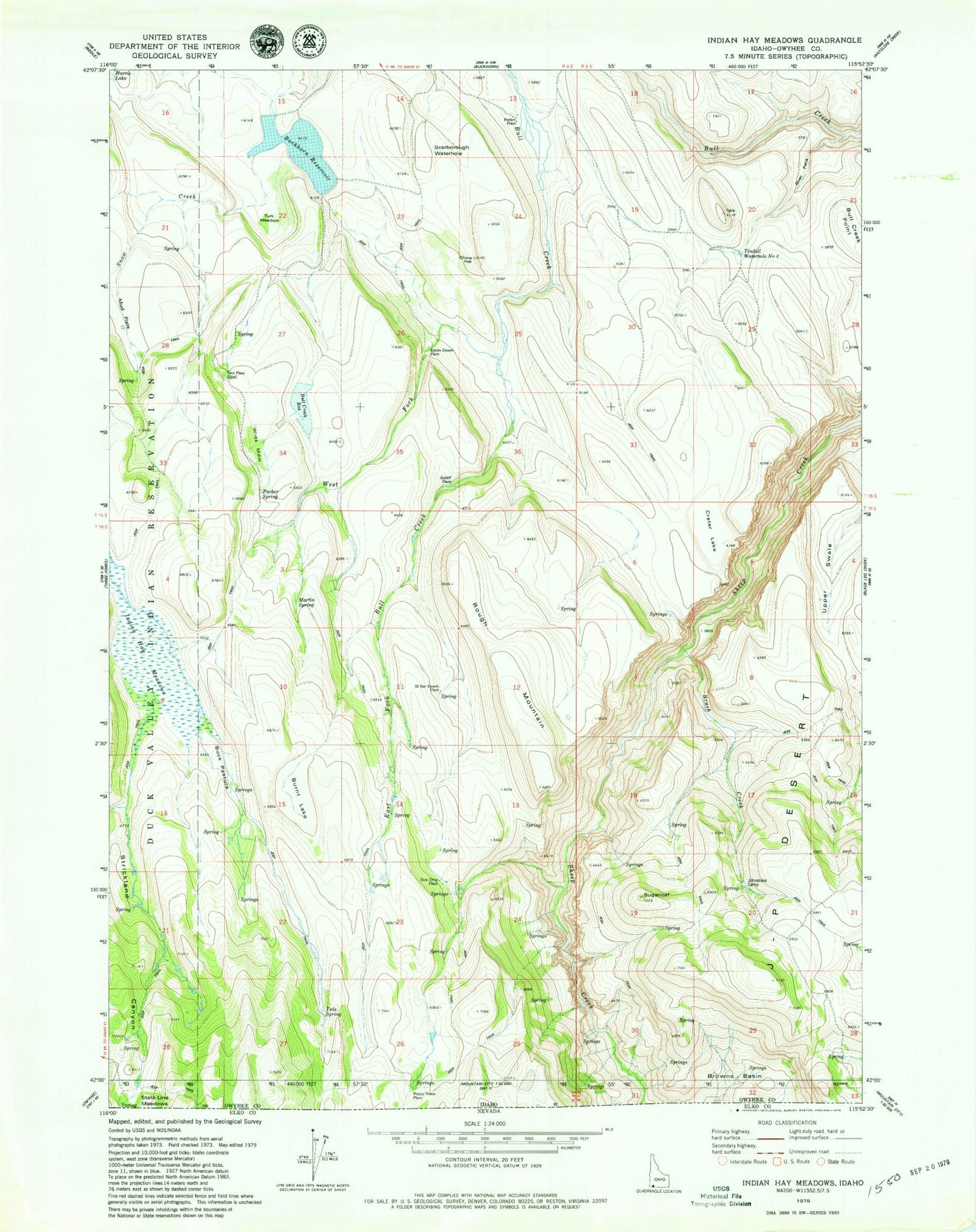
Historical USGS topographic quad map of Indian Hay Meadows in the state of Idaho. Map scale may vary for some years, but is generally around 1:24,000. Print size is approximately 24" x 27"
This quadrangle is in the following counties: Owyhee.
The map contains contour lines, roads, rivers, towns, and lakes. Printed on high-quality waterproof paper with UV fade-resistant inks, and shipped rolled.
Contains the following named places: Browns Basin, Brush Creek, Buck Pasture, Buckhorn Reservoir, Bull Creek Point, Bull Creek Reservoir, Burnt Lake, China Hat, Crater Lake, Dew Drop Place, East Fork Bull Creek, Eds Spring, Fork Meadow, Goat Pens, Indian Hay Meadows, Johnstons Camp, Katies Desert Place, Krutschmer Field, Martin Spring, Mud Flats, Parker Place, Parker Spring, Ratliff Place, Rough Mountain, Scarborough Waterhole, Snow Creek, Snow Creek Dam, SS Field, State Line Meadows, Strickland Canyon, Sugarloaf, Tate Place, Teds Spring, Tindall Dam, Tindall Water Hole Two, Turk Meadow, Twenty-Two Bar Desert Place, Wagner Field, West Fork Bull Creek, Wids Meadow


