

MyTopo
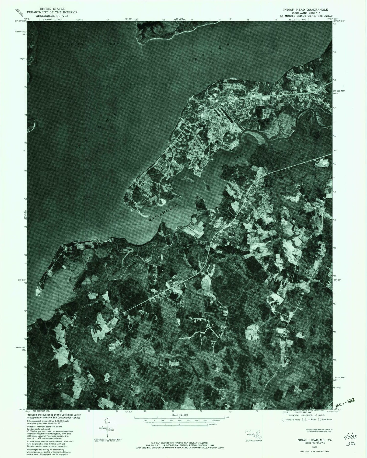
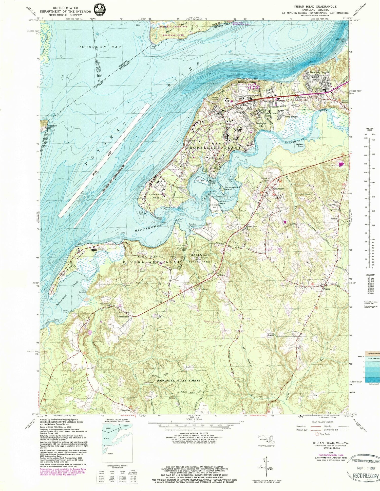
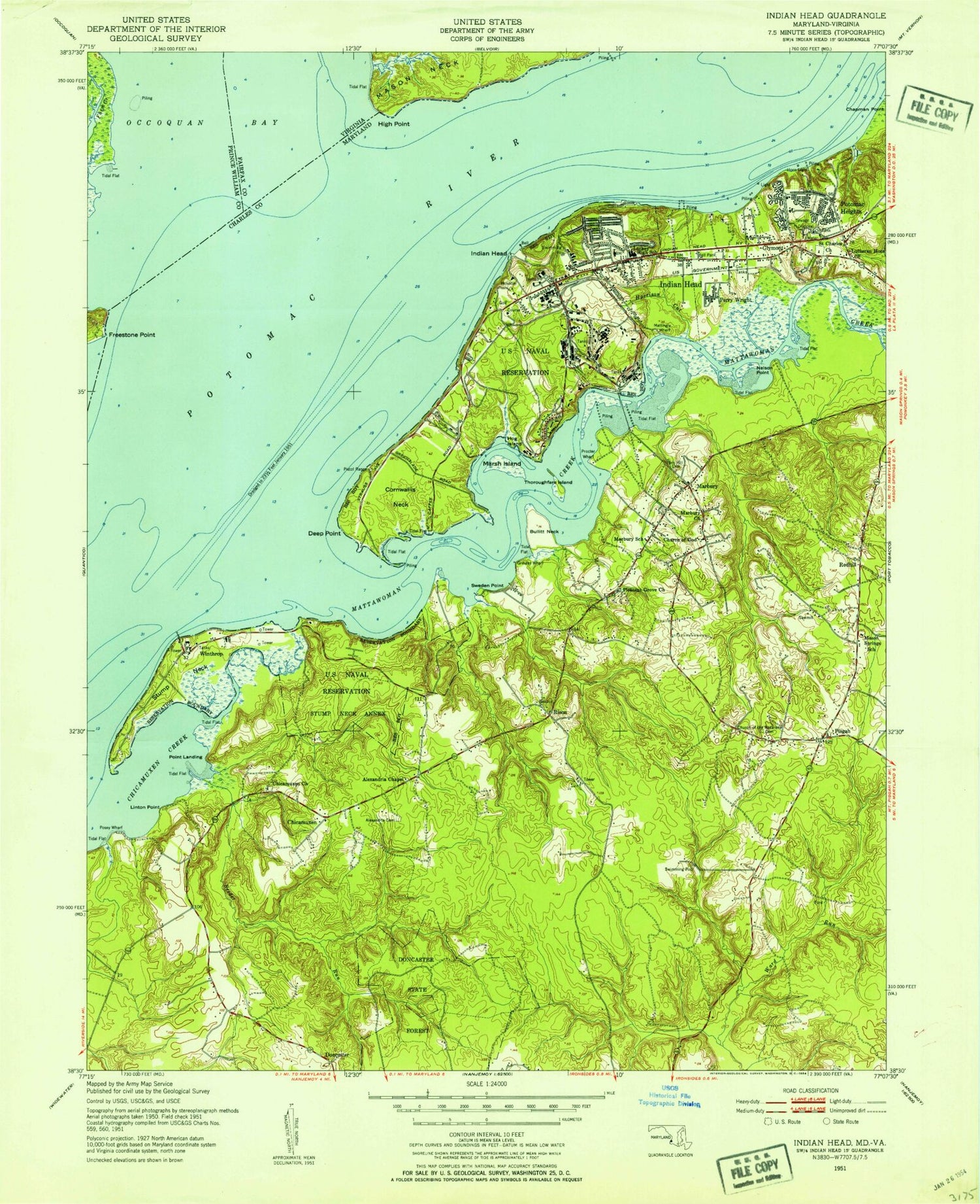
Classic USGS Indian Head Maryland 7.5'x7.5' Topo Map
Couldn't load pickup availability
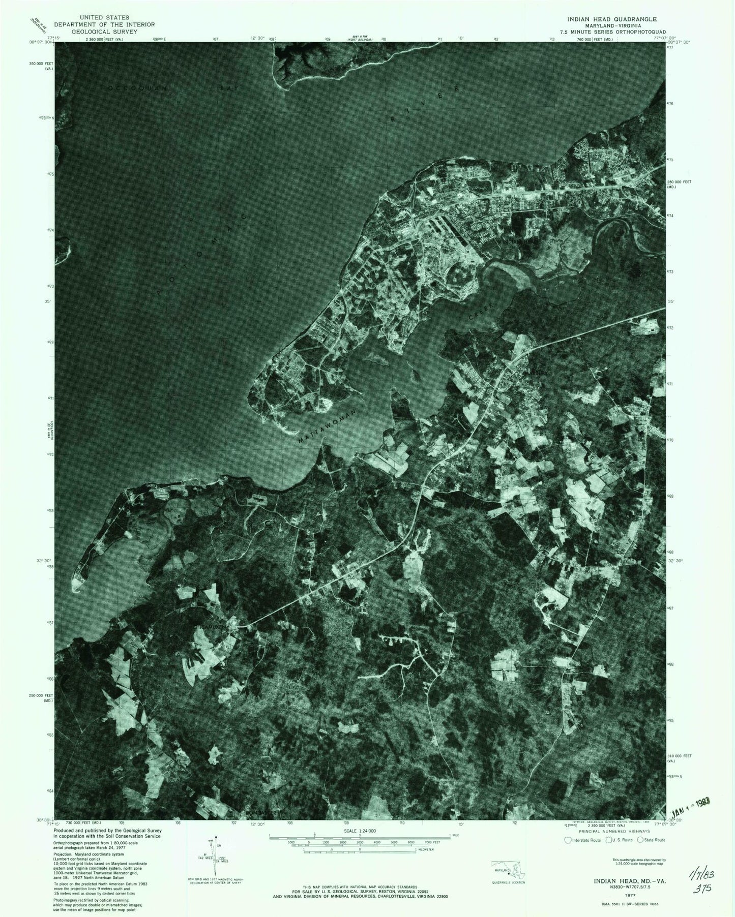
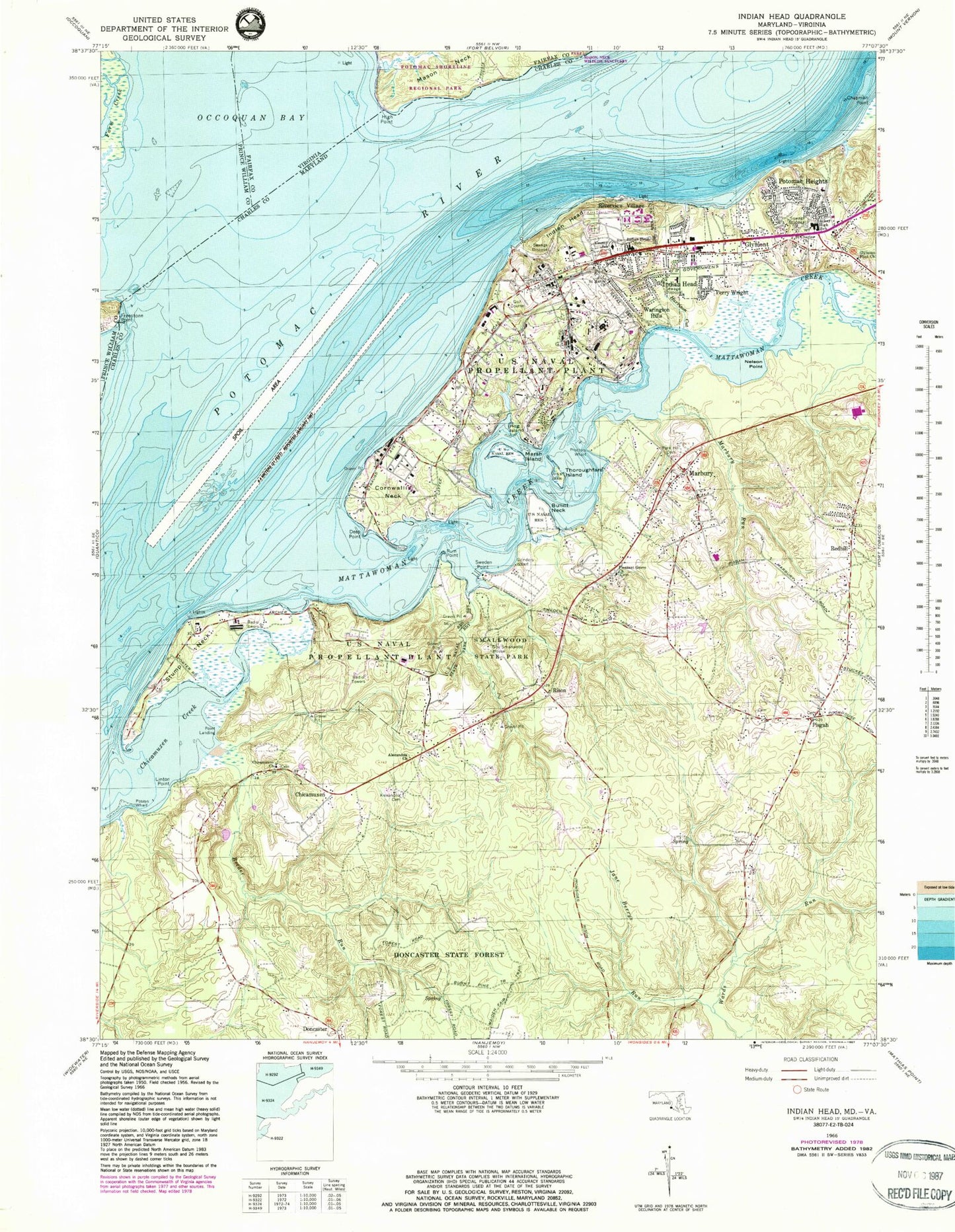
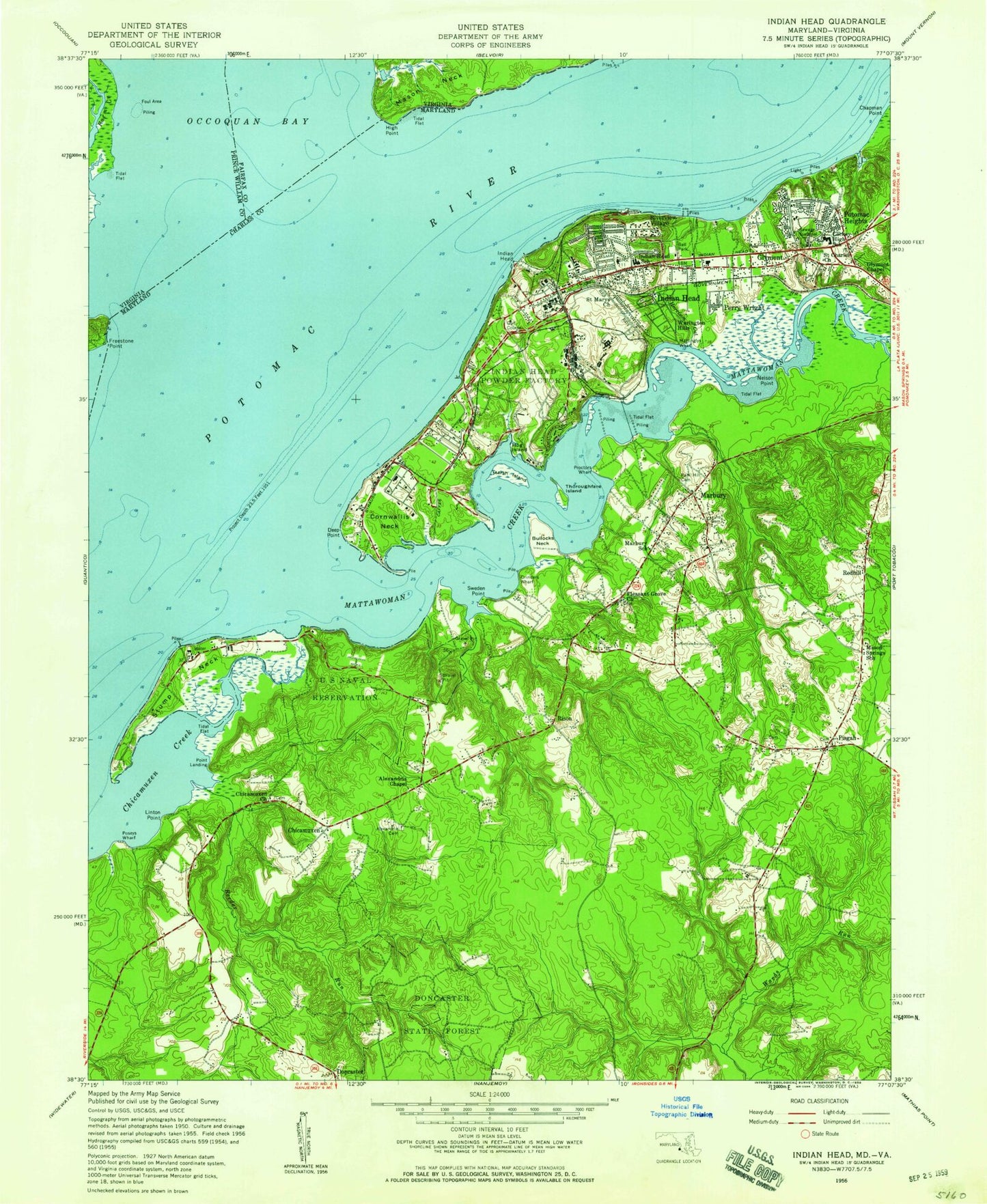
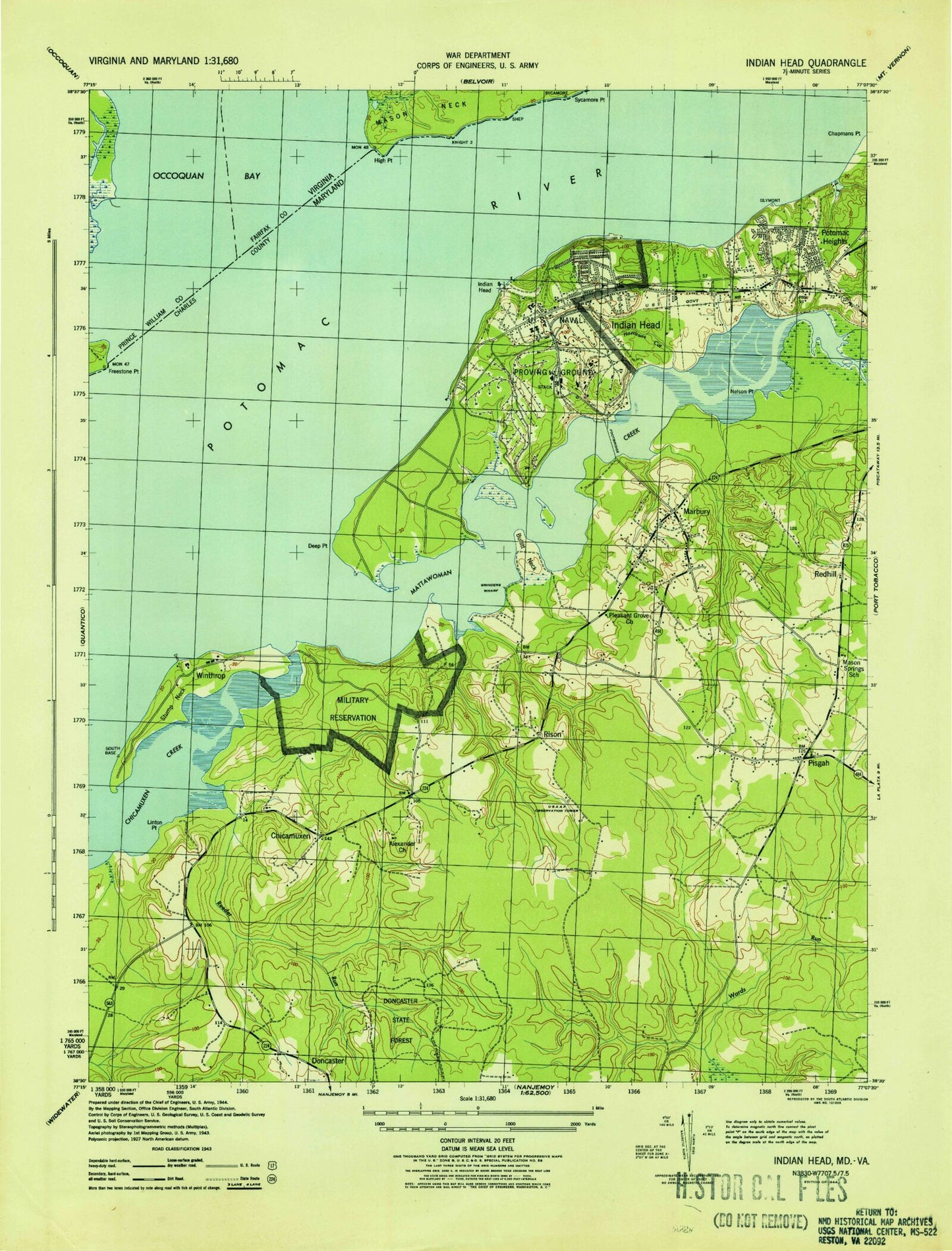
Historical USGS topographic quad map of Indian Head in the states of Maryland, Virginia. Typical map scale is 1:24,000, but may vary for certain years, if available. Print size: 24" x 27"
This quadrangle is in the following counties: Charles, Fairfax, Prince William.
The map contains contour lines, roads, rivers, towns, and lakes. Printed on high-quality waterproof paper with UV fade-resistant inks, and shipped rolled.
Contains the following named places: Alexandria Cemetery, Alexandria Church, Bullitt Neck, Burnt Pine Trail, Chicamuxen Church, Chicamuxen Creek, Cornwallis Neck, Deep Point, Doncaster State Forest, Glymont Flint Church, Government Smallwood House, Grinders Wharf, Harrison Cut, Hog Island, Indian Head, Indian Head Elementary School, Jane Berrys Run, Lackey High School, Linton Point, Maiden Fair Trail, Marbury Run, Marsh Island, Nelson Point, Park Hill Cemetery, Pisgah, Pleasant Grove Church, Poseys Wharf, Proctors Wharf, Reeder Run, Rum Point, Saint Charles Church, Saint Marys Church, Smallwood State Park, Stump Neck, Sweden Point, Thoroughfare Island, Chicamuxen, Glymont, Indian Head, Marbury, Perry Wright, Point Landing, Potomac Heights, Redhill, Rison, Riverview Village, Warington Hills, Mattawoman Creek, Charles County Sanitary Landfill, Charleston Gardens, Chicamuxen Cemetery, Diffenbach Court Park, Du-Mar Estates, Gale - Bailey Elementary School, Glynmont Branch Charles County Public Library, Glymont Medical Building, Glymont School (historical), Granny Thompson School (historical), Holly Haven, Indian Head Baptist Church, Indian Head Church of the Nazarene, Indian Head Post Office, Indian Head Shopping Center, Indian Head United Methodist Church, Indian Head Town Hall, Jones View, Henry E Lackey High School, Marbury Baptist Church, Marbury Baptist Church Cemetery, Marbury Church of God, Marbury Post Office, Mason Springs School (historical), Mattawoman State Natural Environmental Area, Mattawoman Village, Mattawoman Woods, Mattinglys Wharf (historical), Montaine, Our Savior Lutheran Church, Pisgah United Methodist Church Cemetery, Pisgah Methodist Church, Pisgah Post Office, Pleasant Grove Estates, Potomac Heights Baptist Church, Potomac Heights Christian School, Potomac Heights Company 7 Fire Station, Potomac Wood, Redhill Estates, Rison Acres, Rison Post Office (historical), Pleasant Grove Missionary Baptist Church Cemetery, Saint Charles Cemetery, Saint James Episcopal Church, Smallwood Estates, Winthrop (historical), District 10 Marbury, Potomac Heights Volunteer Fire Department and Rescue Squad, Tenth District Volunteer Fire Department and Emergency Medical Service, Indian Head Volunteer Fire Department and Rescue Squad, General Smallwood Middle School, Potomac Heights Census Designated Place, Town of Indian Head, Greater Spiritual Fellowship Community Church, Indian Head Wastewater Treatment Plant, Naval Surface Warfare Center Indian Head, Naval Support Facility Fire Department, Charles County Sheriff's Office District 2, Farm Creek, Freestone Point, High Point, Mason Neck Wildlife Sanctuary, Occoquan Bay, Potomac Shoreline Regional Park, Alexandria Cemetery, Alexandria Church, Bullitt Neck, Burnt Pine Trail, Chicamuxen Church, Chicamuxen Creek, Cornwallis Neck, Deep Point, Doncaster State Forest, Glymont Flint Church, Government Smallwood House, Grinders Wharf, Harrison Cut, Hog Island, Indian Head, Indian Head Elementary School, Jane Berrys Run, Lackey High School, Linton Point, Maiden Fair Trail, Marbury Run, Marsh Island, Nelson Point, Park Hill Cemetery, Pisgah, Pleasant Grove Church, Poseys Wharf, Proctors Wharf, Reeder Run, Rum Point, Saint Charles Church, Saint Marys Church, Smallwood State Park, Stump Neck, Sweden Point, Thoroughfare Island, Chicamuxen, Glymont, Indian Head, Marbury, Perry Wright, Point Landing, Potomac Heights, Redhill, Rison, Riverview Village, Warington Hills, Mattawoman Creek, Charles County Sanitary Landfill, Charleston Gardens, Chicamuxen Cemetery, Diffenbach Court Park, Du-Mar Estates, Gale - Bailey Elementary School, Glynmont Branch Charles County Public Library, Glymont Medical Building, Glymont School (historical), Granny Thompson School (historical), Holly Haven, Indian Head Baptist Church, Indian Head Church of the Nazarene, Indian Head Post Office, Indian Head Shopping Center, Indian Head United Methodist Church, Indian Head Town Hall, Jones View, Henry E Lackey High School, Marbury Baptist Church, Marbury Baptist Church Cemetery, Marbury Church of God, Marbury Post Office, Mason Springs School (historical), Mattawoman State Natural Environmental Area, Mattawoman Village, Mattawoman Woods, Mattinglys Wharf (historical), Montaine, Our Savior Lutheran Church, Pisgah United Methodist Church Cemetery, Pisgah Methodist Church, Pisgah Post Office, Pleasant Grove Estates, Potomac Heights Baptist Church, Potomac Heights Christian School, Potomac Heights Company 7 Fire Station, Potomac Wood, Redhill Estates, Rison Acres, Rison Post Office (historical), Pleasant Grove Missionary Baptist Church Cemetery, Saint Charles Cemetery, Saint James Episcopal Church, Smallwood Estates, Winthrop (historical), District 10 Marbury, Potomac Heights Volunteer Fire Department and Rescue Squad, Tenth District Volunteer Fire Department and Emergency Medical Service, Indian Head Volunteer Fire Department and Rescue Squad, General Smallwood Middle School, Potomac Heights Census Designated Place, Town of Indian Head, Greater Spiritual Fellowship Community Church, Indian Head Wastewater Treatment Plant, Naval Surface Warfare Center Indian Head, Naval Support Facility Fire Department, Charles County Sheriff's Office District 2, Farm Creek, Freestone Point, High Point, Mason Neck Wildlife Sanctuary, Occoquan Bay, Potomac Shoreline Regional Park, Alexandria Cemetery, Alexandria Church, Bullitt Neck, Burnt Pine Trail, Chicamuxen Church, Chicamuxen Creek, Cornwallis Neck, Deep Point, Doncaster State Forest, Glymont Flint Church, Government Smallwood House, Grinders Wharf