MyTopo
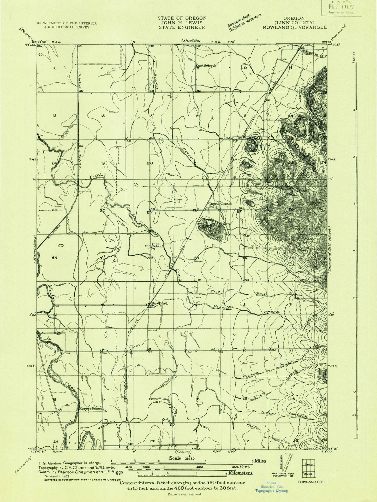
Classic USGS Indian Head Oregon 7.5'x7.5' Topo Map
Couldn't load pickup availability
Historical USGS topographic quad map of Indian Head in the state of Oregon. Map scale may vary for some years, but is generally around 1:24,000. Print size is approximately 24" x 27"
This quadrangle is in the following counties: Linn.
The map contains contour lines, roads, rivers, towns, and lakes. Printed on high-quality waterproof paper with UV fade-resistant inks, and shipped rolled.
Contains the following named places: Bishop Creek, Blan Cemetery, Bond Butte, Brownsville Wastewater Treatment Facility, Charity Grange Hall, Crocus, Daniels Field LLC Airport, Dinwiddie Valley, Folk, Harris Cemetery, Harris Private School, Indian Head, Lafferty Field, Permaneer Log Pond, Pierce Creek, Putnam Creek, River Spur, Rowland, Rowland Post Office, Stanwood, Tub Run, Twin Buttes, Virgil, White Creek, Wigle Cemetery, Wrights Airfield, ZIP Code: 97446