MyTopo
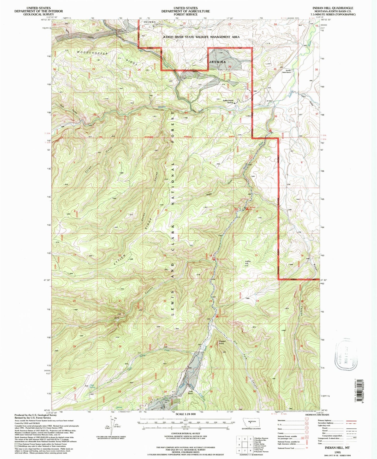
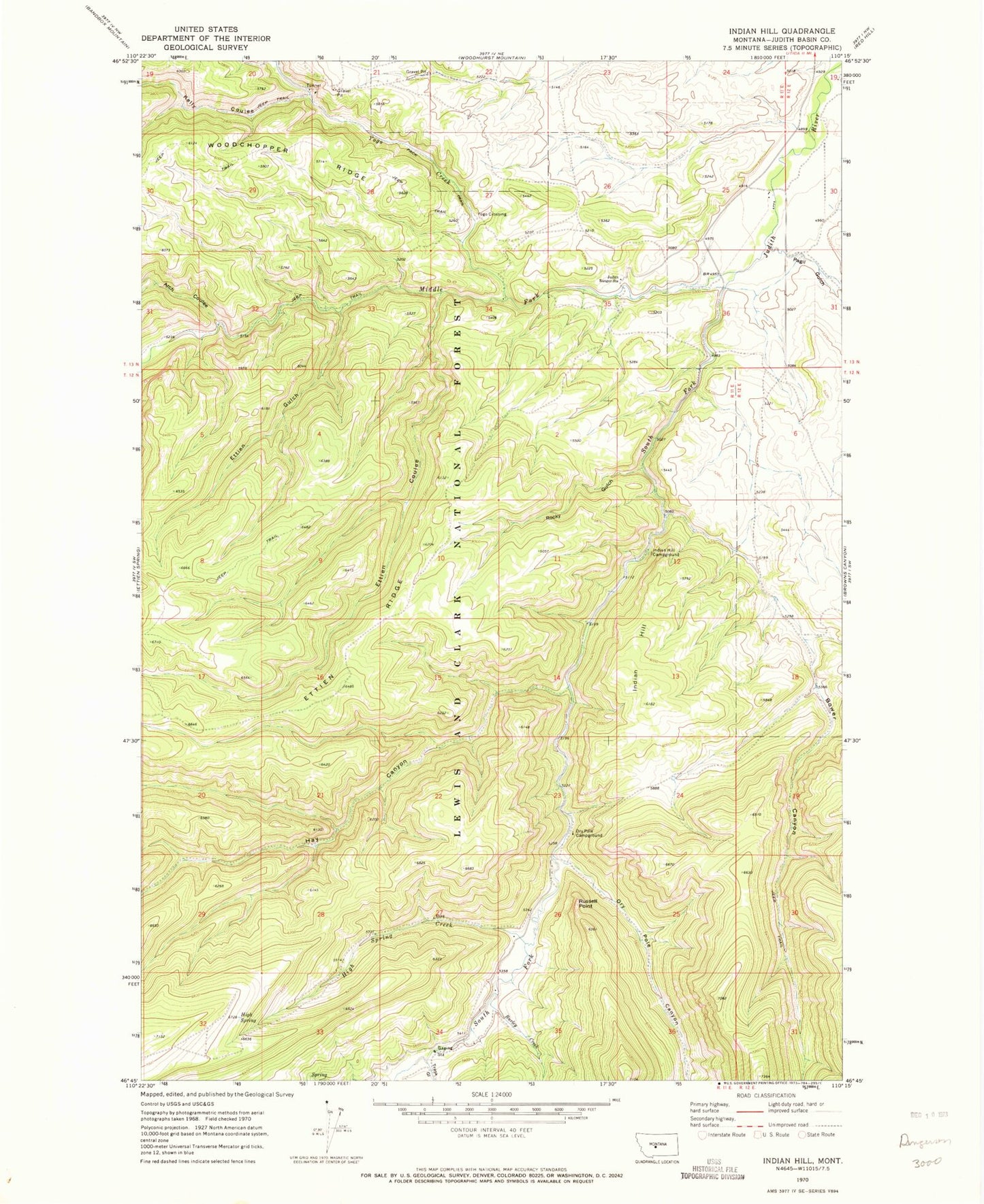
Classic USGS Indian Hill Montana 7.5'x7.5' Topo Map
Couldn't load pickup availability
Historical USGS topographic quad map of Indian Hill in the state of Montana. Typical map scale is 1:24,000, but may vary for certain years, if available. Print size: 24" x 27"
This quadrangle is in the following counties: Judith Basin.
The map contains contour lines, roads, rivers, towns, and lakes. Printed on high-quality waterproof paper with UV fade-resistant inks, and shipped rolled.
Contains the following named places: Arch Coulee, Bower Canyon, Burley Creek, Dry Pole Campground, Dry Pole Canyon, Ettien Gulch, Hay Canyon, High Spring, High Spring Creek, Indian Hill, Indian Hill Campground, Judith Ranger Station, Kelly Coulee, Middle Fork Judith River, Pagil Gulch, Rocky Gulch, Russell Point, South Fork Judith River, Trask Gulch, Yogo Creek, Yogo Crossing, Korells Dude Ranch, Fred M Ellis Memorial Campground, Hay Canyon Campground, Trask Ranch, American Mine, Vortex Mine, NW SE Section 20 Mine, 13N11E36DA__01 Well, 13N11E35AB__01 Well, 13N11E25DA__01 Well, 13N11E25DA__02 Well, 13N11E25DA__03 Well, 13N11E26BD__01 Well, 13N11E26BD__02 Well, 13N12E30BA__01 Well, 13N12E19CA__01 Well, 13N12E19BD__01 Well, Sapphire Post Office (historical)