MyTopo
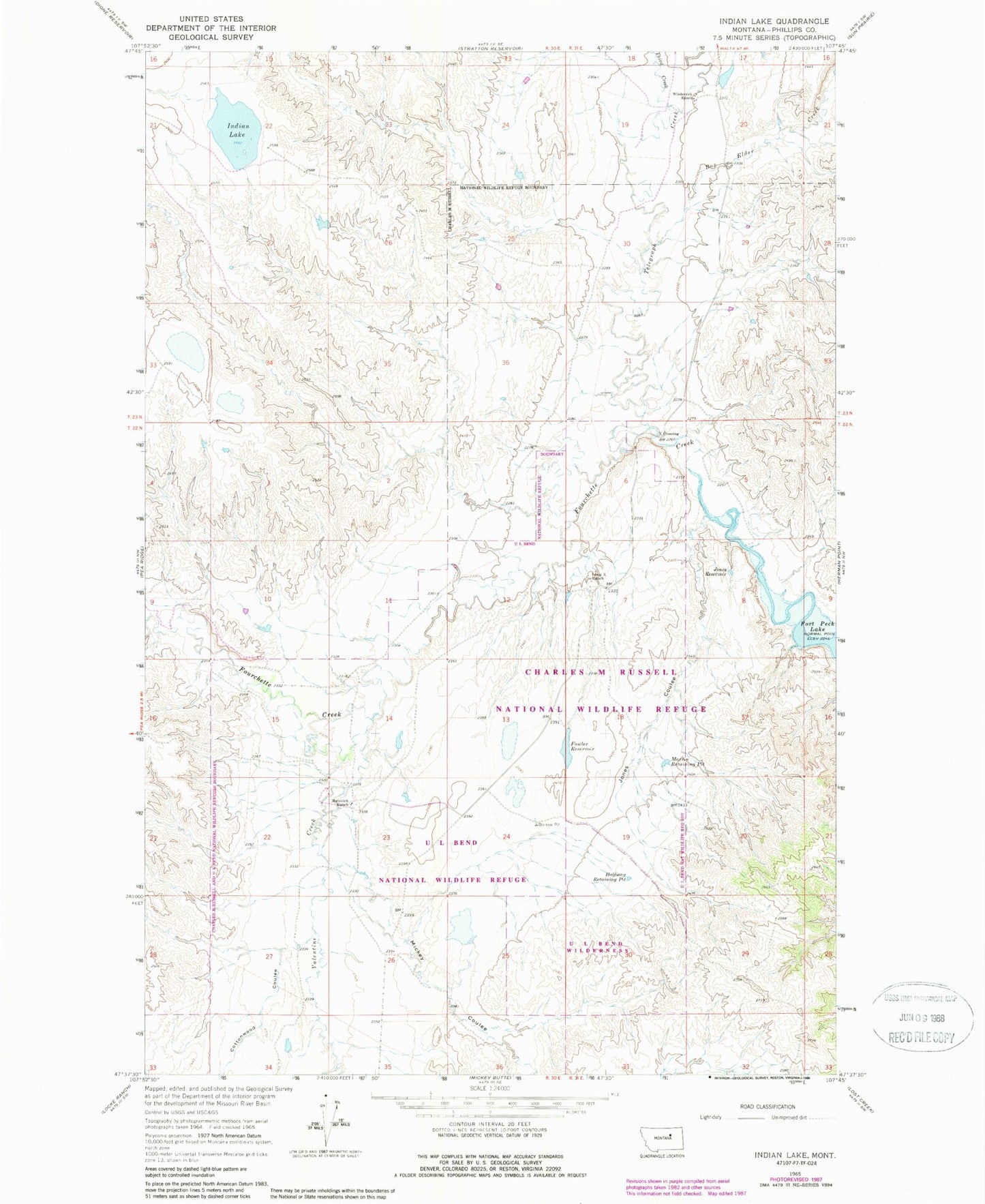
Classic USGS Indian Lake Montana 7.5'x7.5' Topo Map
Couldn't load pickup availability
Historical USGS topographic quad map of Indian Lake in the state of Montana. Map scale may vary for some years, but is generally around 1:24,000. Print size is approximately 24" x 27"
This quadrangle is in the following counties: Phillips.
The map contains contour lines, roads, rivers, towns, and lakes. Printed on high-quality waterproof paper with UV fade-resistant inks, and shipped rolled.
Contains the following named places: 22N30E09AC__01 Well, 22N30E23BB__01 Well, 22N30E28AD__01 Well, 22N31E07BC__01 Well, Box Elder Creek, CCC Indian Division Number 1 Dam, Cottonwood Coulee, Fourchette Creek, Fowler Reservoir, Fowler Reservoir Dam, Halfway Retaining Pit, Indian Lake, Jones Coulee, Jones Reservoir, Long X Ranch, Long X School, Martin Retaining Pit, Matovich Ranch, Mickey Coulee, Stratton School, Telegraph Creek, Third Creek, Valentine Creek, Wiederrick Dam, Wiederrick Ranch, X Crossing