MyTopo
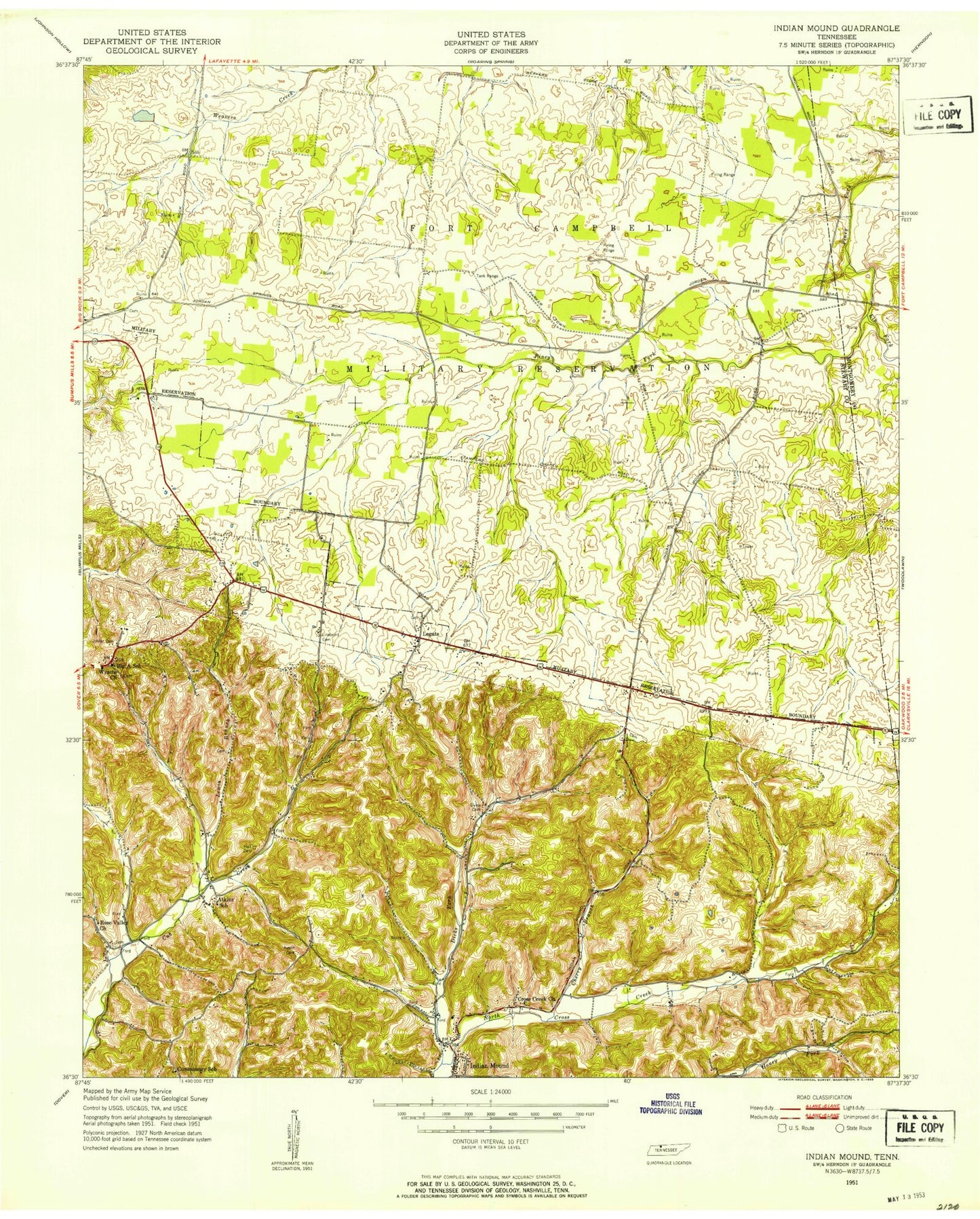
Classic USGS Indian Mound Tennessee 7.5'x7.5' Topo Map
Couldn't load pickup availability
Historical USGS topographic quad map of Indian Mound in the state of Tennessee. Map scale may vary for some years, but is generally around 1:24,000. Print size is approximately 24" x 27"
This quadrangle is in the following counties: Montgomery, Stewart.
The map contains contour lines, roads, rivers, towns, and lakes. Printed on high-quality waterproof paper with UV fade-resistant inks, and shipped rolled.
Contains the following named places: Ardee, Atkins, Atkins School, Austin Cemetery, Big A School, Buckhart Hollow, Buhler School, Cherry Branch, Commissary Hollow Access Point, Commissary School, Commissioner District 2, Cross Creek Church, Dicks Fork Creek, Elk Fork Creek, Gillum Hollow, Givins Cemetery, Green Hollow, Greer Hollow, Guinn School, Hall Cemetery, Indian Mound, Indian Mound Post Office, Indian Mound School, Joiner Cemetery, Keats Hollow, Kyle Lake Dam, Lake Kyle, Legate, Legate School, Lewis Branch, Lewis Hollow, Lineberry Cemetery, Little Cub Creek, McNichols Hollow, Meadow School, Mont Zion Church, North Fork North Cross Creek, North Stewart Elementary School, O K School, Parker Town, Piney Fork Branch, Pool Four, Pool Four Dam, Red Top, Rorie Hollow, Rose Valley Church, Seay Spring, Shepherd Hollow, Smith Cemetery, Smith Hollow, Smiths Grove School, South Fork North Cross Creek, Stampers Chapel, Stewart County Fire Rescue Station 1, Stewart County Fire Rescue Station 10, Stewart County Volunteer Fire and Rescue Station 2 Red Top, Terrell Hollow, Weakley Horn Hollow, Wilson Hollow, Wyatts Chapel, Wyatts Church