
MyTopo
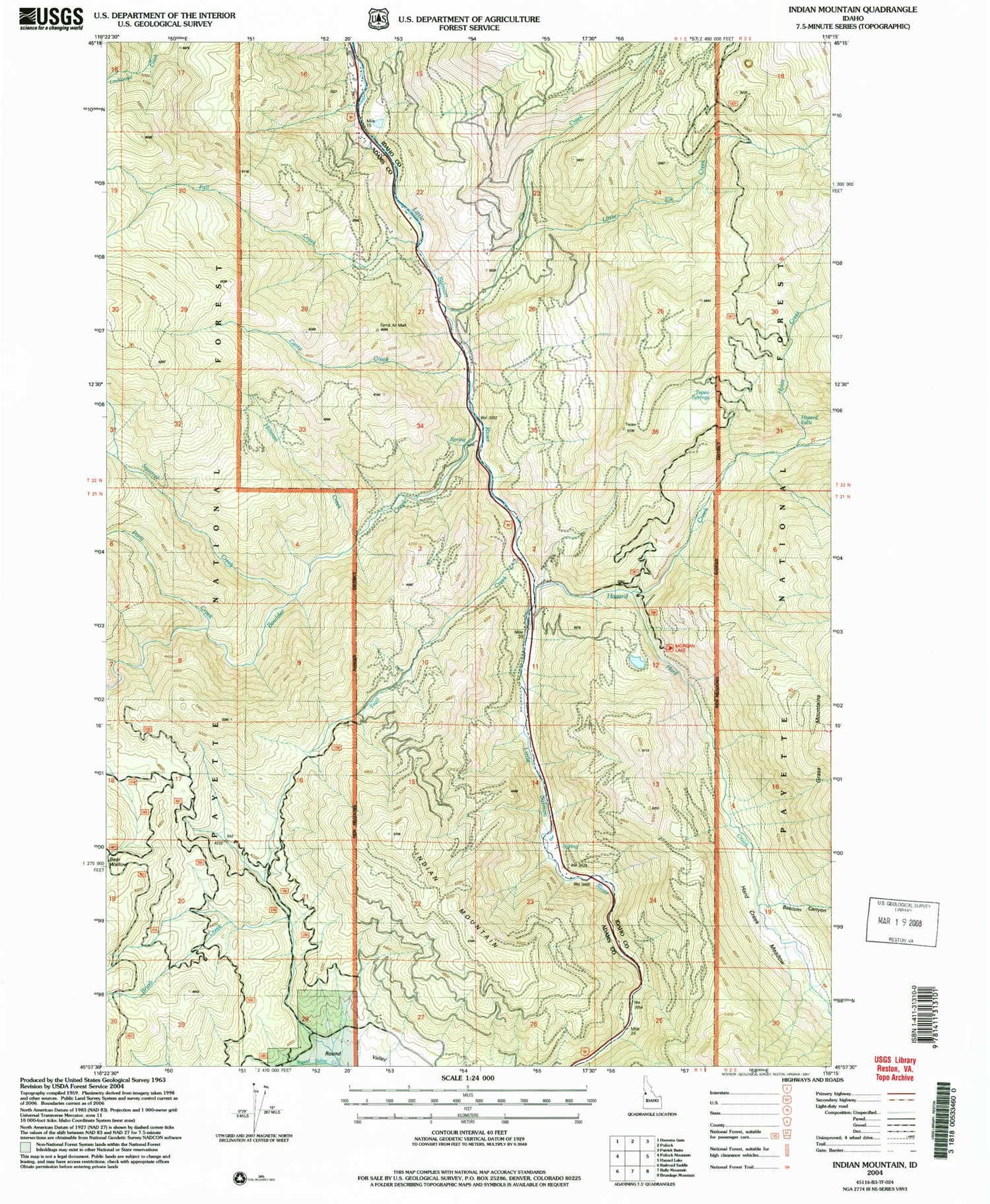
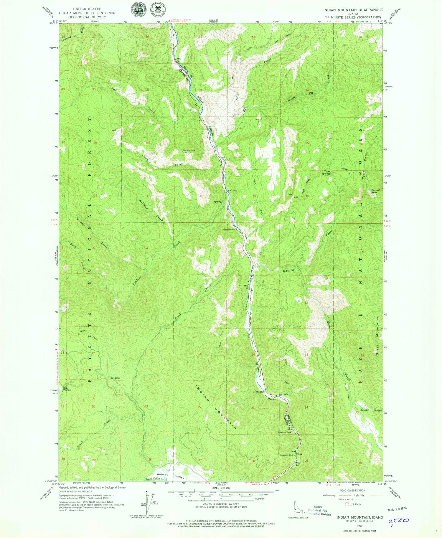
Classic USGS Indian Mountain Idaho 7.5'x7.5' Topo Map
Couldn't load pickup availability
Historical USGS topographic quad map of Indian Mountain in the state of Idaho. Typical map scale is 1:24,000, but may vary for certain years, if available. Print size: 24" x 27"
This quadrangle is in the following counties: Adams, Idaho.
The map contains contour lines, roads, rivers, towns, and lakes. Printed on high-quality waterproof paper with UV fade-resistant inks, and shipped rolled.
Contains the following named places: Brush Creek, Bascom Canyon, Boulder Creek, Elk Creek, Fall Creek, Hard Creek, Hazard Creek, Hazard Falls, Hyatt Creek, Indian Mountain, Little Elk Creek, Pony Creek, Squirrel Creek, Tepee Springs, Trail Creek, Hard Creek meadows, Lockwood Creek, Camp Creek, Hillman Creek, Fall Creek Access Area


