MyTopo
Classic USGS Indian Pass Washington 7.5'x7.5' Topo Map
Couldn't load pickup availability
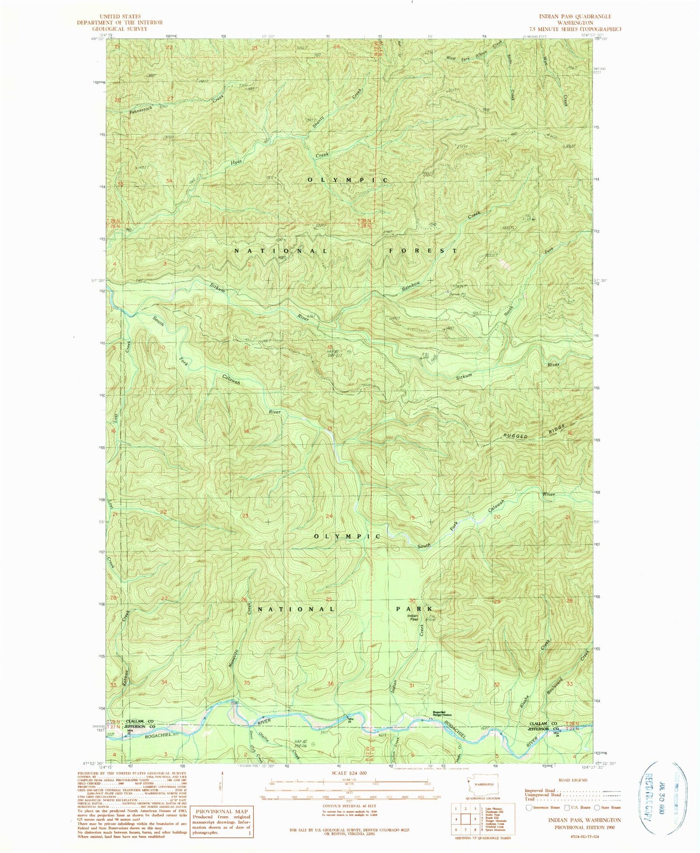
Historical USGS topographic quad map of Indian Pass in the state of Washington. Map scale may vary for some years, but is generally around 1:24,000. Print size is approximately 24" x 27"
This quadrangle is in the following counties: Clallam, Jefferson.
The map contains contour lines, roads, rivers, towns, and lakes. Printed on high-quality waterproof paper with UV fade-resistant inks, and shipped rolled.
Contains the following named places: Bogachiel, Bogachiel Shelter, Boulevard Creek, Calawah Shelter, Cultus Creek, Devil Club Creek, Hades Creek, Hyas Lookout, Indian Creek, Kahkwa Creek, Kloshe Creek, Mosquito Creek, North Fork Sitkum River, Olallie Creek, Pass Trail, Rainbow Creek, Rugged Ridge Trail, Shanty Creek, Sitkum River, Sitkum Shelter, Slide Creek