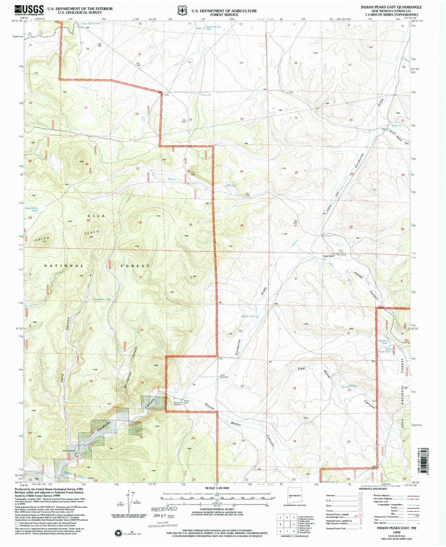
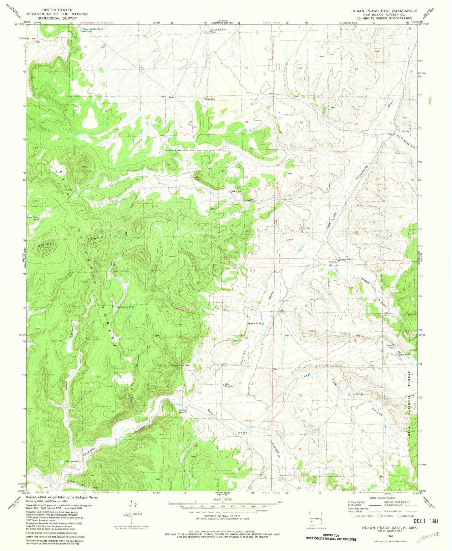
MyTopo
Classic USGS Indian Peaks East New Mexico 7.5'x7.5' Topo Map
Couldn't load pickup availability
Historical USGS topographic quad map of Indian Peaks East in the state of New Mexico. Map scale may vary for some years, but is generally around 1:24,000. Print size is approximately 24" x 27"
This quadrangle is in the following counties: Catron.
The map contains contour lines, roads, rivers, towns, and lakes. Printed on high-quality waterproof paper with UV fade-resistant inks, and shipped rolled.
Contains the following named places: Adobe Canyon, Adobe Headquarters, Adobe Ranch, Adobe Ranch Private Airport, Adobe Ranch Weather Station, Corduroy Draw, Corduroy Windmill, East Forest Tank, East Water Canyon, Elk Tank, Gibson Well, Hiawatha Mine, Indian Peaks, Little Windmill, North Water Canyon, Overhill Tank, Peaks Tank, Sand Canyon, Sand Windmill, Silver Dollar Tank, South Water Canyon, Springtime Canyon, Springtime Tank, Square Tank, Squaw Creek, Tub-in-the-Flat Tank, V Cross T Headquarters