MyTopo
Classic USGS Indian Point Wyoming 7.5'x7.5' Topo Map
Couldn't load pickup availability
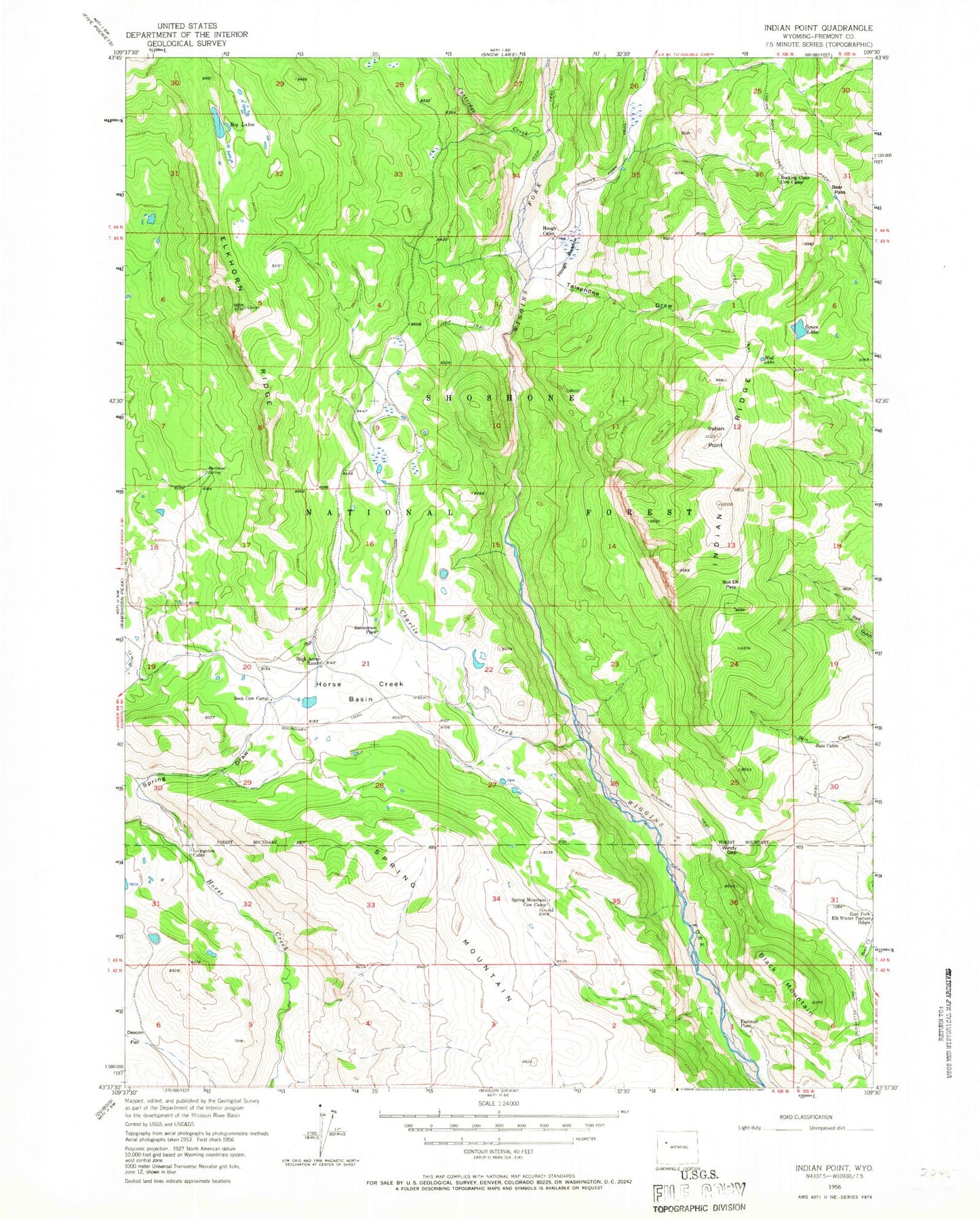
Historical USGS topographic quad map of Indian Point in the state of Wyoming. Typical map scale is 1:24,000, but may vary for certain years, if available. Print size: 24" x 27"
This quadrangle is in the following counties: Fremont.
The map contains contour lines, roads, rivers, towns, and lakes. Printed on high-quality waterproof paper with UV fade-resistant inks, and shipped rolled.
Contains the following named places: Bain Cabin, Bartrand Spring, Bear Pass, Beck Cow Camp, Black Mountain, Bog Lakes, Boundary Trail, Bull Elk Pass, Charlie Creek, East Fork Elk Winter Pasture Headquarters, Elkhorn Ridge, Green Lake, High Acres Ranch, Horse Creek Basin, Hough Cabin, Hough Meadow, Indian Point, Indian Ridge, Livingston Cabin, Rocking Chair Cow Camp, Spring Mountain Cow Camp, Telephone Draw, Windy Gap, Spring Mountain, Eastman Place (historical), Simmerson Place, Cartridge Creek, Indian Point Trail, Mud Lake, Spring Draw