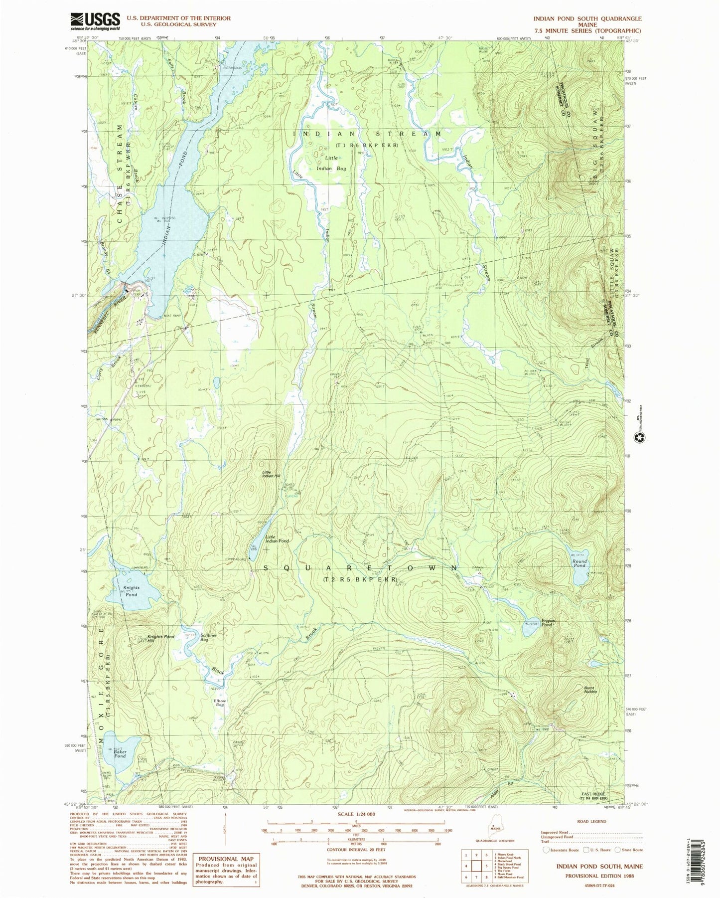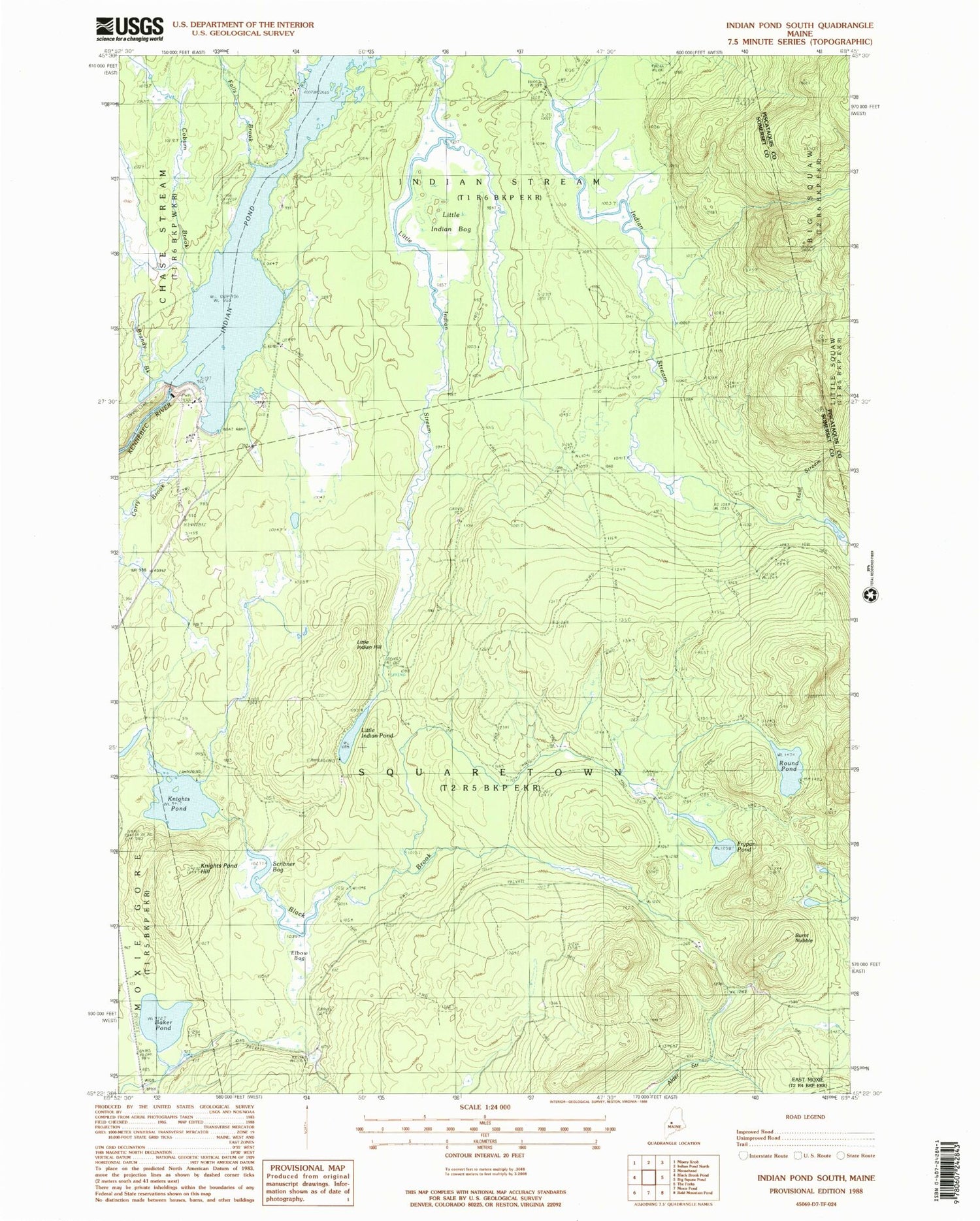
MyTopo
Classic USGS Indian Pond South Maine 7.5'x7.5' Topo Map
Couldn't load pickup availability
Historical USGS topographic quad map of Indian Pond South in the state of Maine. Map scale may vary for some years, but is generally around 1:24,000. Print size is approximately 24" x 27"
This quadrangle is in the following counties: Piscataquis, Somerset.
The map contains contour lines, roads, rivers, towns, and lakes. Printed on high-quality waterproof paper with UV fade-resistant inks, and shipped rolled.
Contains the following named places: Alder Stream, Baker Pond, Brandy Brook, Burnt Nubble, Coburn Brook, Elbow Bog, Falls Brook, Frypan Pond, Harris Dam, Harris Dike, Indian Stream Township, Knights Pond, Knights Pond Hill, Little Indian Bog, Little Indian Hill, Little Indian Pond, Round Pond, Scribner Bog, Squaretown Township, Trout Stream