MyTopo
Classic USGS Indian Rocks Wyoming 7.5'x7.5' Topo Map
Couldn't load pickup availability
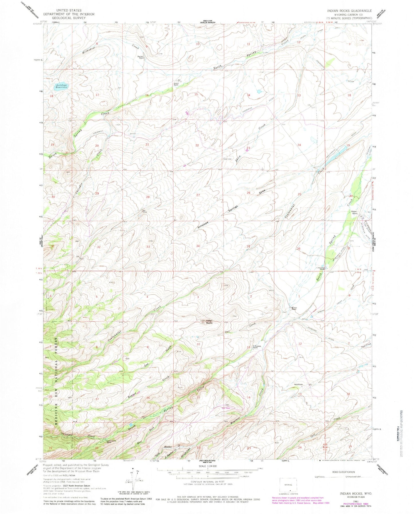
Historical USGS topographic quad map of Indian Rocks in the state of Wyoming. Map scale may vary for some years, but is generally around 1:24,000. Print size is approximately 24" x 27"
This quadrangle is in the following counties: Carbon.
The map contains contour lines, roads, rivers, towns, and lakes. Printed on high-quality waterproof paper with UV fade-resistant inks, and shipped rolled.
Contains the following named places: Antelope Dam, Antelope Reservoir, Antelope Springs Draw, Bartlett Ranch, Bath Ranch, Beaver Creek, Berger Ranch, C Swanson Ranch, Cherokee Creek, Cherokee Ditch, Chippewa Creek, Cozy Canyon Ranch, Dunkard Ditch, East Fork South Spring Creek, Heather Creek, Indian Rocks, Methodist Creek, Mowry Ranch, North Heather Creek, Owl Creek, Owl Gulch, Shingle Creek, South Heather Creek, V Swanson Ranch, Waliser Ranch