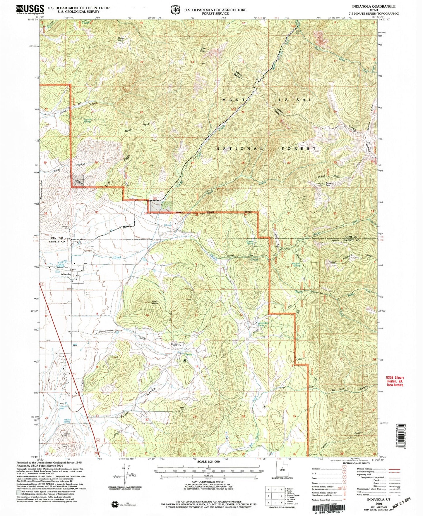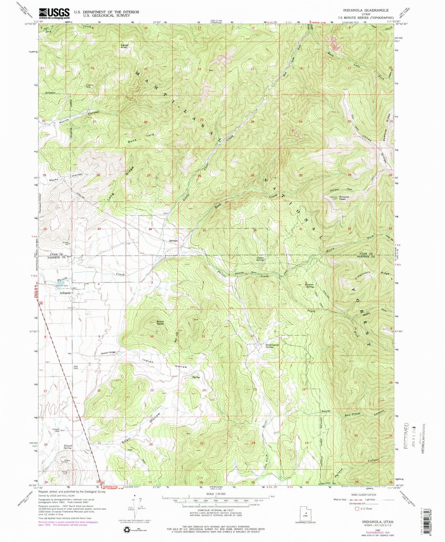
MyTopo
Classic USGS Indianola Utah 7.5'x7.5' Topo Map
Couldn't load pickup availability
Historical USGS topographic quad map of Indianola in the state of Utah. Map scale may vary for some years, but is generally around 1:24,000. Print size is approximately 24" x 27"
This quadrangle is in the following counties: Sanpete, Utah.
The map contains contour lines, roads, rivers, towns, and lakes. Printed on high-quality waterproof paper with UV fade-resistant inks, and shipped rolled.
Contains the following named places: Beehive Ridge, Black Hawk, Bone Yard, Browns Peak, Browns Peak Trail, Cedar Knoll, Coyote Spring, Crotons Mine, East Lake Fork, Indian Hollow, Indianola, Lasson Draw Wildlife Management Area, Lasson Spring, Little Clear Creek, Loggers Fork, Long Ridge, Lucy Fork, Middle Fork Thistle Creek, Mormon Spring, North Fork Thistle Creek, North San Pitch Canyon, Parleys Canyon, Poison Ridge, Poulson Well, Quakingasp Spring, Red Cliff, Rock Creek, Snail Hollow, South Fork Thistle Creek, South San Pitch Canyon, Spencer Cemetery, Tidwell Spring, West Lake Fork, ZIP Code: 84629