MyTopo
Classic USGS Indiantown Florida 7.5'x7.5' Topo Map
Couldn't load pickup availability
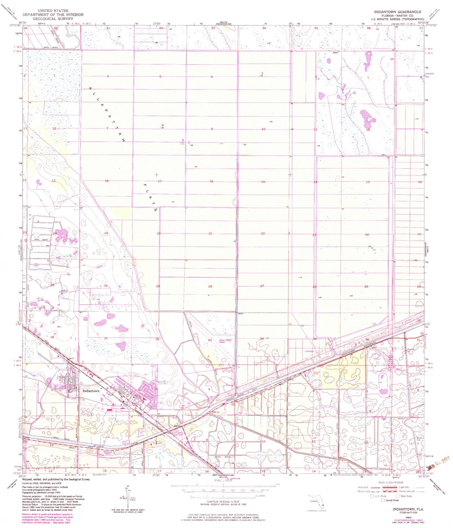
Historical USGS topographic quad map of Indiantown in the state of Florida. Map scale may vary for some years, but is generally around 1:24,000. Print size is approximately 24" x 27"
This quadrangle is in the following counties: Martin.
The map contains contour lines, roads, rivers, towns, and lakes. Printed on high-quality waterproof paper with UV fade-resistant inks, and shipped rolled.
Contains the following named places: Booker Park Fire Department, Evangelical Haitian Church of the Nazarene, Evergreen First Baptist Church, Family Worship Center, First United Methodist Church, Grasslands Golf and Country Club, Hope Rural School, Indian Town Bridge, Indiantown, Indiantown Airport, Indiantown Baptist Church, Indiantown Census Designated Place, Indiantown Middle School, Indiantown Post Office, Martin County, Martin County Fire Rescue Station 24, Martin County Public Library System Indiantown Branch Library, Martin County Sheriff's Office Indiantown Substation, Rowland Canal, Saint Lucie Canal, Sheltras Trailer Park, Village of Indiantown, Warfield Elementary School, WCNO-FM (Palm City), WKGR-FM (Fort Pierce), WOVV-FM (Fort Pierce), WPBF-TV (Tequesta), WTVX-TV (Fort Pierce), WWFR-FM (Okeechobee), ZIP Code: 34956