MyTopo
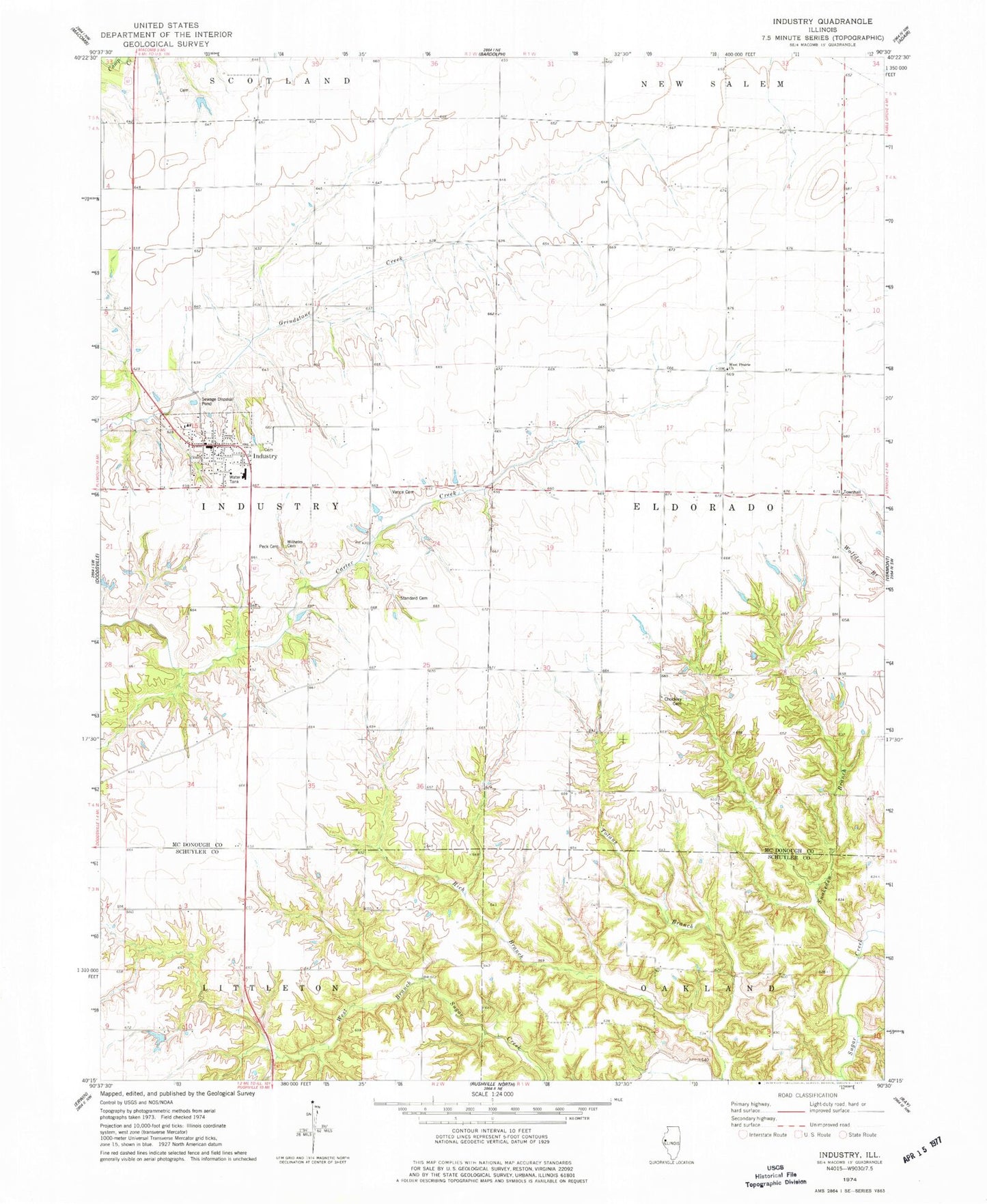
Classic USGS Industry Illinois 7.5'x7.5' Topo Map
Couldn't load pickup availability
Historical USGS topographic quad map of Industry in the state of Illinois. Map scale may vary for some years, but is generally around 1:24,000. Print size is approximately 24" x 27"
This quadrangle is in the following counties: McDonough, Schuyler.
The map contains contour lines, roads, rivers, towns, and lakes. Printed on high-quality waterproof paper with UV fade-resistant inks, and shipped rolled.
Contains the following named places: Browns School, Chalkey School, Chockley Cemetery, Claybough Cemetery, Coloma School, Craig Cemetery, Crossroads Cemetery, Dixie School, Egypt School, Eldorado Townhall, Ferndale School, Industry, Industry Assembly of God Church, Industry Cemetery, Industry Elementary School, Industry Fire Protection District, Industry High School, Industry Post Office, Industry United Methodist Church, McKamey School, Moore Cemetery, Nevada School, Peck Cemetery, Pleasant Grove Cemetery, Pleasant Grove Methodist Episcopal Church, Pleasant Grove School, Pleasant Ridge School, Price School, Rich Branch, Salem Meeting House of the Brethren in Christ, School Number 16, Snakeden Branch, Spring Grove Cemetery, Standard Cemetery, Stewardsville, Township of Eldorado, Township of Industry, Union Grove School, Vail Cemetery, Vance Cemetery, Village of Industry, West Prairie Cumberland Presbyterian Church, Wilhelm Cemetery, ZIP Code: 61440