MyTopo
Classic USGS Ingalls Kansas 7.5'x7.5' Topo Map
Couldn't load pickup availability
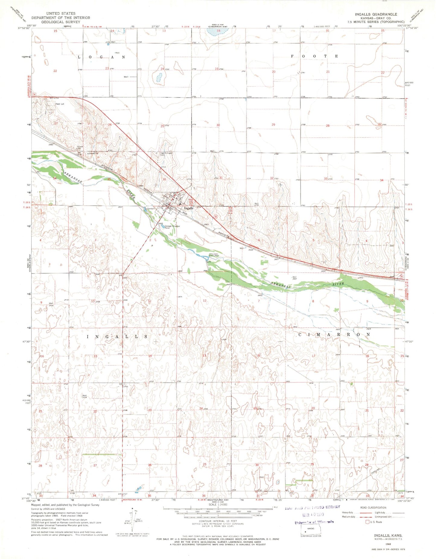
Historical USGS topographic quad map of Ingalls in the state of Kansas. Map scale may vary for some years, but is generally around 1:24,000. Print size is approximately 24" x 27"
This quadrangle is in the following counties: Gray.
The map contains contour lines, roads, rivers, towns, and lakes. Printed on high-quality waterproof paper with UV fade-resistant inks, and shipped rolled.
Contains the following named places: City of Ingalls, Dodge City Co - Operative Exchange Grain Elevator Number 10, Ingalls, Ingalls City Hall, Ingalls Community Bible Church, Ingalls Elementary School, Ingalls Junior - Senior High School, Ingalls Library, Ingalls Post Office, Ingalls Volunteer Fire Department, Ingalls-Logan Cemetery, KKJQ - FM (Cimarron), KSKZ - FM (Cimarron), KSSA - FM (Cimarron), Saint Stanislaus Catholic Church, Santa Fe Trail Museum, Theoni Elementary School