MyTopo
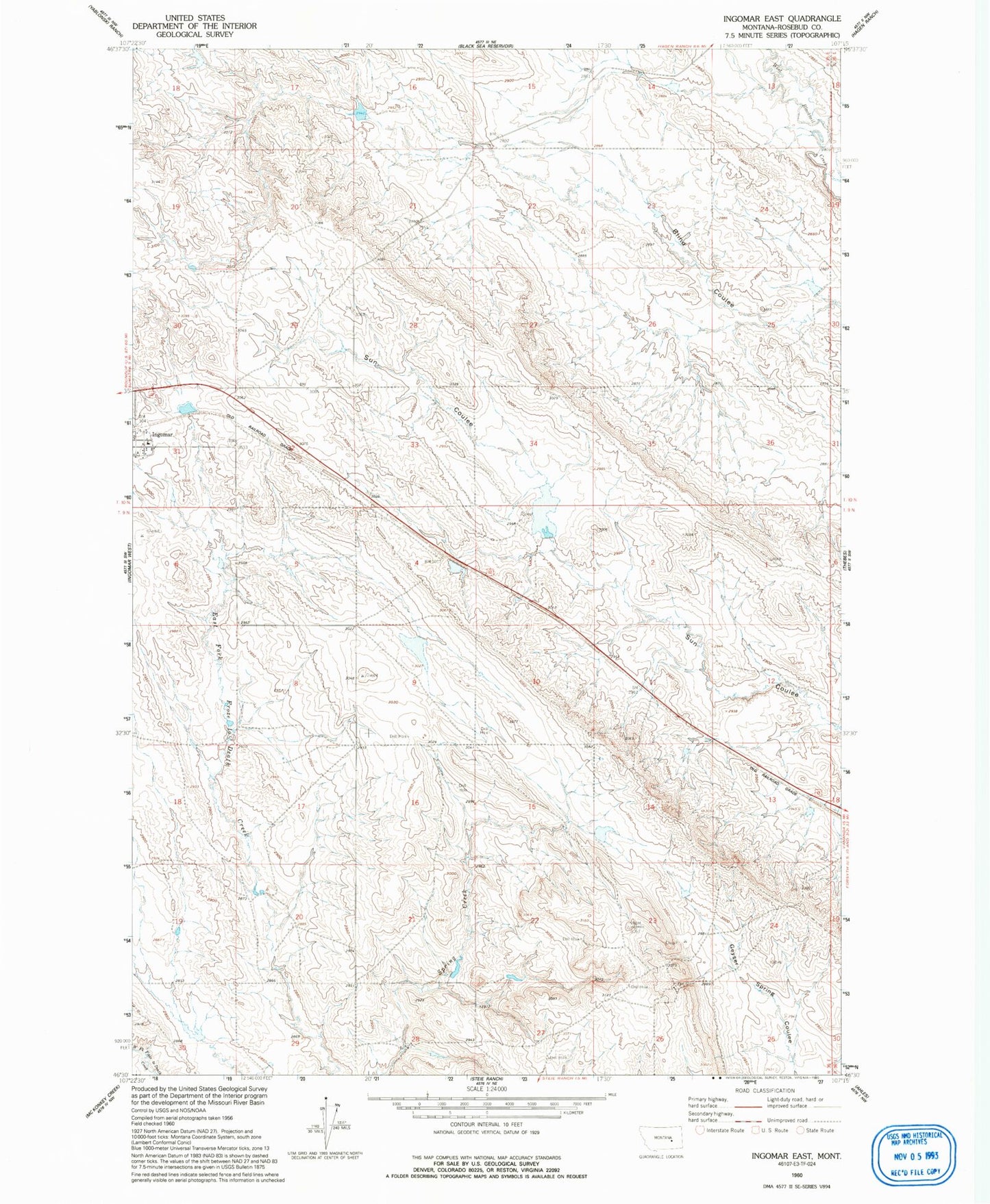
Classic USGS Ingomar East Montana 7.5'x7.5' Topo Map
Regular price
$16.95
Regular price
Sale price
$16.95
Unit price
per
Couldn't load pickup availability
Historical USGS topographic quad map of Ingomar East in the state of Montana. Map scale may vary for some years, but is generally around 1:24,000. Print size is approximately 24" x 27"
This quadrangle is in the following counties: Rosebud.
The map contains contour lines, roads, rivers, towns, and lakes. Printed on high-quality waterproof paper with UV fade-resistant inks, and shipped rolled.
Contains the following named places: 09N35E28BA__01 Well, Big Timber Number 20 Dam, Big Timber Number 21 Dam, Big Timber Number 37 Dam, Brooks School, Downs Number 1 Dam, Ingomar, Ingomar School, L Olson Number 1 Dam, Lambing Shed Dam, Montana Number 17 Dam, Sun Coulee Dam