MyTopo
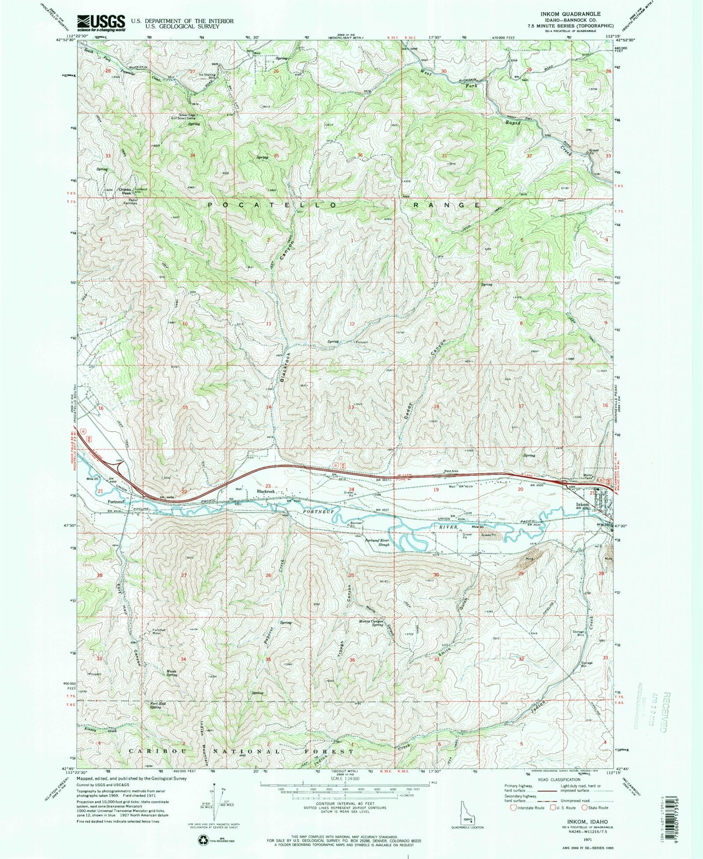
Classic USGS Inkom Idaho 7.5'x7.5' Topo Map
Couldn't load pickup availability
Historical USGS topographic quad map of Inkom in the state of Idaho. Map scale may vary for some years, but is generally around 1:24,000. Print size is approximately 24" x 27"
This quadrangle is in the following counties: Bannock.
The map contains contour lines, roads, rivers, towns, and lakes. Printed on high-quality waterproof paper with UV fade-resistant inks, and shipped rolled.
Contains the following named places: Ames Gulch, Blackrock, Blackrock Canyon, Caddy Canyon, Caribou Ski Area, Chinese Peak, City of Inkom, Fort Hall Canyon, Fort Hall Mine, Fort Hall Spring, Indian Creek, Inkom, Inkom Division, Inkom Elementary School, Inkom Post Office, Marsh Creek, Mink Creek, Morris Canyon, Morris Canyon Spring, Munn Spring, Papoose Creek, Pocatello Valley Fire Department Station 1, Portneuf, Portneuf River Slough, Rapid Creek, Silver Sage Girl Scout Camp, Smith Gulch