
MyTopo
Classic USGS Innis Louisiana 7.5'x7.5' Topo Map
Couldn't load pickup availability
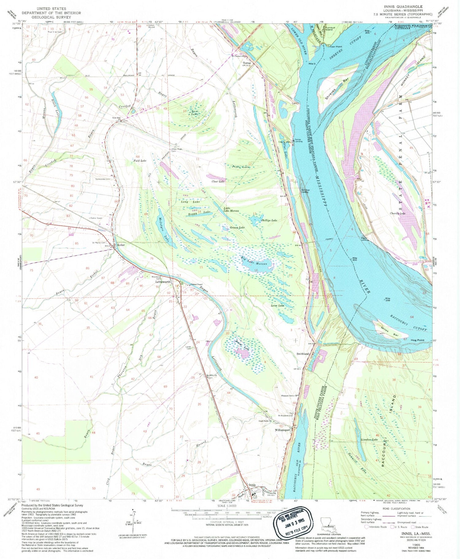
Historical USGS topographic quad map of Innis in the state of Louisiana. Map scale may vary for some years, but is generally around 1:24,000. Print size is approximately 24" x 27"
This quadrangle is in the following counties: Concordia, Pointe Coupee, West Feliciana, Wilkinson.
The map contains contour lines, roads, rivers, towns, and lakes. Printed on high-quality waterproof paper with UV fade-resistant inks, and shipped rolled.
Contains the following named places: Angola Landing, Bayou Fisher, Bayou Hazard, Bayou Lettsworth, Big Lake Moreau, Black Lake, Boggy Lake, Camp C, Camp D, Camp G, Carr Cut-Off, Carr Point, Carr Point Revetment, Carrs Point Landing, Charity Lake, Chinns Chapel, Clear Lake, Crooked Bayou, Dry Bayou, Field Lake, Flat Lake, Good Faith Cemetery, Good Faith Church, Good Faith School, Grassy Lake, Hog Point, Hunter Creek, Innis, Innis High School, Innis Post Office, Innis Volunteer Fire Department, Jones Lake, Keller, Lettsworth, Lettsworth Post Office, Levee Cemetery, Levee Lake, Levi Lake, Limeless Lake, Little Lake Moreau, Long Lake, McIntyre Lake, Miles Bar, Monkey Island, Morefield Cemetery, Mount Carmel Church, Mount Olive Cemetery, Mount Olive Church, New Zion Church, Parish Governing Authority District 1, Phillips Lake, Phillipston, Pikes Peak Cemetery, Pikes Peak Lake, Pleasant Grove Church, Pointe Coupee Parish Library Innis Branch, Prevailing Word Christian Center, Raccourci Cutoff, Red River Landing, Round Lake, Saint Marys Cemetery, Saint Marys Church, Saint Stephens Episcopal Church, Saint Stephens Episcopal Church Cemetery, Sawmill Lake, Shreves Bar, Shreves Cutoff, Smithland, Smithland Landing, Sunnyside Cemetery, Torras, Torras Landing, True Vine Cemetery, Ward Two, Williamsport, ZIP Code: 70753


