MyTopo
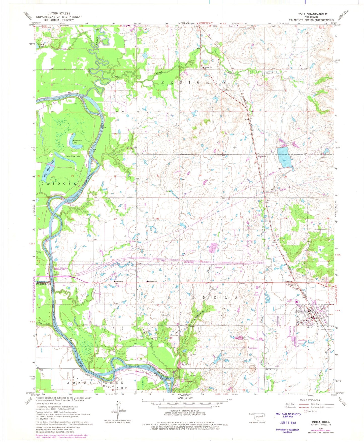
Classic USGS Inola Oklahoma 7.5'x7.5' Topo Map
Couldn't load pickup availability
Historical USGS topographic quad map of Inola in the state of Oklahoma. Map scale may vary for some years, but is generally around 1:24,000. Print size is approximately 24" x 27"
This quadrangle is in the following counties: Rogers, Wagoner.
The map contains contour lines, roads, rivers, towns, and lakes. Printed on high-quality waterproof paper with UV fade-resistant inks, and shipped rolled.
Contains the following named places: Big Flag Lake, Commodore Creek, Dobie's Airport, Dog Creek, Gilstrap Field, Gregory, Gregory Census Designated Place, Gregory Church, Gregory School, Horseshoe Lake, Inola, Inola Division, Inola Elementary School, Inola Fire Department Station 1 Headquarters, Inola Fire Department Station 2, Inola High School, Inola Lake, Inola Lake Dam, Inola Middle School, Inola Police Department, Inola Post Office, Little Flag Lake, McFarlin, Night Hawk Airpatch, Oknoname 131006 Dam, Oknoname 131006 Reservoir, Otter Creek, Rocky Point Public Use Area, Salt Creek, Sweeten Cemetery, Tiawah, Tiawah Census Designated Place, Township of Inola, Willieo Church, ZIP Code: 74036