MyTopo
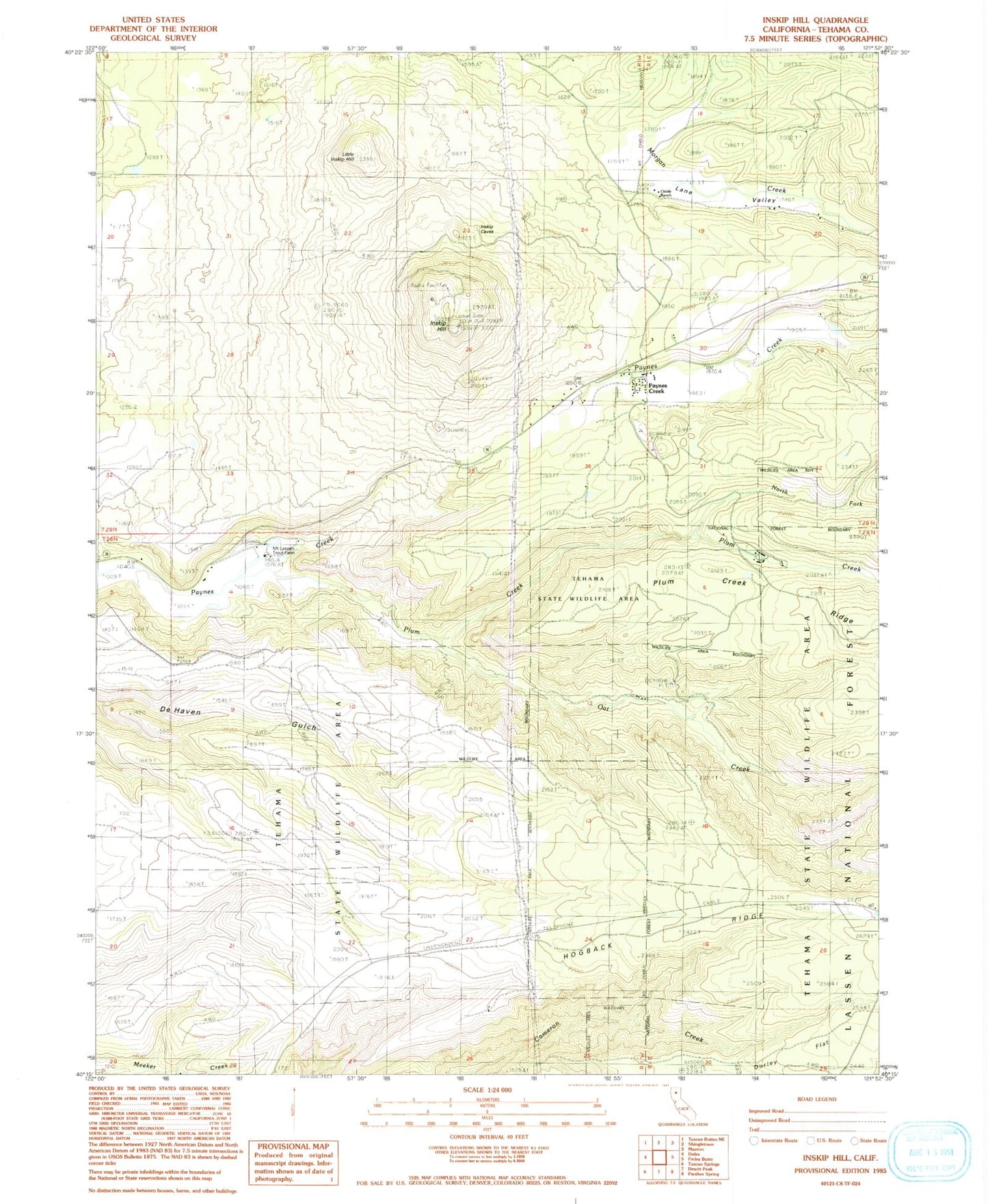
Classic USGS Inskip Hill California 7.5'x7.5' Topo Map
Couldn't load pickup availability
Historical USGS topographic quad map of Inskip Hill in the state of California. Map scale may vary for some years, but is generally around 1:24,000. Print size is approximately 24" x 27"
This quadrangle is in the following counties: Tehama.
The map contains contour lines, roads, rivers, towns, and lakes. Printed on high-quality waterproof paper with UV fade-resistant inks, and shipped rolled.
Contains the following named places: Childs Ranch, Hogback Ridge, Inskip Hill, Lane Valley, Lane Valley School, Little Inskip Hill, McKenzie Place, Meyers Place, Mount Lassen Trout Farm, North Fork Plum Creek, Oat Creek, Paynes Creek, Paynes Creek Census Designated Place, Plum Creek, Plum Valley Elementary School, Shults Ranch, Tehama County Fire Department Paynes Creek, Tehama County Fire Department Station 21 Paynes Creek, Wade Place