MyTopo
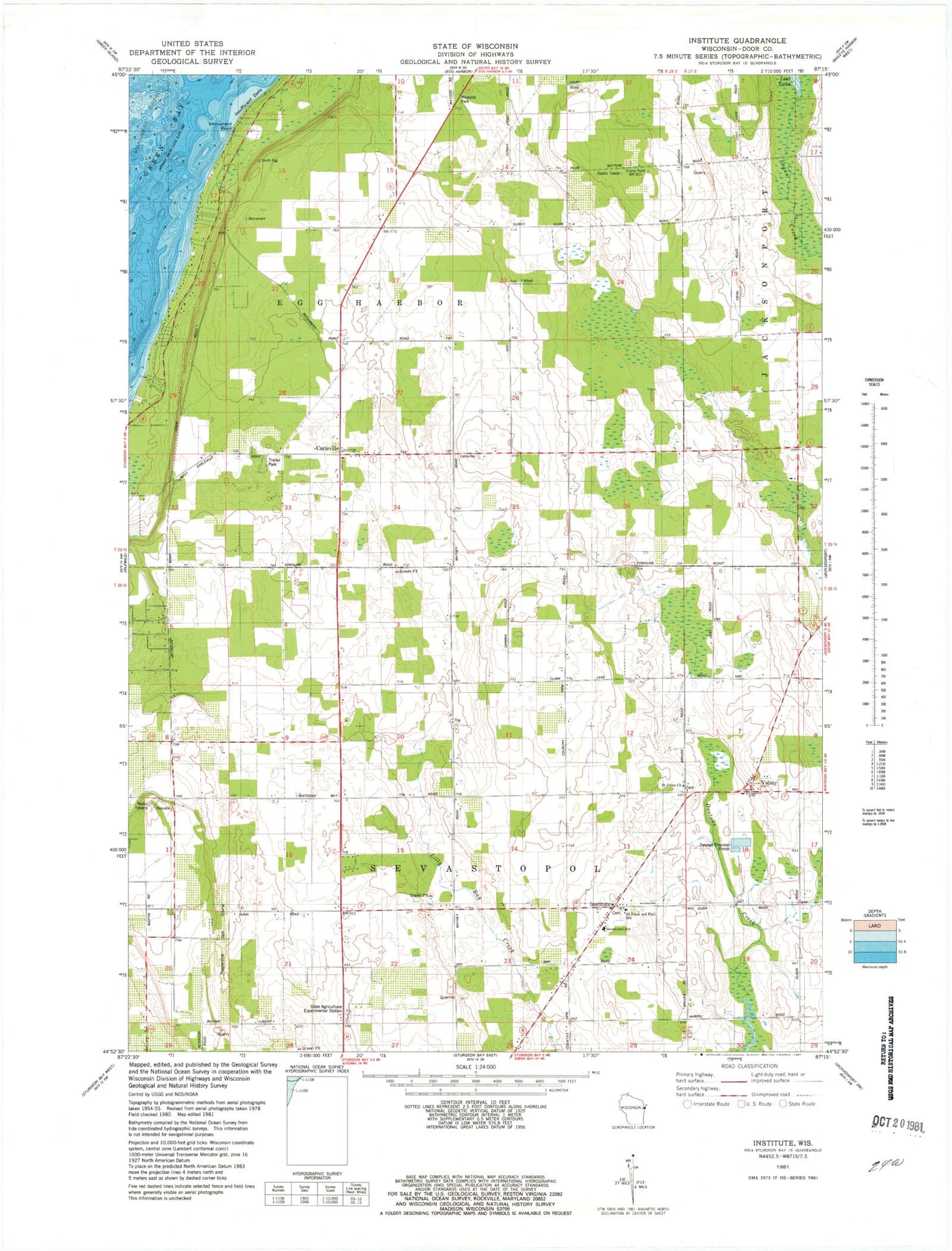
Classic USGS Institute Wisconsin 7.5'x7.5' Topo Map
Couldn't load pickup availability
Historical USGS topographic quad map of Institute in the state of Wisconsin. Map scale may vary for some years, but is generally around 1:24,000. Print size is approximately 24" x 27"
This quadrangle is in the following counties: Door.
The map contains contour lines, roads, rivers, towns, and lakes. Printed on high-quality waterproof paper with UV fade-resistant inks, and shipped rolled.
Contains the following named places: Carlsville, Cedar Breeze Farm, Cherrydale Farm, Cherryland Dairy Farm, Choice Orchards, Country View Farms, Door Peninsula, Egg Harbor Fire Department Station 2, Fellner Orchards, Giesel Dairy Farm, Homestead Farm, Institute, Keller Farm, Kuehn Acres Farm, Low Valley Farm, Meikle Farms, Monument Point, Monument Shoal, Pepperdine Golf Course, S and B Farm, Saint Johns Church, Saint Peter and Paul School, Schopf Hillside Dairy, Sevastopol Elementary School, Sevastopol High School, Sevastopol Junior High School, Sevastopol Preschool, Sevastopol School, Sevastpool School, Smejkal Farm, State Agricultural Experimental Station, Sunny Slope Farms, Sunny Slope Runway Airport, Valmy, Walker Road Quarry, WDOR-FM (Sturgeon Bay), WFNL-FM (Sturgeon Bay), WHET-FM (Sturgeon Bay), WPFF-FM (Sturgeon Bay), WRAH-TV (Sturgeon Bay)