MyTopo
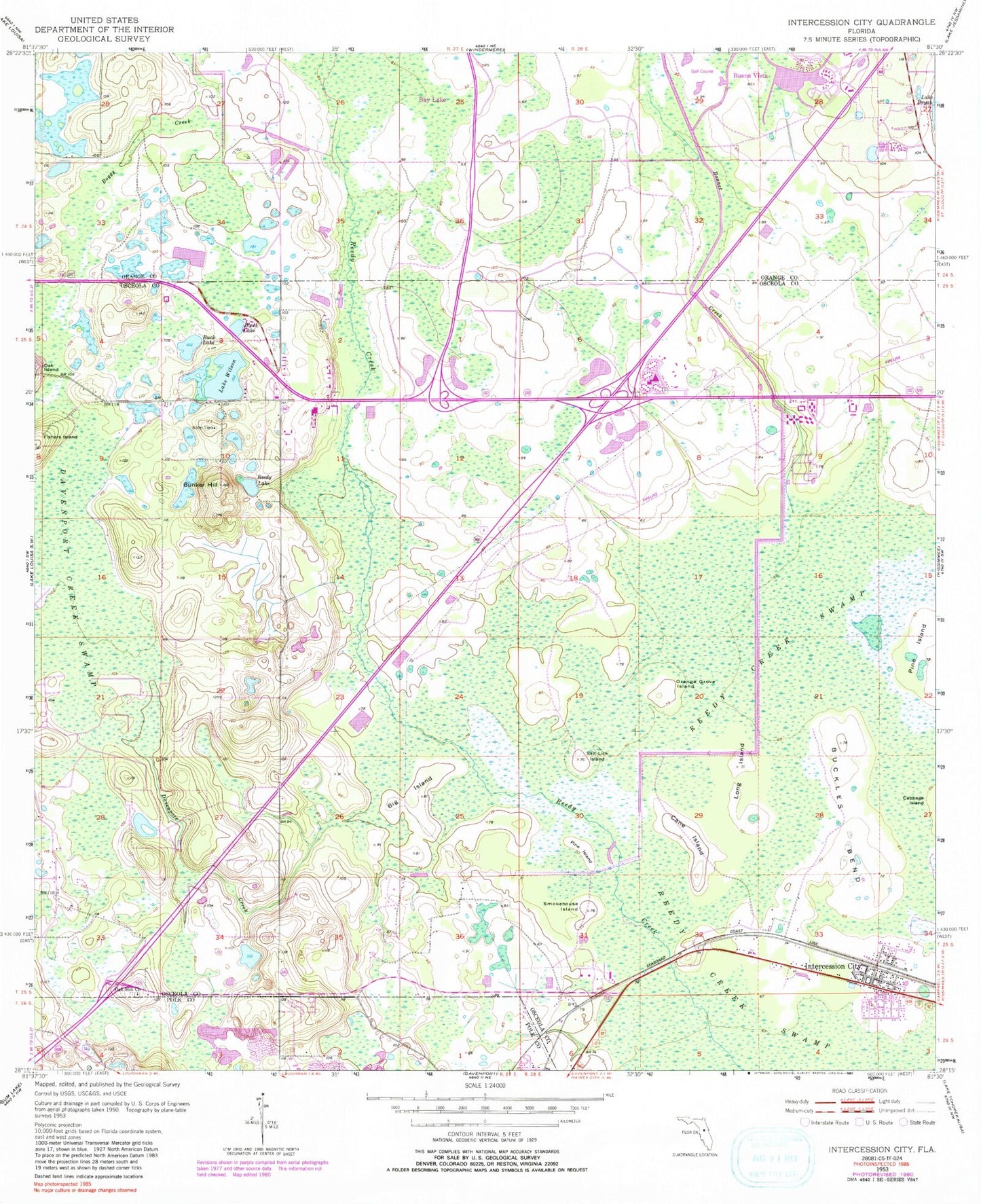
Classic USGS Intercession City Florida 7.5'x7.5' Topo Map
Couldn't load pickup availability
Historical USGS topographic quad map of Intercession City in the state of Florida. Map scale may vary for some years, but is generally around 1:24,000. Print size is approximately 24" x 27"
This quadrangle is in the following counties: Orange, Osceola, Polk.
The map contains contour lines, roads, rivers, towns, and lakes. Printed on high-quality waterproof paper with UV fade-resistant inks, and shipped rolled.
Contains the following named places: Big Island, Black Lake, Boggy Creek, Bonnet Creek, Buck Lake, Buckles Bend, Buena Vista, Bunker Hill, Cane Island, Celebration, Celebration Census Designated Place, Celebration Community Church, Celebration Post Office, Champion Stadium, ChampionsGate, Davenport Creek, Epcot Center Ultralight Airport, Fletcher Park Monument, Florida Hospital Celebration Health, Hyde Park Golf Club, Intercession City, Intercession City Fire Department, Intercession City Post Office, Interlachen Country Club, Interocean Post Office, Johnson Rainbow Trailer Park, Lake Britt, Lake Wilson, Long Island, Millers Lakeside Trailer Park, Mouse Mountain Mobile Home Resort, Oak Hill Baptist Church, Oak Hill Church, Orange County Fire Rescue Station 32, Orange Grove Island, Orlando Hyatt House Heliport, Osceola County Fire Rescue and Emergency Medical Services Station 72, Osceola County Public Library Main Branch, Pine Island, Ponce De Leon Golf Course, Reedy Creek Fire and Rescue Station 1 Headquarters, Reedy Creek Fire and Rescue Station 2, Reedy Lake, Reunion, Robards Number Four Heliport, Salt Lick Island, Sheraton Lakeside Inn Heliport, Smokehouse Island, ZIP Codes: 33848, 33896, 34747