
MyTopo
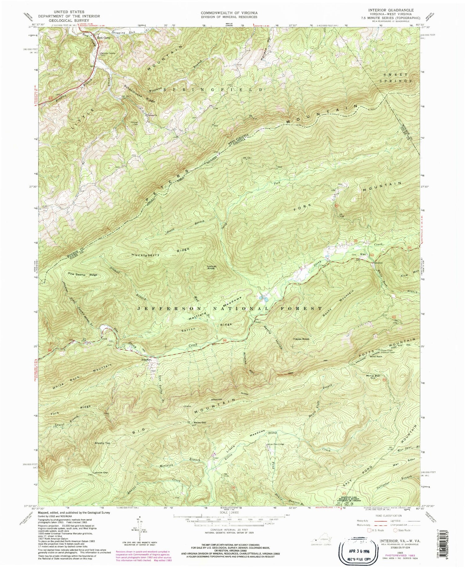
Classic USGS Interior Virginia 7.5'x7.5' Topo Map
Couldn't load pickup availability
Historical USGS topographic quad map of Interior in the states of Virginia, West Virginia. Typical map scale is 1:24,000, but may vary for certain years, if available. Print size: 24" x 27"
This quadrangle is in the following counties: Giles, Monroe.
The map contains contour lines, roads, rivers, towns, and lakes. Printed on high-quality waterproof paper with UV fade-resistant inks, and shipped rolled.
Contains the following named places: Hemlock Branch, Bailey Gap, Big Mountain, Brushy Top, Dismal Branch, Dixon Branch, Hayes Knob, Huckleberry Ridge, Hunters Branch, Interior, Iron Spring Branch, Little Meadows, Lybrook Gap, Maple Flats Branch, Meredith Branch, Minie Ball Hill, Nettle Hollow, Pine Swamp Branch, Pine Swamp Ridge, Pond Drain, Sarton Ridge, North Fork Stony Creek, Stony Creek Lookout Tower, University of Virginia Mountain Lake Biological Station, War Spur, White Rock Branch, White Rock Mountain, Wildcat Hollow, Hatfield Meadows, Epling Draft, Falt Peter Trail, Mud Branch, Bailey Gap Shelter, Virginia Division Game and Inland Fisheries Shop, Pine Swamp Shelter, Interior Picnic Area, Kire, Locust Knob, Rocky Mountain, White Pine Lodge, Wind Rock, Kire Community Cemetery, Mount Pleasant Fire and Rescue, Norfolk Southern Railway Police, Vinton Police Department, Wrights Peak, Allegheny Trail, Alleheny Trail, Ballard-Harvey Cemetery, Bradley Branch, Dropping Lick Creek, Fortner Cemetery, Fortner Church, Peters Mountain, Schoolhouse Ridge, Wiseman Branch, Little Mountain, Rock Camp, Rock Camp School (historical), Wallace School (historical), Walnut Knob School (historical), Rock Camp Spring, Rock Camp American Baptist Church


