MyTopo
Classic USGS International Peace Garden North Dakota 7.5'x7.5' Topo Map
Couldn't load pickup availability
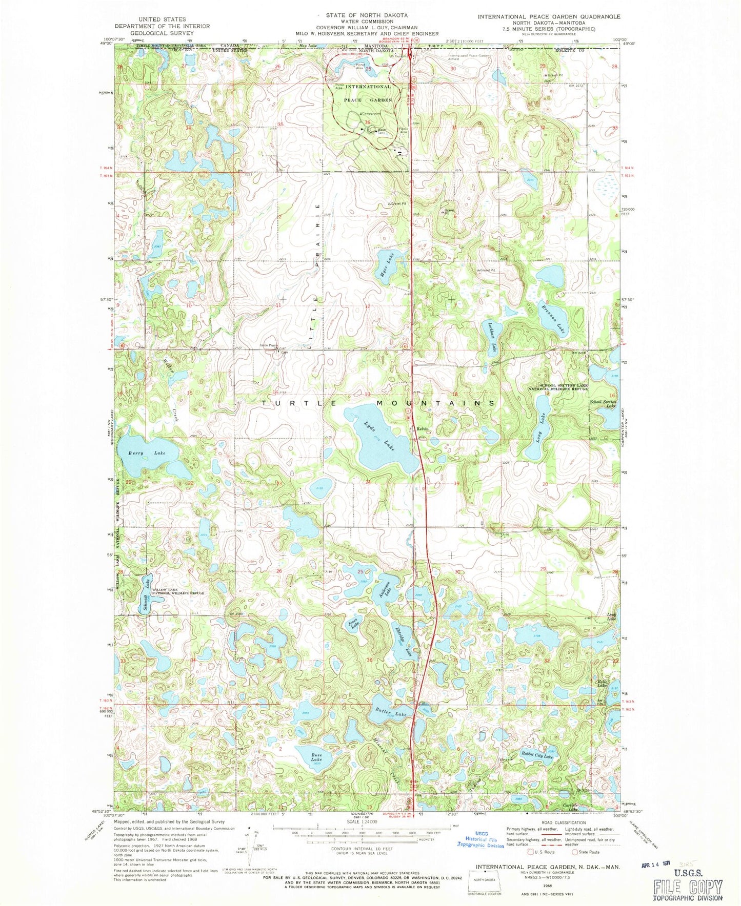
Historical USGS topographic quad map of International Peace Garden in the state of North Dakota. Map scale may vary for some years, but is generally around 1:24,000. Print size is approximately 24" x 27"
This quadrangle is in the following counties: Rolette.
The map contains contour lines, roads, rivers, towns, and lakes. Printed on high-quality waterproof paper with UV fade-resistant inks, and shipped rolled.
Contains the following named places: Anderson Lake, Berry Lake, Brennan Lake, Butler Lake, Eldridge Lake, International Peace Garden, International Peace Garden Airport, Jones Lake, Kelvin, Little Prairie, Little Prairie Cemetery, Little Prairie Church, Lockhart Lake, Long Lake, Lyde Lake, Myer Lake, Rabbit City Lake, Rose Lake, Schmidt Lake, Turtle Mountains