
MyTopo
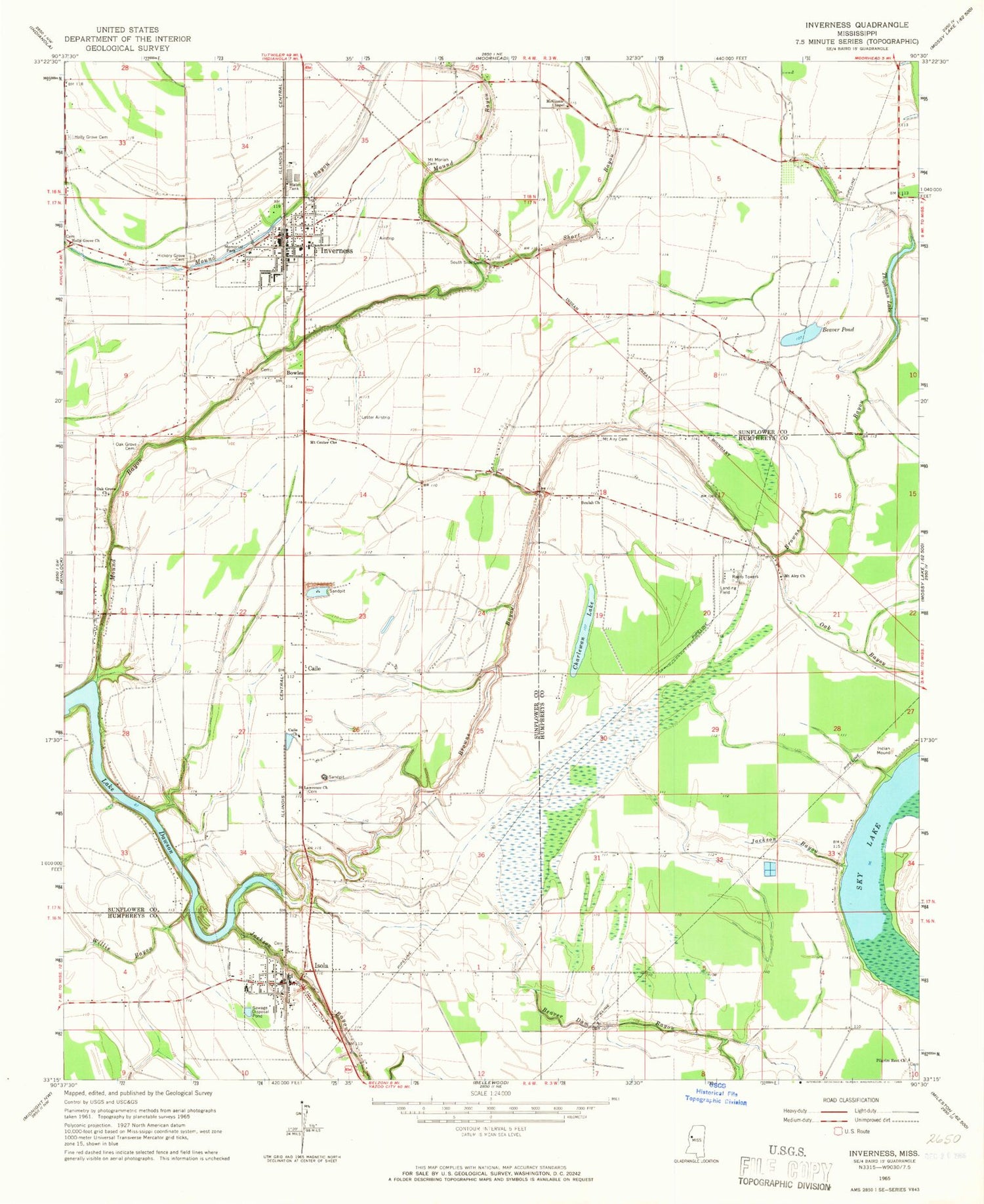
Classic USGS Inverness Mississippi 7.5'x7.5' Topo Map
Couldn't load pickup availability
Historical USGS topographic quad map of Inverness in the state of Mississippi. Map scale may vary for some years, but is generally around 1:24,000. Print size is approximately 24" x 27"
This quadrangle is in the following counties: Humphreys, Sunflower.
The map contains contour lines, roads, rivers, towns, and lakes. Printed on high-quality waterproof paper with UV fade-resistant inks, and shipped rolled.
Contains the following named places: Beaver Pond, Beulah Church, Bowles, Browns Bayou, Caile, Caile Church, Caile School, Central Delta Academy, Charles Rowland Lake Dam, Charlewan Lake, Clark Pond Dam, Crawford Brothers Pond Dam, Duke Lake Dam, Duthu Lake Dam, H B Rowland Pond Dam, Hickory Grove Cemetery, Hickory Grove Church, Holly Grove Cemetery, Holly Grove Church, Inverness, Inverness Baptist Church, Inverness Elementary School, Inverness High School, Inverness Police Department, Inverness United Methodist Church, Inverness Volunteer Fire Department Sunflower Co Fire Dist 2, Isola, Isola Attendance Center, Isola Police Department, Isola Post Office, Isola Volunteer Fire Department, Jackson Bayou, Lester Field, Loyd Fish Farm, McGinnis Chapel, Milroy, Montgomery Airport, Mound Bayou, Mound Bayou Church, Mount Airy Cemetery, Mount Airy Church, Mount Center Church, Mount Moriah Cemetery, Myers Lake Dam, New Hope Church, Newell Flying Service Airport, Oak Bayou, Oak Grove Cemetery, Oak Grove Church, Paxton Church, Paxton School, Pilgrim Rest Church, Saint Lawrence Church, Short Bayou, South Side Cemetery, Southside, Southside School, Supervisor District 1, Thighman Lake, Toler School, Town of Inverness, Town of Isola, WABG-TV (Greenwood), Willis Bayou, ZIP Code: 38753


