MyTopo
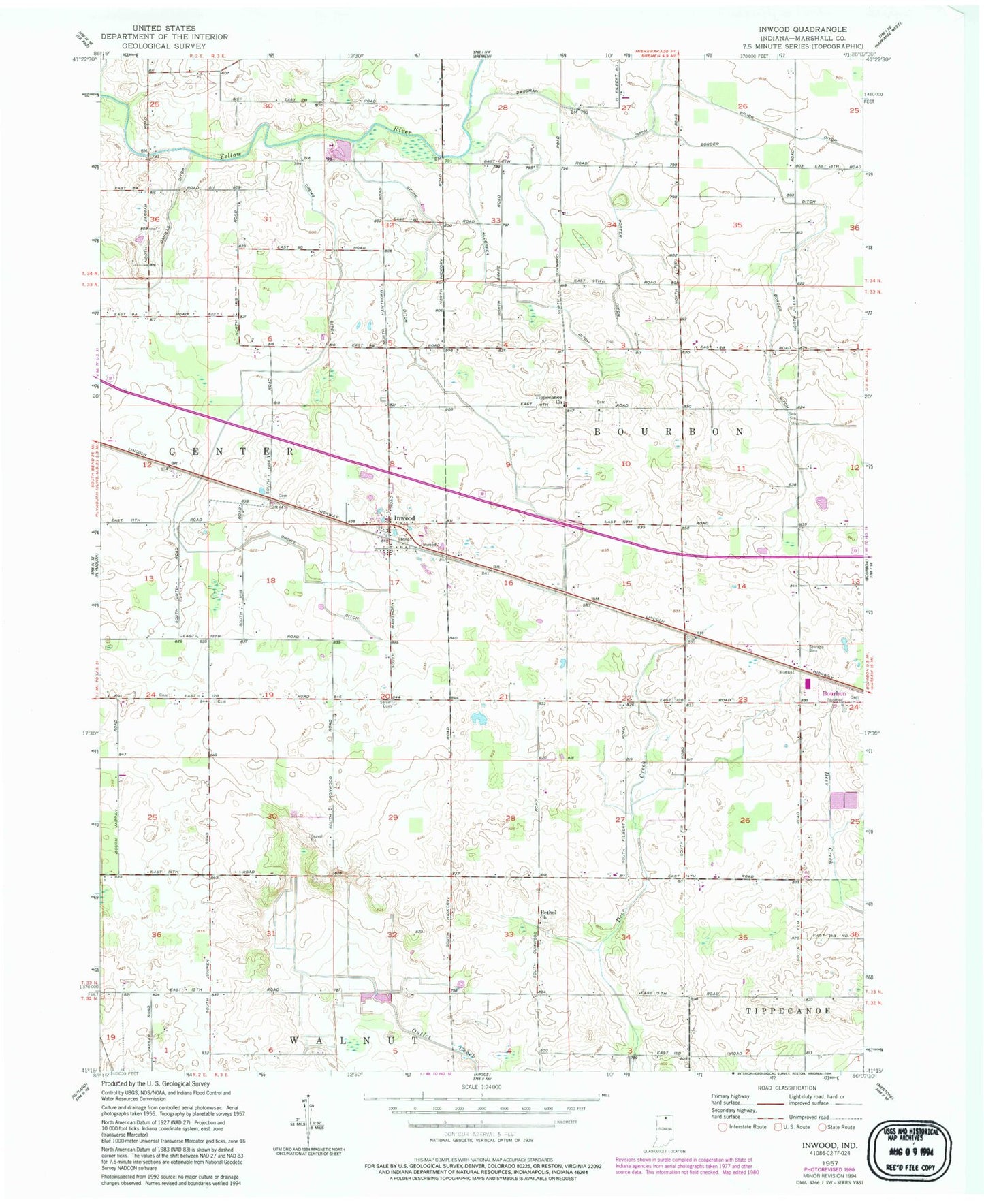
Classic USGS Inwood Indiana 7.5'x7.5' Topo Map
Couldn't load pickup availability
Historical USGS topographic quad map of Inwood in the state of Indiana. Map scale may vary for some years, but is generally around 1:24,000. Print size is approximately 24" x 27"
This quadrangle is in the following counties: Marshall.
The map contains contour lines, roads, rivers, towns, and lakes. Printed on high-quality waterproof paper with UV fade-resistant inks, and shipped rolled.
Contains the following named places: Alderfer Ditch, Bair Ditch, Ball Field, Barnhart Farm, Bethel Church, Border Ditch, Clauss Farms, Crews Ditch, Dairy N Farm, Daniels Ditch, Double K Farms, Filbert Farms, Inwood, Kaiser Farms, Motz Farms, Porter Ditch, Salem Cemetery, Scott Field, Stone Ditch, Tippecanoe Church, Township of Bourbon, Tri State Airport, Weissert Farms, Woodward Farms