MyTopo
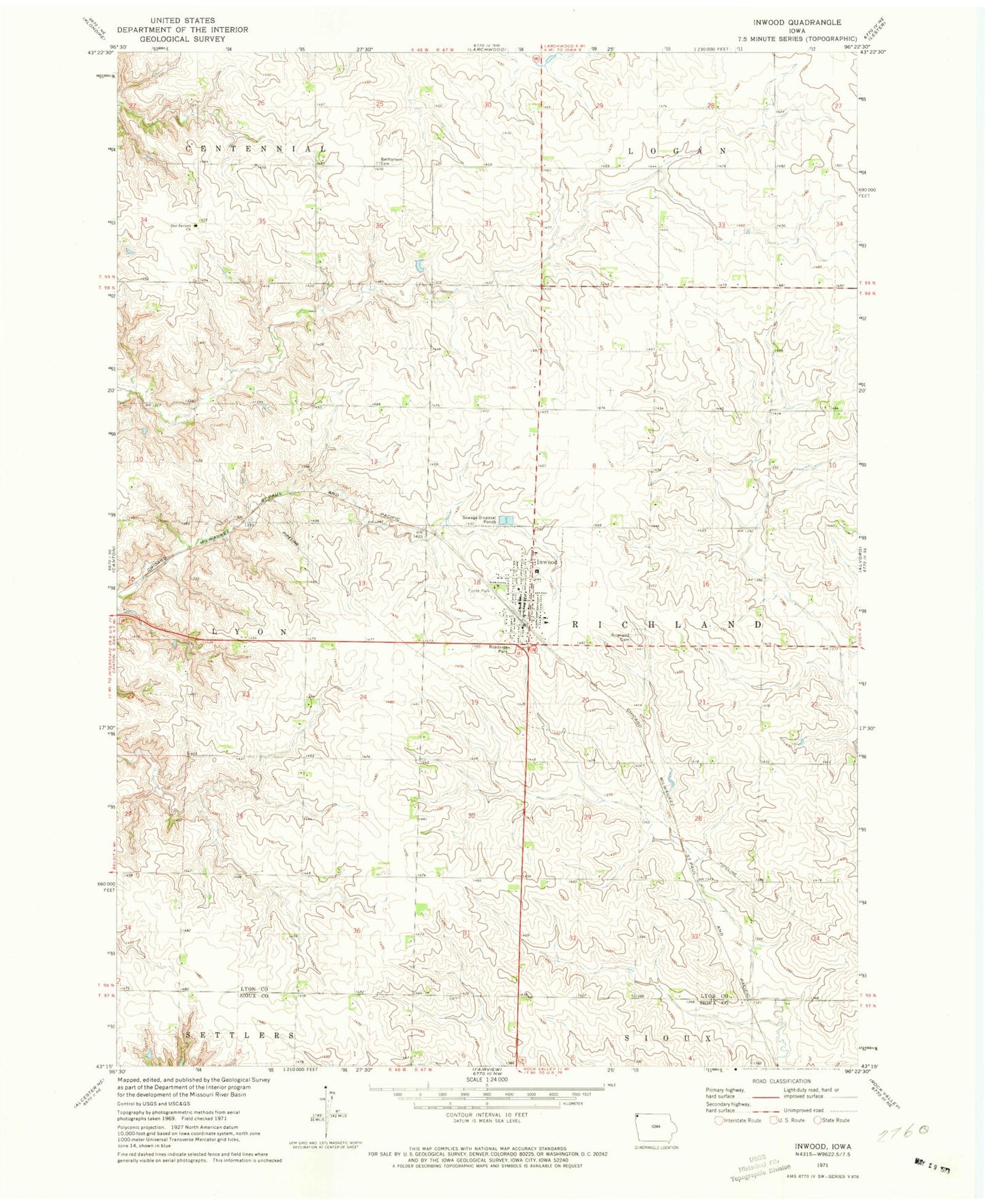
Classic USGS Inwood Iowa 7.5'x7.5' Topo Map
Couldn't load pickup availability
Historical USGS topographic quad map of Inwood in the state of Iowa. Map scale may vary for some years, but is generally around 1:24,000. Print size is approximately 24" x 27"
This quadrangle is in the following counties: Lyon, Sioux.
The map contains contour lines, roads, rivers, towns, and lakes. Printed on high-quality waterproof paper with UV fade-resistant inks, and shipped rolled.
Contains the following named places: Bethel United Methodist Church, Bethlehem Cemetery, Bos Farm, Bragstad Family Cemetery, Canton Family Physicians Building, City of Inwood, County Edge Dairy, Elm Spring, First Reformed Church, Fluit Farms, Foote Park, G and D Farm, G and G Farms, Inwood, Inwood Christian Reformed Church, Inwood Christian School, Inwood Community Fire and Rescue, Inwood Post Office, Inwood Public Library, K and L Farms, Kollis Farms, Krogness Post Office, New Life Assembly of God Church, Northway Farms, Our Saviors Church, Our Saviors Lutheran Cemetery, Richland Cemetery, Ridgecrest Farms, Sunnycrest Farms, Township of Richland, Triple V Farms, Van Beek Feed Lot, Vanbeek Farm, ZIP Code: 51240