MyTopo
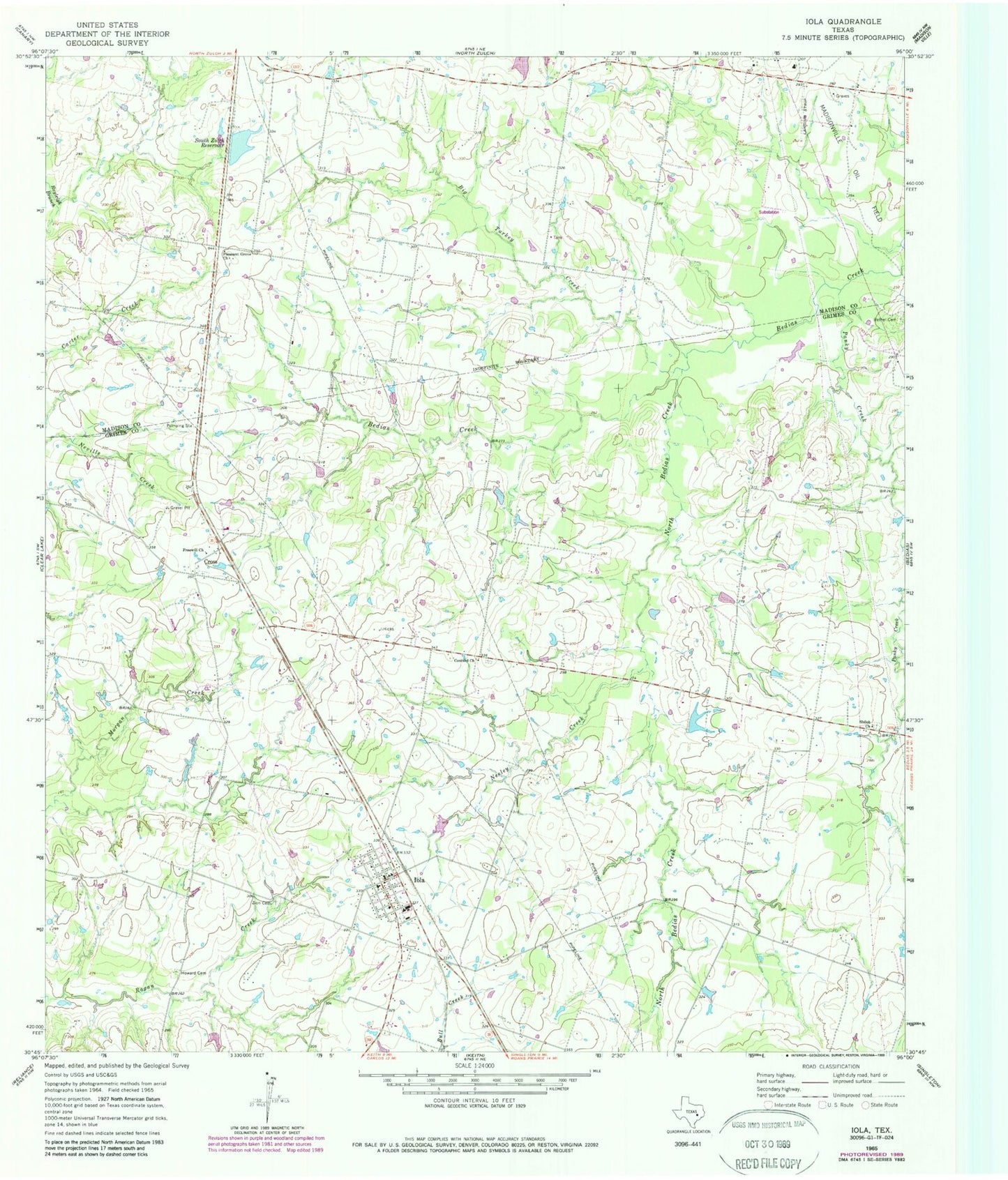
Classic USGS Iola Texas 7.5'x7.5' Topo Map
Couldn't load pickup availability
Historical USGS topographic quad map of Iola in the state of Texas. Map scale may vary for some years, but is generally around 1:24,000. Print size is approximately 24" x 27"
This quadrangle is in the following counties: Grimes, Madison.
The map contains contour lines, roads, rivers, towns, and lakes. Printed on high-quality waterproof paper with UV fade-resistant inks, and shipped rolled.
Contains the following named places: Bethel Cemetery, Big Turkey Creek, City of Iola, Concord Church, Cross, Freewill Church, Howard Cemetery, Iola, Iola Post Office, Iola Volunteer Fire Department, KAGG-FM (Madisonville), LFD Ranch Lake, Neeley Creek, North Bedias Creek, Panky Creek, Pleasant Grove Church, Shiloh Church, South Zulch Reservoir, South Zulch Reservoir Dam, Walker Lake, Walker Lake Dam, Zion Cemetery