MyTopo
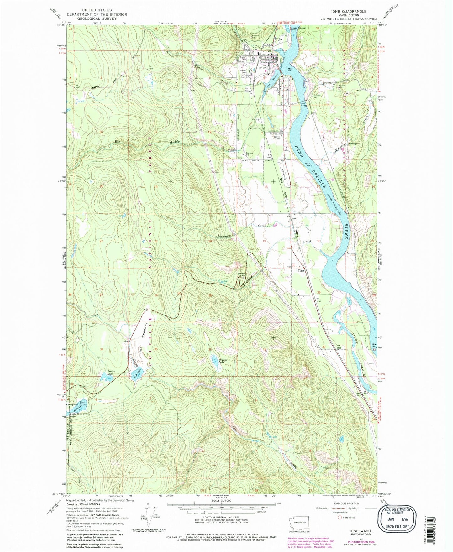
Classic USGS Ione Washington 7.5'x7.5' Topo Map
Couldn't load pickup availability
Historical USGS topographic quad map of Ione in the state of Washington. Typical map scale is 1:24,000, but may vary for certain years, if available. Print size: 24" x 27"
This quadrangle is in the following counties: Pend Oreille, Stevens.
The map contains contour lines, roads, rivers, towns, and lakes. Printed on high-quality waterproof paper with UV fade-resistant inks, and shipped rolled.
Contains the following named places: Big Muddy Creek, Browns Lake, Cedar Creek, Diamond Creek, Frater Lake, Ione, Ione Bridge, Ione Millpond, Lake Leo, Little Muddy Creek, Maitlen Creek, Nile Lake, Renshaw Creek, Riverside Cemetery, Tiger Meadows, Tiger Slough, Tiger, Lake Leo Campground, Ione Primary School, Ione Mill Pond Dam, Ione Municipal Airport, Town of Ione, Ione Pit, Ione Post Office, Serendipity Golf Course, Ione Community Center, Ione Baptist Church, Ione Public Library, Ione City Hall, Ione Sewage Treatment Plant, Ione Volunteer Fire Department, Pend Oreille Fire District 2 Station 23