MyTopo
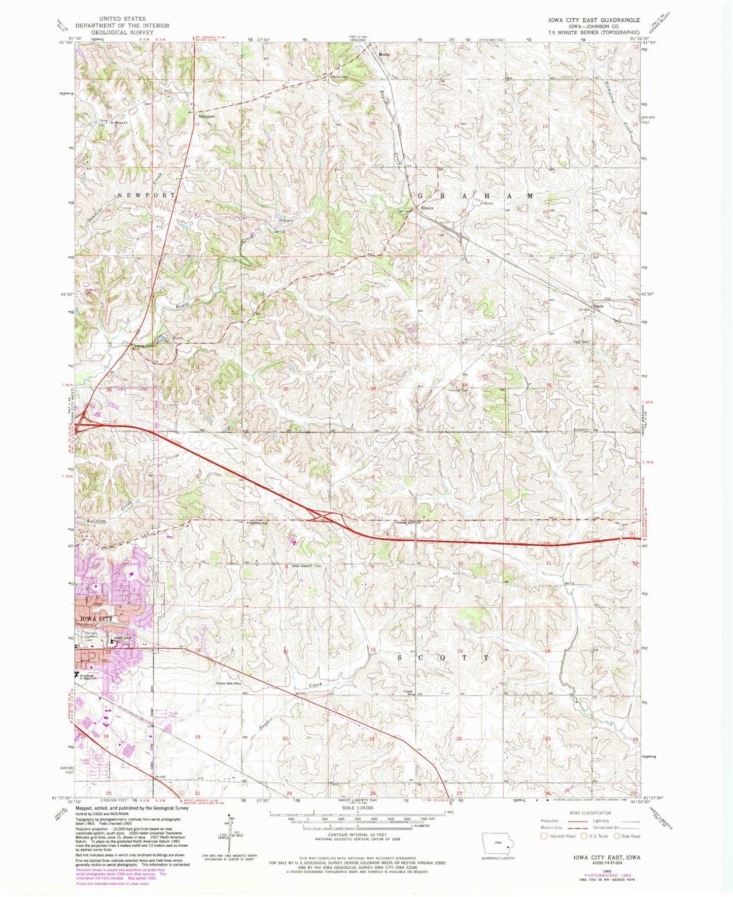
Classic USGS Iowa City East Iowa 7.5'x7.5' Topo Map
Couldn't load pickup availability
Historical USGS topographic quad map of Iowa City East in the state of Iowa. Map scale may vary for some years, but is generally around 1:24,000. Print size is approximately 24" x 27"
This quadrangle is in the following counties: Johnson.
The map contains contour lines, roads, rivers, towns, and lakes. Printed on high-quality waterproof paper with UV fade-resistant inks, and shipped rolled.
Contains the following named places: Bethany Baptist Church, Bon-Aire Mobile Home Lodge, Brick Chapel, Carthage Post Office, Carthage School, Center School, Court Hill Park, Dodd Post Office, Elmira, Fairview Cemetery, Fairview Golf Course, First Presbyterian Church, Graham, Helen Lemme Elementary School, Herbert Hoover Elementary School, Hi Point Golf Course, Hope United Methodist Church, Iowa City Church of Christ, Ives, Ives Post Office, Lucas Elementary School, Memory Gardens Cemetery, Mercer Park, Modern Manor Mobile Home Park, Molback Farm Cemetery, Morse, Morse Cemetery, Morse Community Building, Morse Post Office, New Newport Cemetery, Newport, Newport Centre Post Office, Newport Post Office, North Scott Cemetery, Oasis, Oasis Cemetery, Oasis Post Office, Pheasant Hill Park, Prairie Dale School, Railroad School, Robert Lucas Elementary School, Saint Marks United Methodist Church, Saint Marys Cemetery, Saint Marys Church, Scott Park, Southeast Junior High School, Southeastern Iowa Synod Evangelical Lutheran Church, Sunrise Mobile Home Village, The Church of Jesus Christ of Latter Day Saints, Township of Graham, Township of Scott, Victory Temple Church, Willowwind School