MyTopo
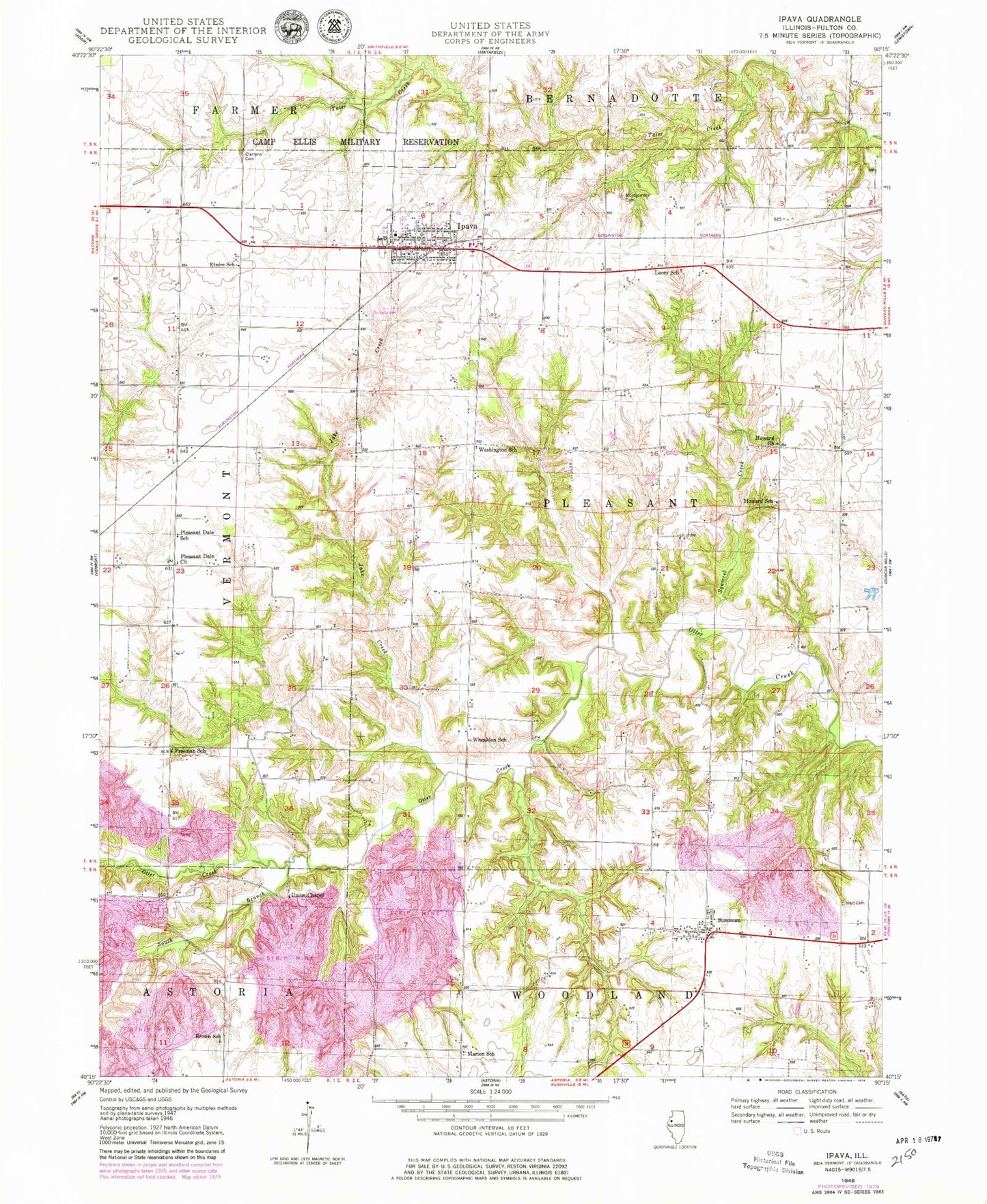
Classic USGS Ipava Illinois 7.5'x7.5' Topo Map
Couldn't load pickup availability
Historical USGS topographic quad map of Ipava in the state of Illinois. Map scale may vary for some years, but is generally around 1:24,000. Print size is approximately 24" x 27"
This quadrangle is in the following counties: Fulton.
The map contains contour lines, roads, rivers, towns, and lakes. Printed on high-quality waterproof paper with UV fade-resistant inks, and shipped rolled.
Contains the following named places: Astoria Fire Protection District Station 2, Brown School, Camp Ellis, Clemens Cemetery, Danner Cemetery, Elliot School, Etnire School, Fleming Cemetery, Freeman School, Fulton County Emergency Medical Association, Hart Cemetery, Howard, Howard Cemetery, Howard Christian Church, Howard School, Ipava, Ipava Cemetery, Ipava Fire Protection District, Ipava Post Office, Ipava School, Jake Creek, Lacey Cemetery, Lacey School, Marion School, Montgomery Cemetery, Old Ipava Cemetery, Pleasant Dale Church, Pleasant Dale School, Quaker Cemetery, South Branch Otter Creek, Squirrel Creek, Summum, Summum Cemetery, Summum Dunkard Church, Summum Post Office, Summum School, Township of Pleasant, Union Chapel, Union Chapel Cemetery, Village of Ipava, Washington School, Whealdon School, ZIP Code: 61441