MyTopo
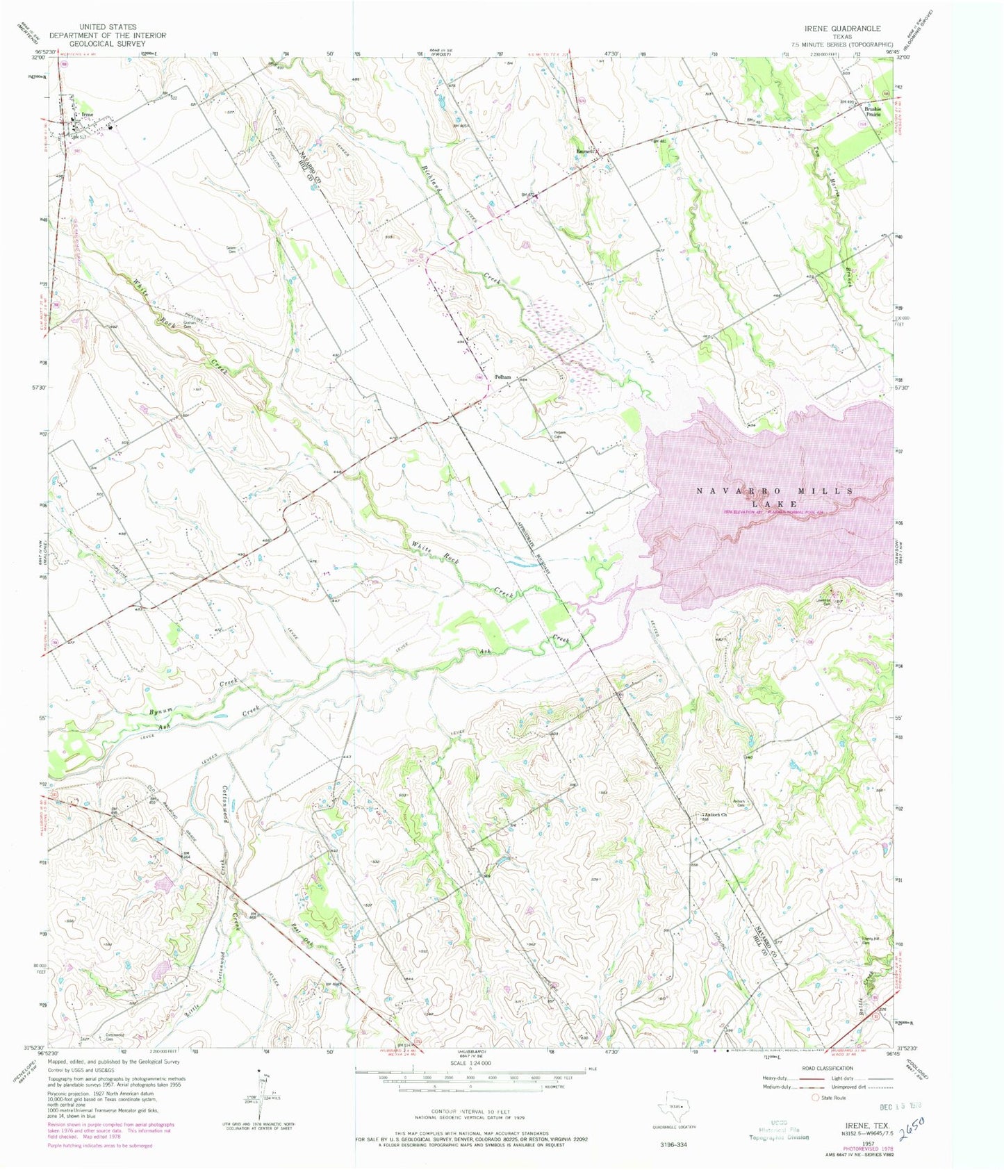
Classic USGS Irene Texas 7.5'x7.5' Topo Map
Couldn't load pickup availability
Historical USGS topographic quad map of Irene in the state of Texas. Map scale may vary for some years, but is generally around 1:24,000. Print size is approximately 24" x 27"
This quadrangle is in the following counties: Hill, Navarro.
The map contains contour lines, roads, rivers, towns, and lakes. Printed on high-quality waterproof paper with UV fade-resistant inks, and shipped rolled.
Contains the following named places: Antioch Cemetery, Antioch Church, Ash Creek, Brushie Prairie, Bynum Creek, Cottonwood Cemetery, Cottonwood Creek, Emmett, Graham Cemetery, Hackberry Creek, Irene, Irene Remotely Managed Post Office, Lawrence Cemetery, Liberty Hill Cemetery, Little Cottonwood Creek, Pelham, Pelham Cemetery, Post Oak Creek, Salem Cemetery, Soil Conservation Service Site 89 Dam, Soil Conservation Service Site 89 Reservoir, Soil Conservation Service Site 90 Dam, Soil Conservation Service Site 90 Reservoir, White Rock Creek, ZIP Code: 76650