MyTopo
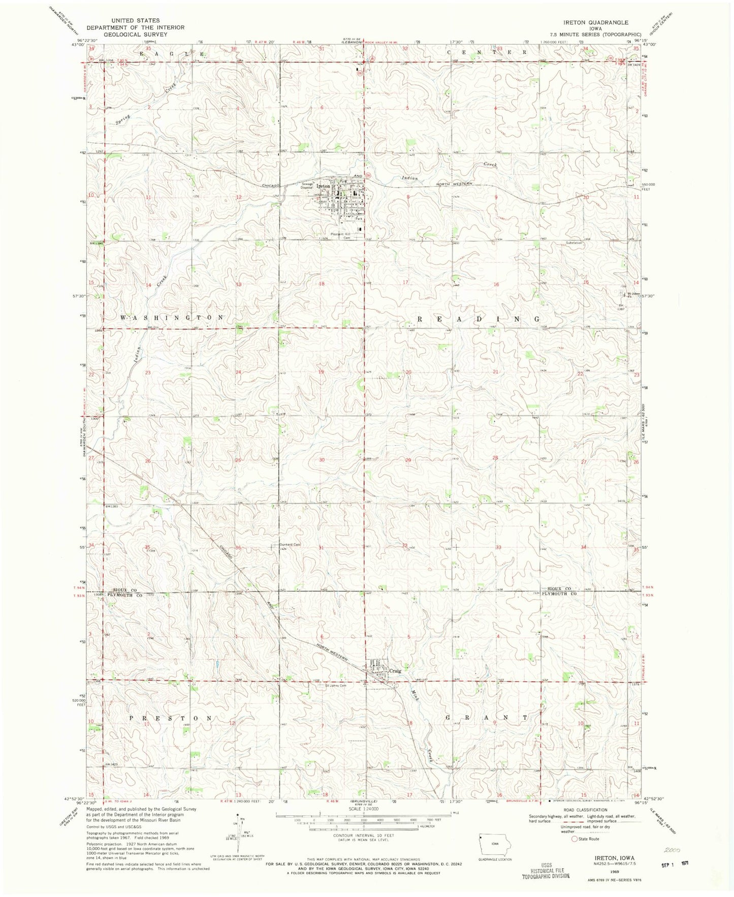
Classic USGS Ireton Iowa 7.5'x7.5' Topo Map
Couldn't load pickup availability
Historical USGS topographic quad map of Ireton in the state of Iowa. Map scale may vary for some years, but is generally around 1:24,000. Print size is approximately 24" x 27"
This quadrangle is in the following counties: Plymouth, Sioux.
The map contains contour lines, roads, rivers, towns, and lakes. Printed on high-quality waterproof paper with UV fade-resistant inks, and shipped rolled.
Contains the following named places: Bacon Ridge Farm, Christian Reformed Church, City of Craig, City of Ireton, Corn Valley, Corn Valley Post Office, Craig, Craig Post Office, Deweerd Farms, Dunkard Cemetery, Farmers Cooperative Company Elevator, Farmers Cooperative Society Elevator, First Reformed Church, Hulshof Farms, Ireton, Ireton Christian School, Ireton Community Fire Department, Ireton Family Practice Building, Ireton Medical Clinic, Ireton Post Office, Methodist Church, Oshkosh, Pleasant Hill Cemetery, Saint John Lutheran Cemetery, Saint Johns Cemetery, Saint Johns Church, Saint Johns Lutheran Church, Saint Pauls Lutheran Cemetery, Saint Pauls Lutheran Church, Sioux County Sheriffs Office, Ten Napel Brothers Incorporated Elevator, Township of Reading, Triple K Farms, Vlotho Farms, West Sioux Elementary School, ZIP Code: 51027