MyTopo
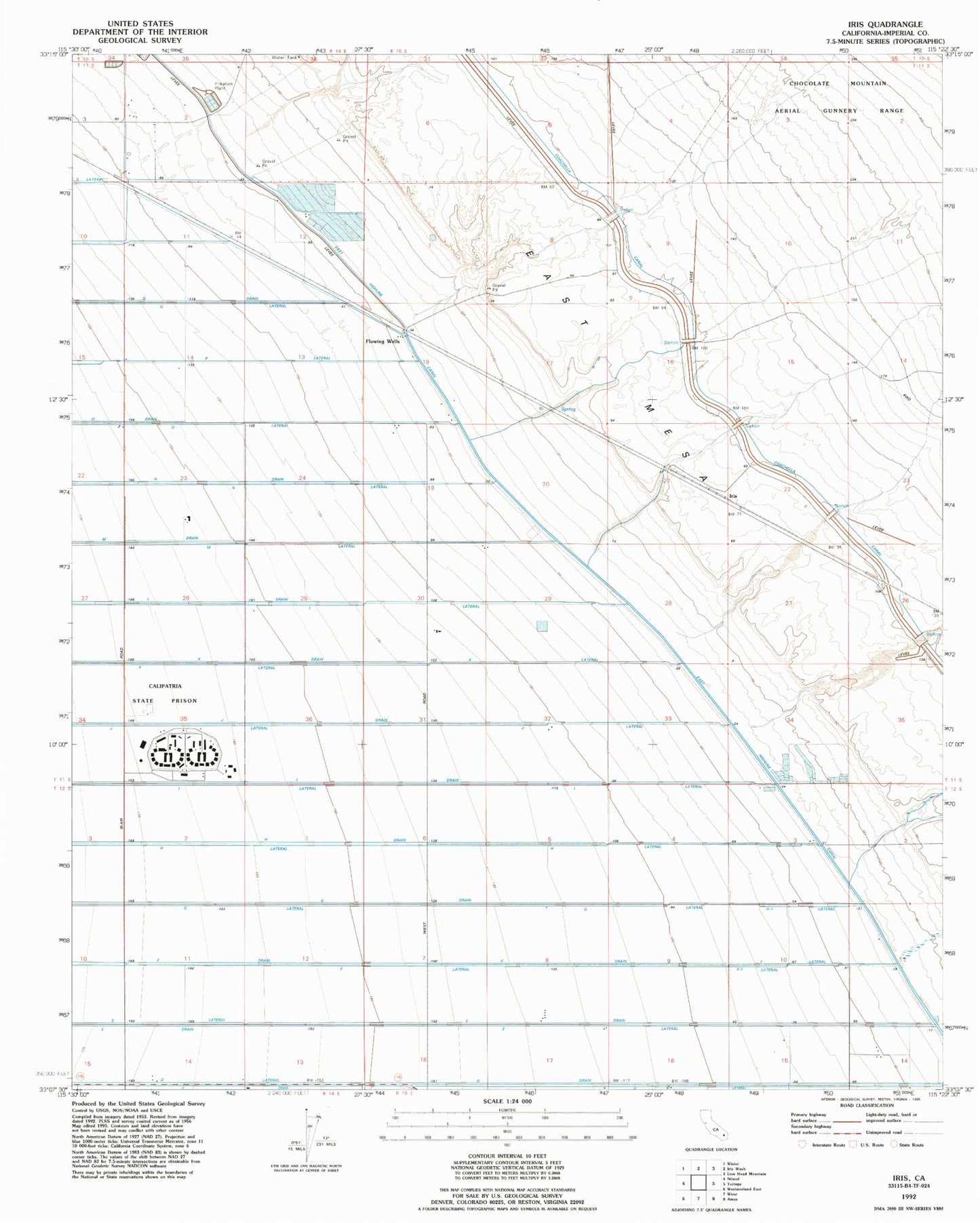
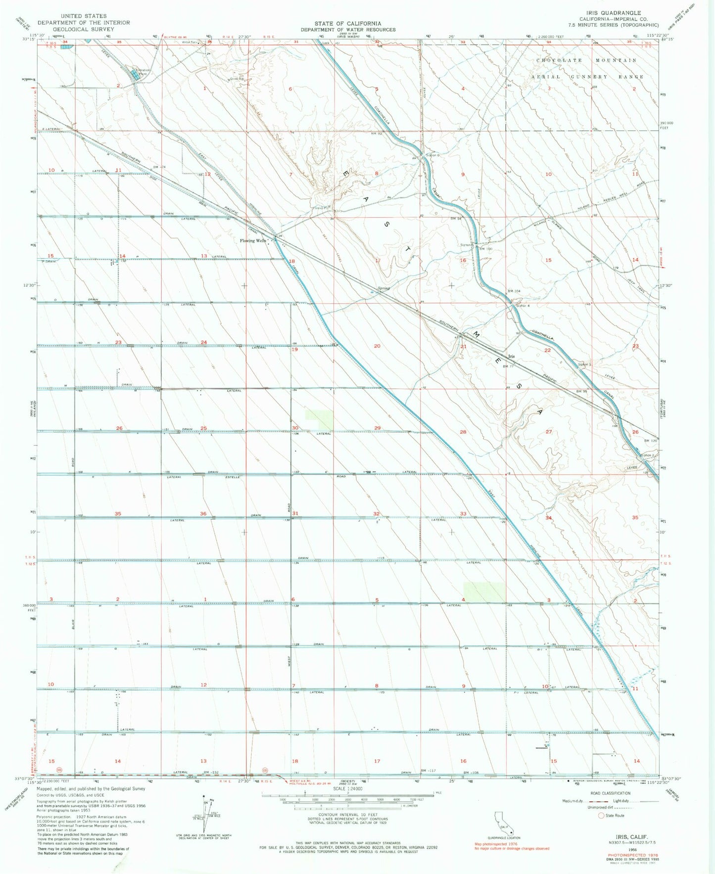
Classic USGS Iris California 7.5'x7.5' Topo Map
Couldn't load pickup availability
Historical USGS topographic quad map of Iris in the state of California. Map scale may vary for some years, but is generally around 1:24,000. Print size is approximately 24" x 27"
This quadrangle is in the following counties: Imperial.
The map contains contour lines, roads, rivers, towns, and lakes. Printed on high-quality waterproof paper with UV fade-resistant inks, and shipped rolled.
Contains the following named places: Calipatria State Prison, Calipatria State Prison Fire Department, City of Calipatria, D Drain, D Lateral, E Drain, E Lateral, East Highline Canal, F Drain, F Lateral, F-I Lateral, Flowing Wells, G Drain, G Lateral, G-I Lateral, H Drain, H Lateral, I Drain, I Lateral, Iris, J Drain, J Lateral, K Drain, K Lateral, L Drain, L Lateral, M Drain, M Lateral, N Drain, N Lateral, O Drain, O Lateral, P Lateral, R Side Main Canal, Siphon Five, Siphon Four, Siphon Six, Siphon Three, Siphon Two