MyTopo
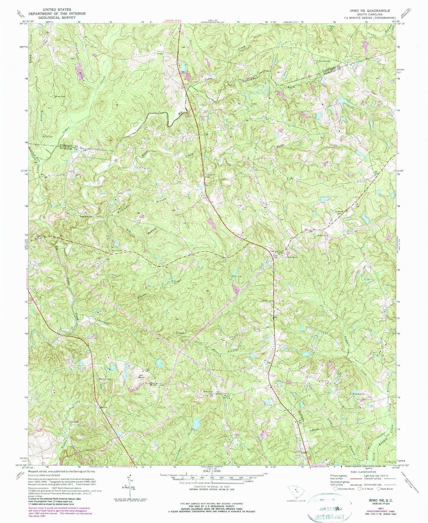
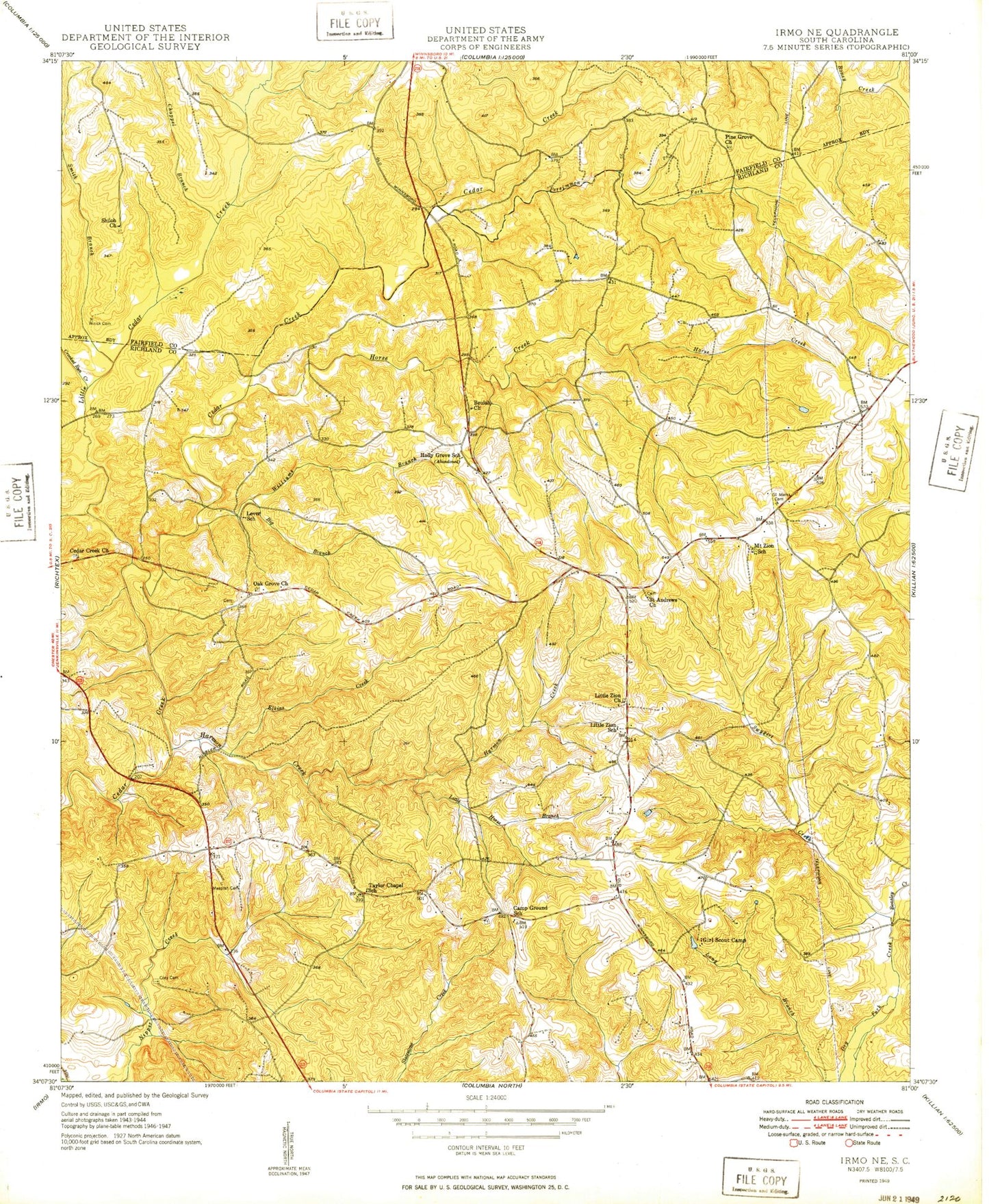
Classic USGS Irmo NE South Carolina 7.5'x7.5' Topo Map
Couldn't load pickup availability
Historical USGS topographic quad map of Irmo NE in the state of South Carolina. Map scale may vary for some years, but is generally around 1:24,000. Print size is approximately 24" x 27"
This quadrangle is in the following counties: Fairfield, Richland.
The map contains contour lines, roads, rivers, towns, and lakes. Printed on high-quality waterproof paper with UV fade-resistant inks, and shipped rolled.
Contains the following named places: Beasley Creek, Beaulah Church, Bellview School, Beulah Cemetery, Beulah Church, Big Branch, Bruce's Greenhouses, Camp Dixon, Camp Ground Division, Camp Ground School, Cedar Creek Church, Chappel Branch, Columbia - Richland Fire Department Upper Richland, Columbia Fire Department - Station 15 Cedar Creek, Cory Cemetery, Crooked Run Creek, Elkins Creek, Green Acres, Harmon Creek, Holly Grove School, Horse Creek, Keels Lake, Keels Lake D-0293 Dam, Langford School, Lever, Lever School, Little Cedar Creek, Little Horse Branch, Little Zion Church, Mespiah Cemetery, Mount Pleasant Church, Mount Zion Church, Mount Zion School, Mullers Lake, Mullers Lake D-0279 Dam, Oak Grove Church, Oak Grove Community House, Persimmon Fork, Pine Grove Church, Piney Grove Cemetery, Piney Grove School, Pleasant, Rock Dam Creek, Saint Andrews Church, Saint Marks Cemetery, Shiloh Cemetery, Shiloh Church, Smith Branch, Smith Pond, Smiths Pond D-0541 Dam, South Carolina Noname 20001 D-0529 Dam, South Carolina Noname 20024 D-1571 Dam, South Carolina Noname 20025 D-1673 Dam, South Carolina Noname 40036 D-0271 Dam, South Carolina Noname 40091 D-0273 Dam, Swygert Creek, Taylor Chapel, Taylor Chapel School, WCOS-FM (Columbia), Williams Branch, Wirick Cemetery, Zion School