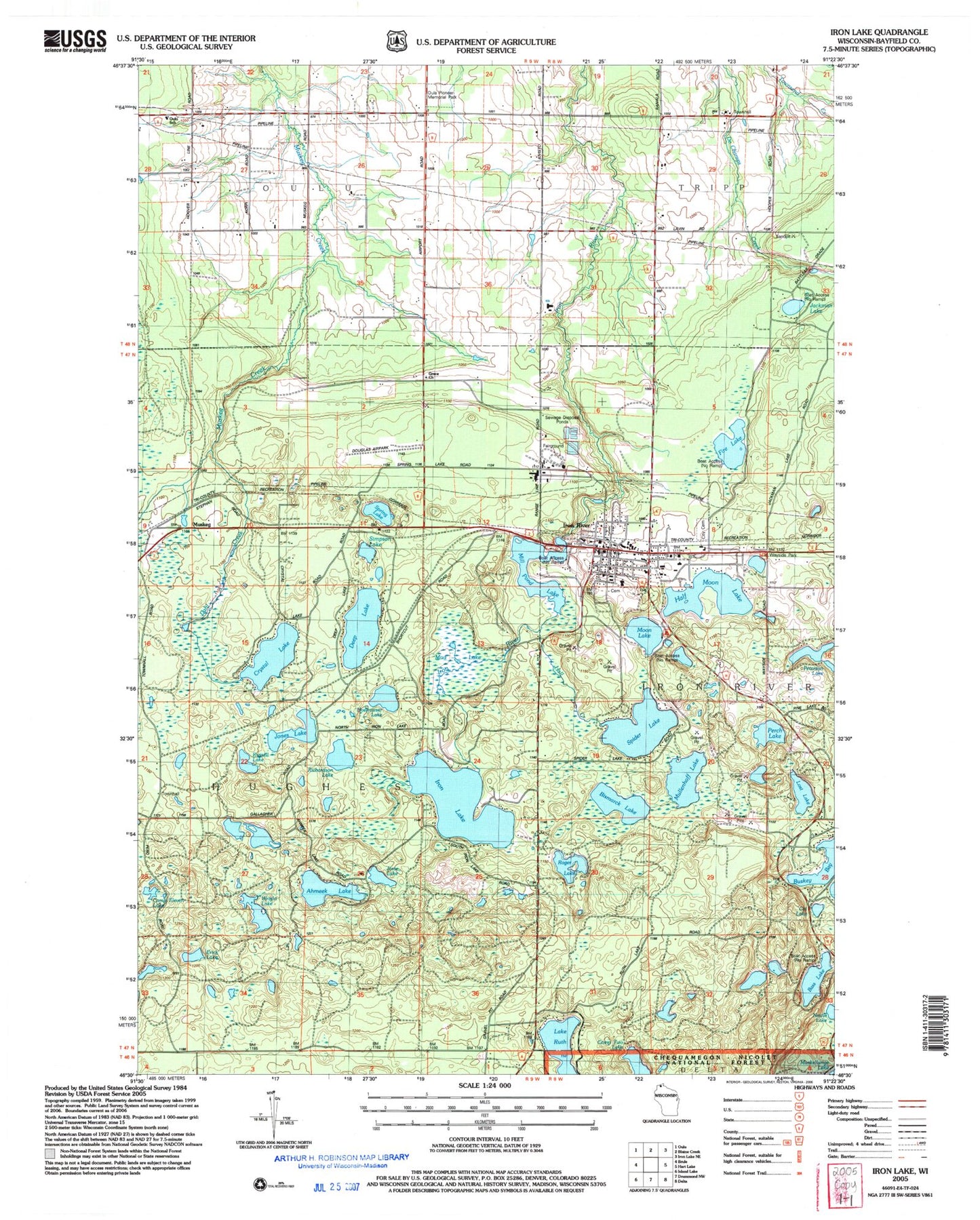
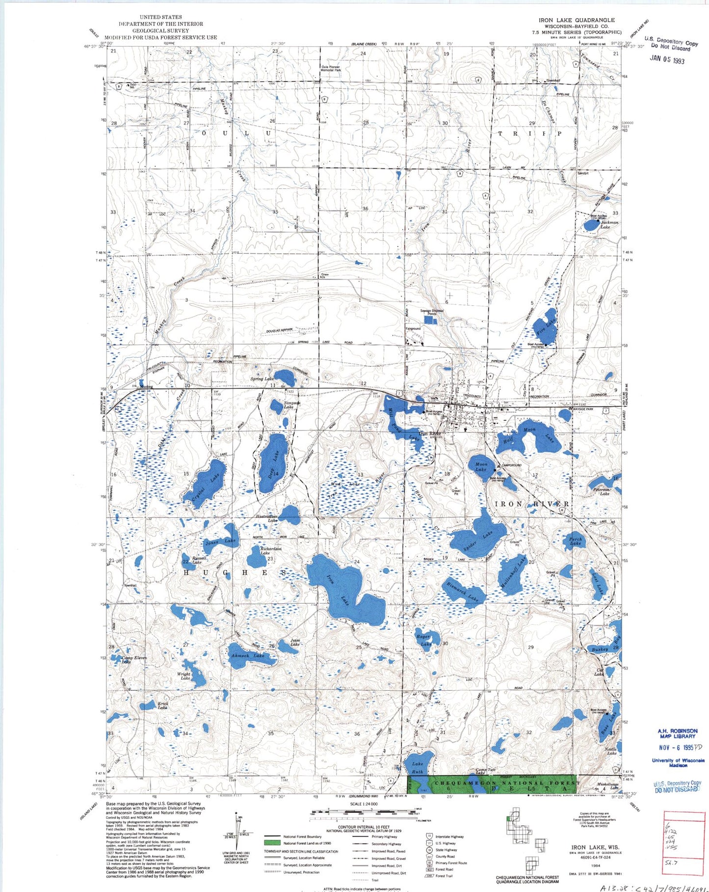
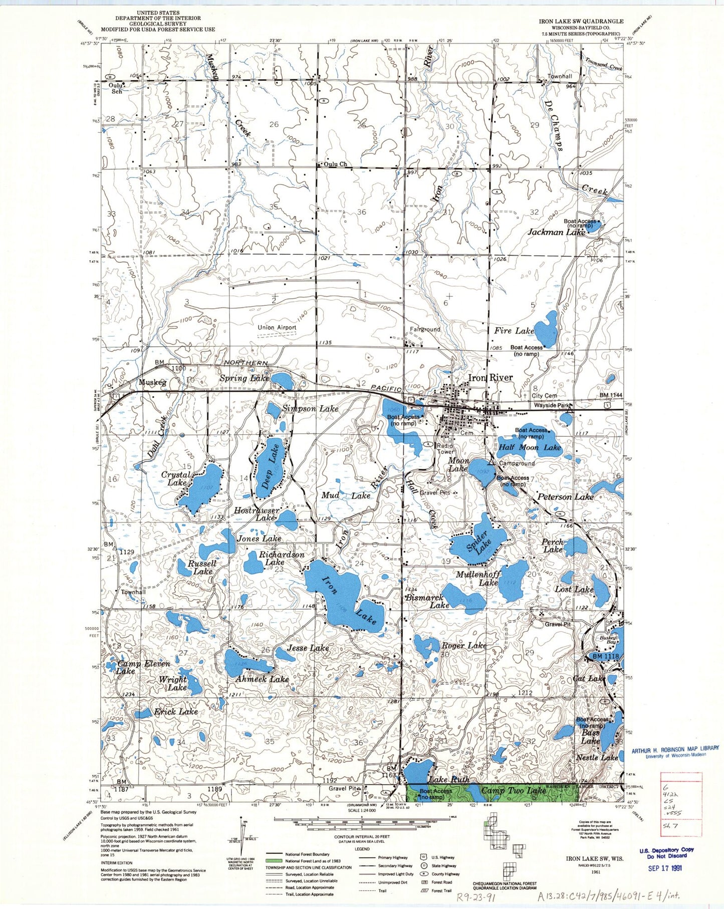
MyTopo
Classic USGS Iron Lake Wisconsin 7.5'x7.5' Topo Map
Couldn't load pickup availability
Historical USGS topographic quad map of Iron Lake in the state of Wisconsin. Map scale may vary for some years, but is generally around 1:24,000. Print size is approximately 24" x 27"
This quadrangle is in the following counties: Bayfield.
The map contains contour lines, roads, rivers, towns, and lakes. Printed on high-quality waterproof paper with UV fade-resistant inks, and shipped rolled.
Contains the following named places: Ahmeek Lake, Bass Lake, Bayfield County Airport, Bismarck Lake, Camp Eleven Lake, Camp Two Lake, Cat Lake, Crystal Lake, Dahl Creek, Deep Lake, Erick Lake, Fire Lake, Half Moon Lake, Hall Creek, Hostrawser Lake, Iron Lake, Iron River, Iron River Ambulance Service, Iron River Census Designated Place, Iron River City Cemetery, Iron River Elementary School, Iron River Fire Department, Iron River Flowage 8.37, Iron River Light and Power Company WP182 Dam, Iron River Police Department, Iron River Post Office, Jackman Lake, Jesse Lake, Jones Lake, Lake Ruth, Lost Lake, Mill Pond Lake, Minor Lake, Moon Lake, Mud Lake, Mullenhoff Lake, Muskeg, Nestle Lake, Oula Pioneer Memorial Park, Oulu Church, Oulu School, Perch Lake, Peterson Lake, Richardson Lake, Roger Lake, Russell Lake, Simpson Lake, Spider Lake, Spring Lake, Town of Hughes, Tripp Townhall, Wright Lake, ZIP Code: 54847